The peaceful coast of Emäsalo: Varlaxudden, Porvoo
Do you long to cast your gaze out to the open sea? Then you should head to Varlaxudden, which is part of Porvoo’s archipelago and located just off the southern tip of Emäsalo. Emäsalo is a large island of around 34 square kilometres, slightly southwest of Porvoo, accessible via bridge. The Varlaxudden recreational area is 12 hectares, but I suspect that most visitors don’t stray far from the shoreline.
I started my daytrip by car, heading south down the Emäsalo Road from Porvoo almost all the way to the pilot station, where you can’t go without permission. Varlaxudden’s carpark was right by the road. Not far along path, there was a neat outhouse on the rocks and some firewood.
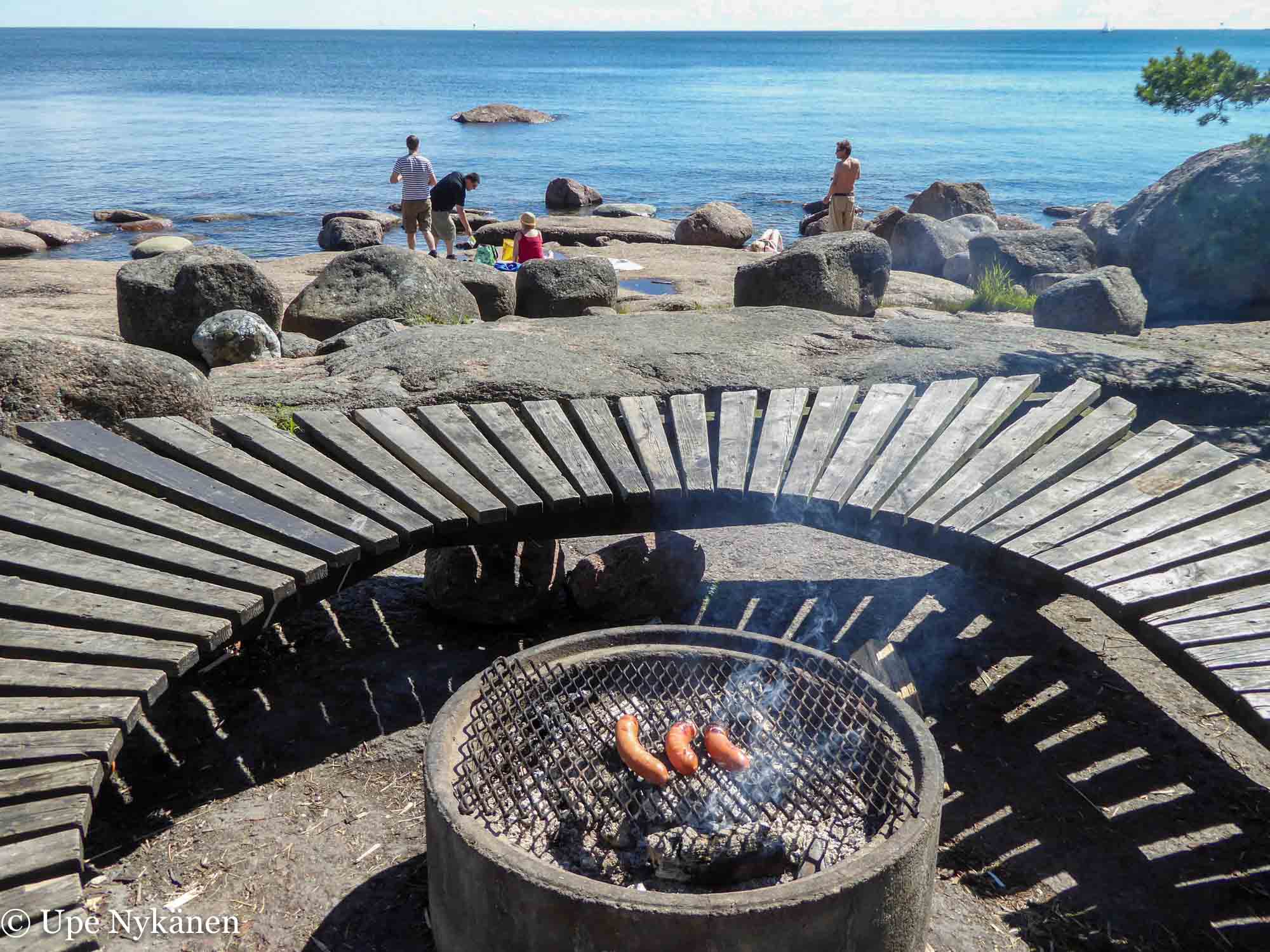
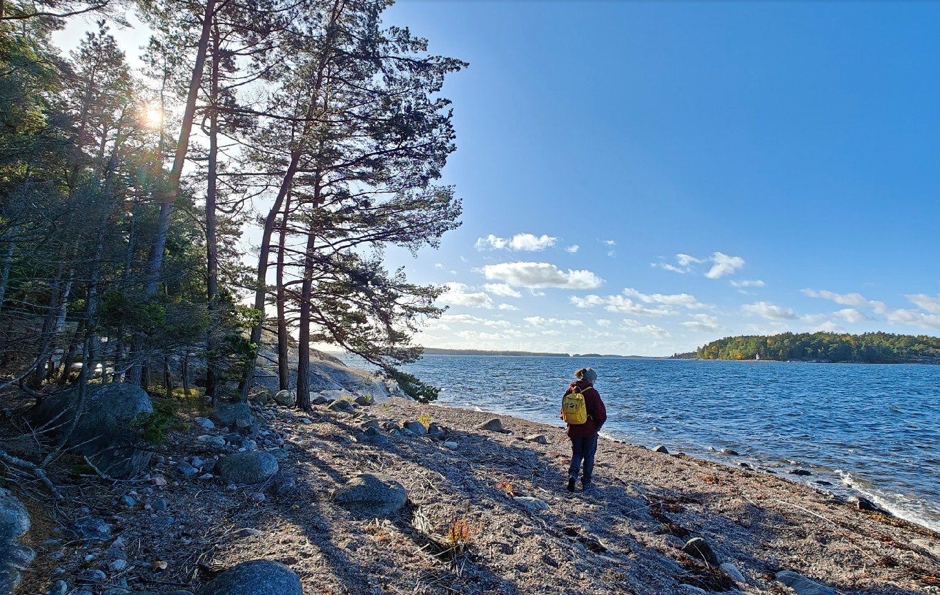
Several daytrippers were dotted around the coastal rocks enjoying the calm weather whilst sitting, standing, laying on beach towels or wading in shallow water. Smoke rose from the depth of the sheltered campfire site as well as from the hot coals of an open campfire place nearby. A gentleman assuming the role of sausage guard went to turn the hotdogs and at the same time seemed to be making sure that I didn’t mistakenly think that they were up for grabs. Oh why didn’t I take my own sausages with me!
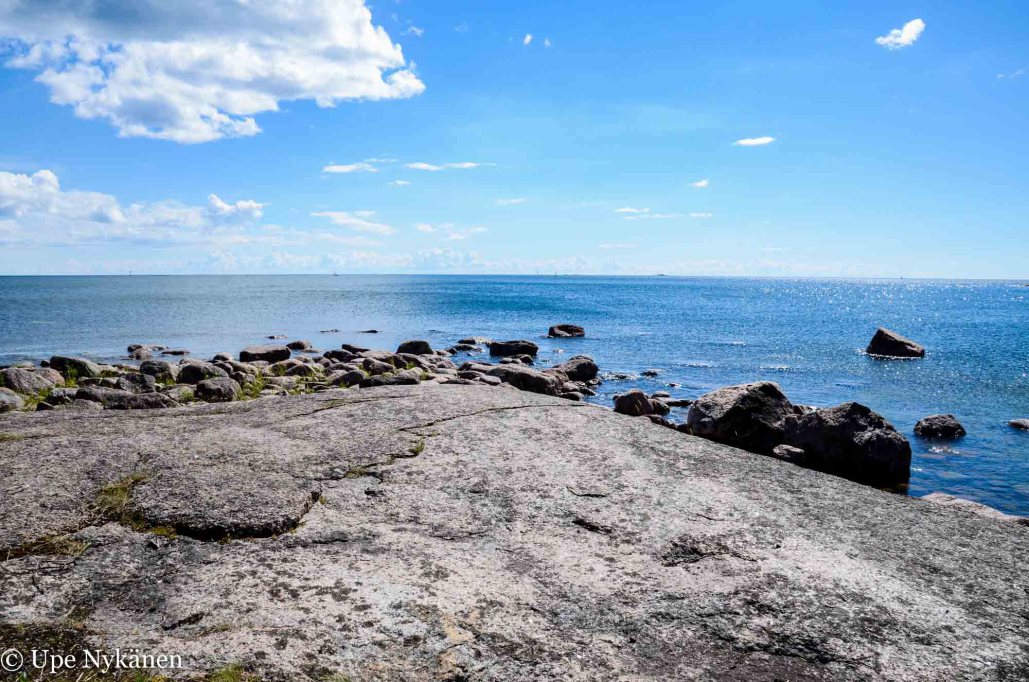
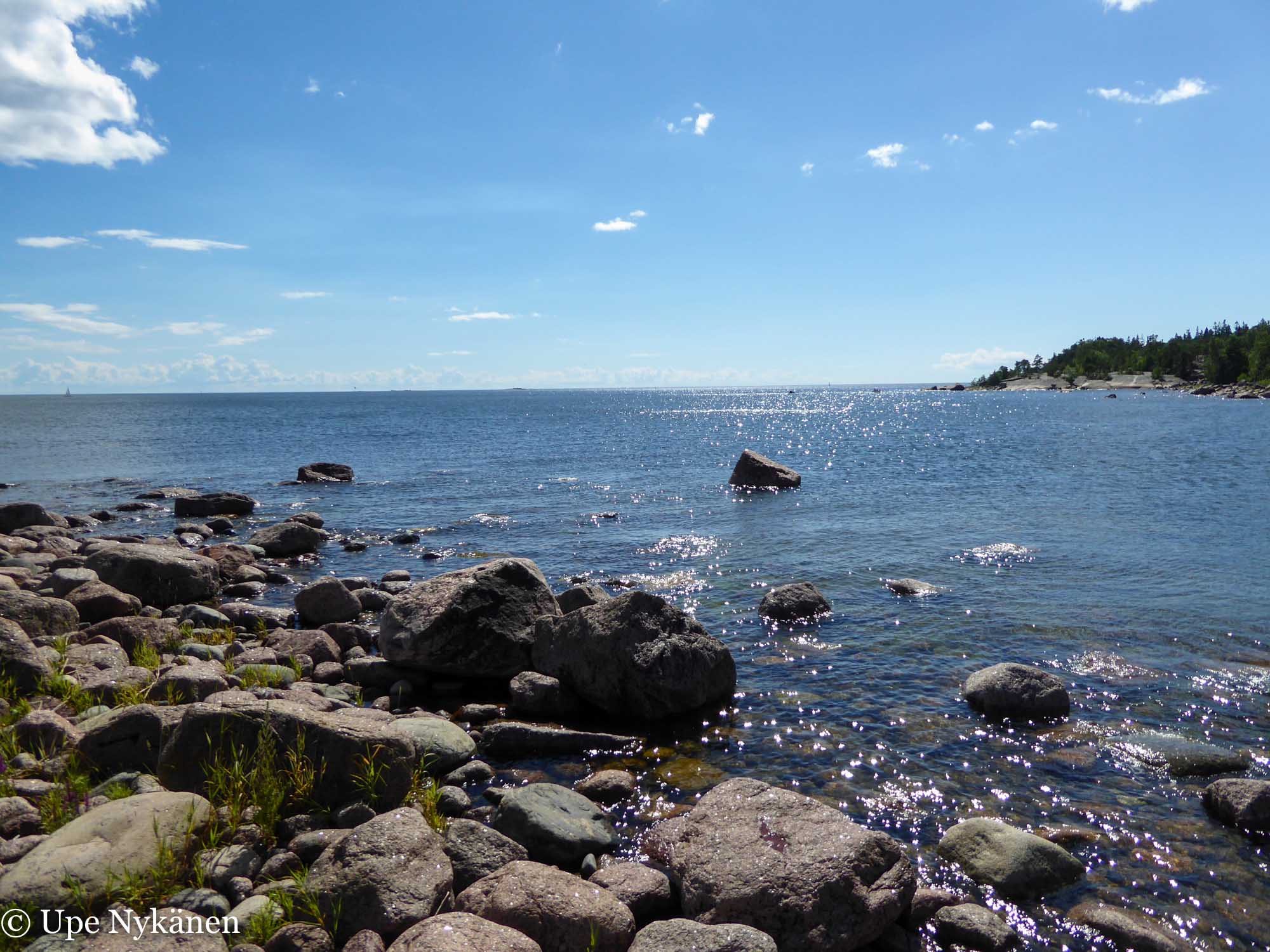
A lovely view of the Gulf of Finland’s outer archipelago was visible from most of Varlaxudden beach. A few sailboats glided lazily forward in the distance and I wondered if the taller vertical post on the horizon was a lighthouse. I should have thought to take binoculars with me.
I bounded along the beach to the left and wondered if I could manage a visit to a sweet-looking rocky headland called Fågelboet with dry feet. The promontory must have been a former island, as the land has risen around Emäsalo approximately 5 metres in the last couple of thousand years. I decided to move from the edge of coastal waters to the forest side and see if I could find a path leading to Fågelboet.
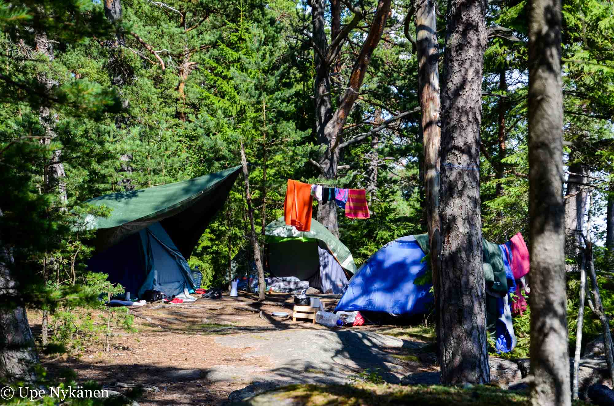
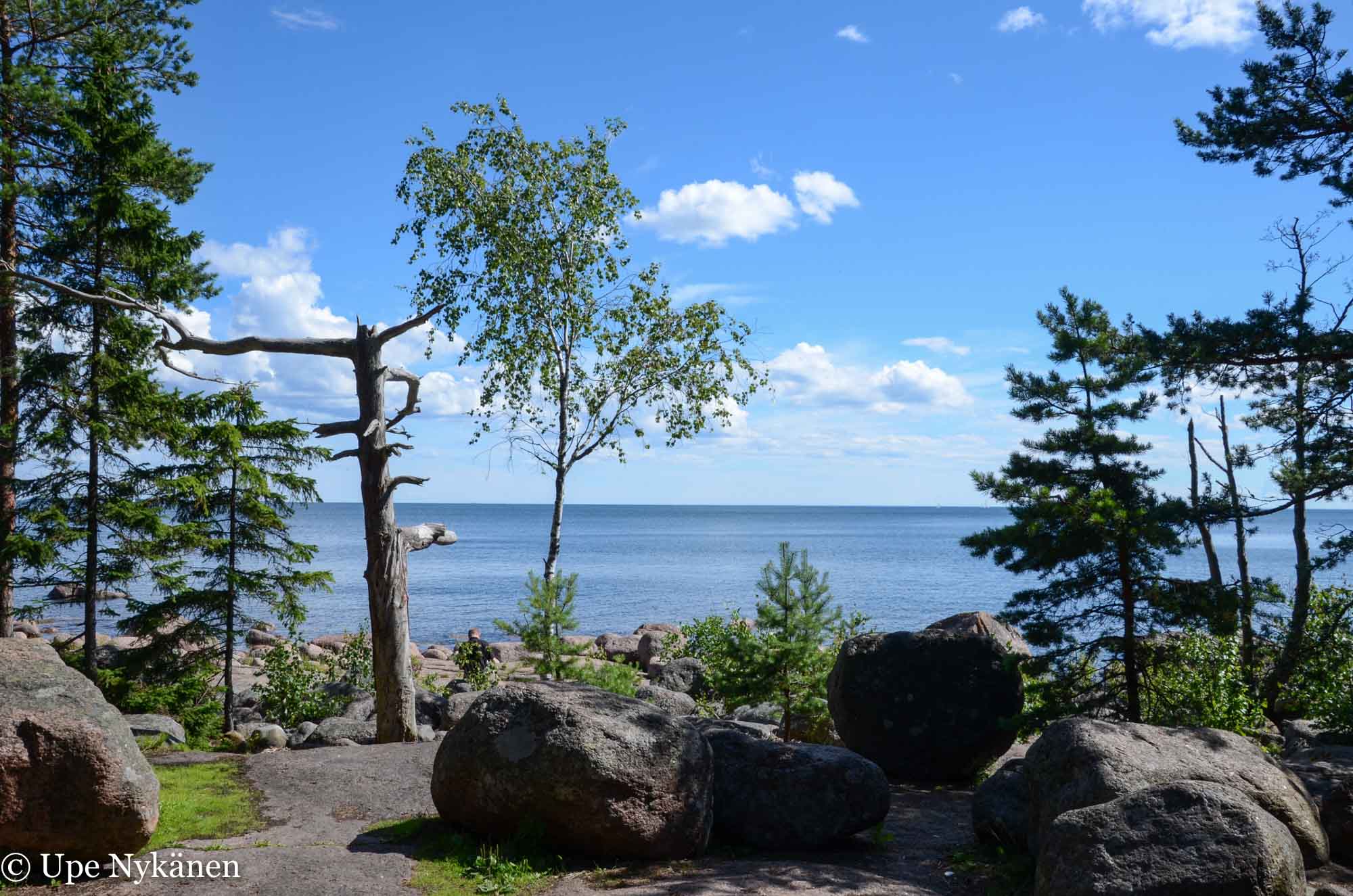
Having found the forest path leading in the right direction, I then came across a mini camp by the trail. It seems that Varlaxudden had attracted some overnight visitors as well as daytrippers and they had found the perfect spot for their three tents in the shade of pine trees. I stepped around the tent ropes and back onto the path.
It occurred to me that the campers might be paddlers, but no kayaks could be seen on the coastal rocks. It would be nice to do a kayaking trip here from around Hakasalo for example, to save carrying a kayak from the parking place to the beach along the forest path. Alternatively, a little further north of Varlaxudden, from Edesviken to Vaarlahti, kayaks can effortlessly be launched into the water straight from the carpark and that trip could then be combined with a tour of Hakasalo and Varlaxudden by sea.
Varlaxudden belongs to areas managed by the association of Uusimaa recreation area (website only in Finnish and Swedish), for which you can use free mobile applications (Recreational Canoeing Map and Map) to explore them.
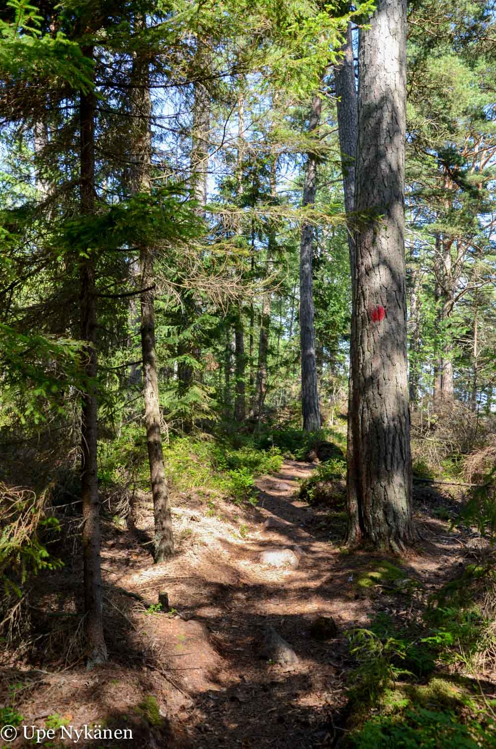
There didn’t appear to be any signs for Fågelboet along the coast, but after a short while on the forest trail I noticed that I was actually on a marked path. I stopped for a moment to observe a tiptoeing chaffinch, who seemed oblivious to my presence.
The route, which was marked by painted red dots, soon led me to a logged area and a warning sign which said ‘Private’. Thankfully, I had already reached the headland, so it didn’t matter, and I turned and headed towards the beach. I suspect that the owners of the summer cottage on the neighbouring headland probably didn’t want any random passers-by wandering onto their land.
The path from the beach to the Fågelboet’s rocky headland, which I feared might have been wet, was very short and my feet remained dry in trainers. Part of the path is marked with painted red dots on the trees and private areas are marked with warning signs.
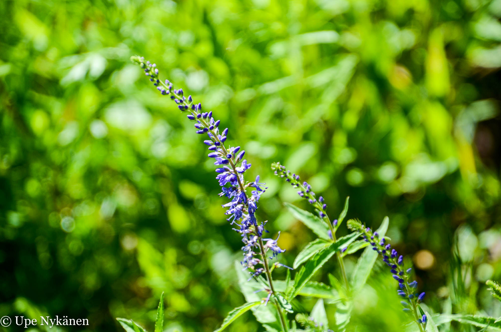
The long slender violet wands of the speedwell flower swayed in the light wind and I stopped to observe a buzzing bee, looking for nectar. Life is full of small joys.
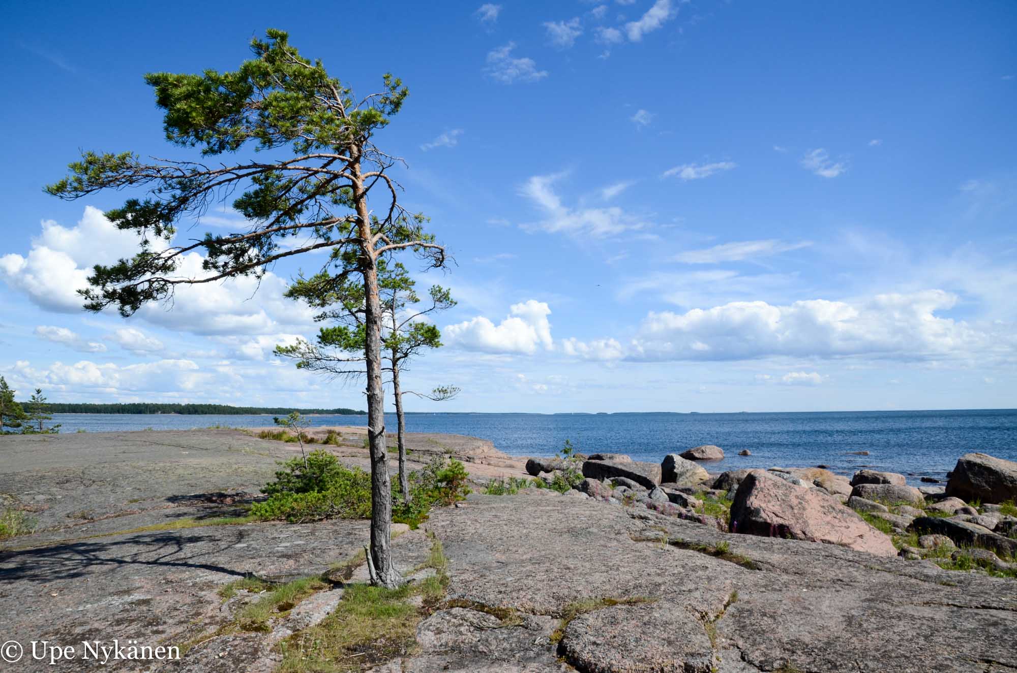
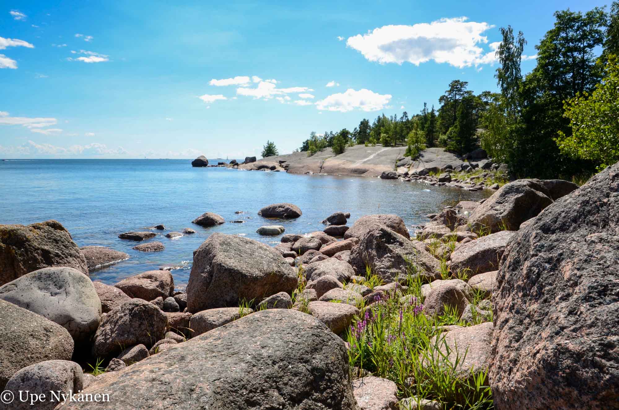
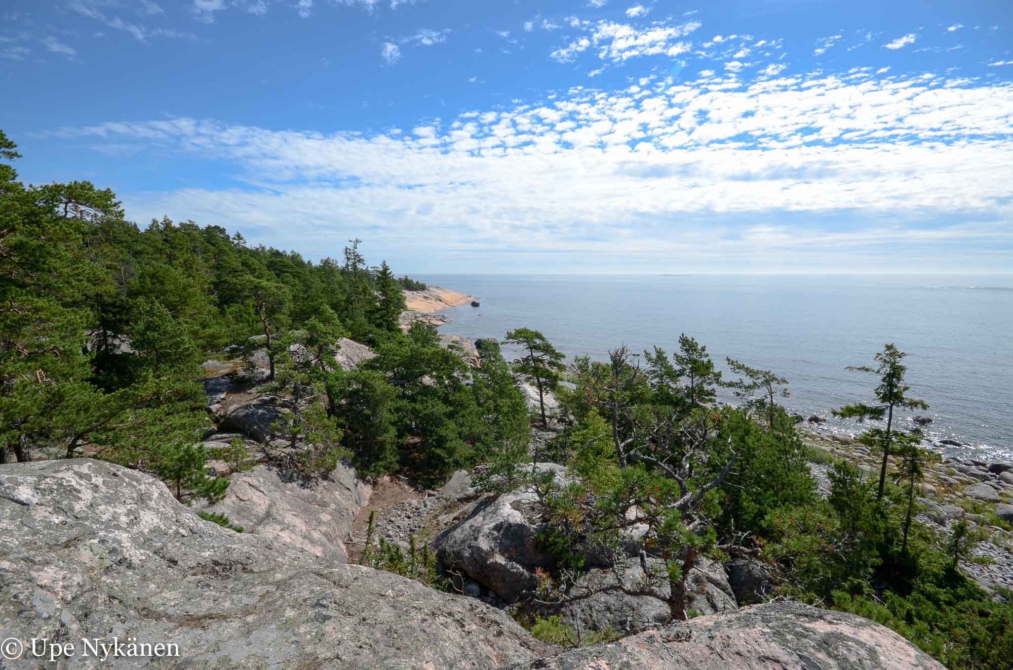
And what fine rocks! It was definitely worth making the short journey here from the beach. I sat down contented, enjoying the view of the sea and its islands. Sitting on rocks is the perfect way to take in marine life with its birds and boats or no boats at all. The only camera you need is your brain. I decided that this would be a good place to eat my sandwich.
In the middle of Fågelboet is an area sheltered by pine trees. There are signs to remind us that making campfires is forbidden. Careless handling of fire can easily destroy all of the vegetation here, on this dry rock. You can make campfires at the designated campfire spots on the beach without risk of causing damage.
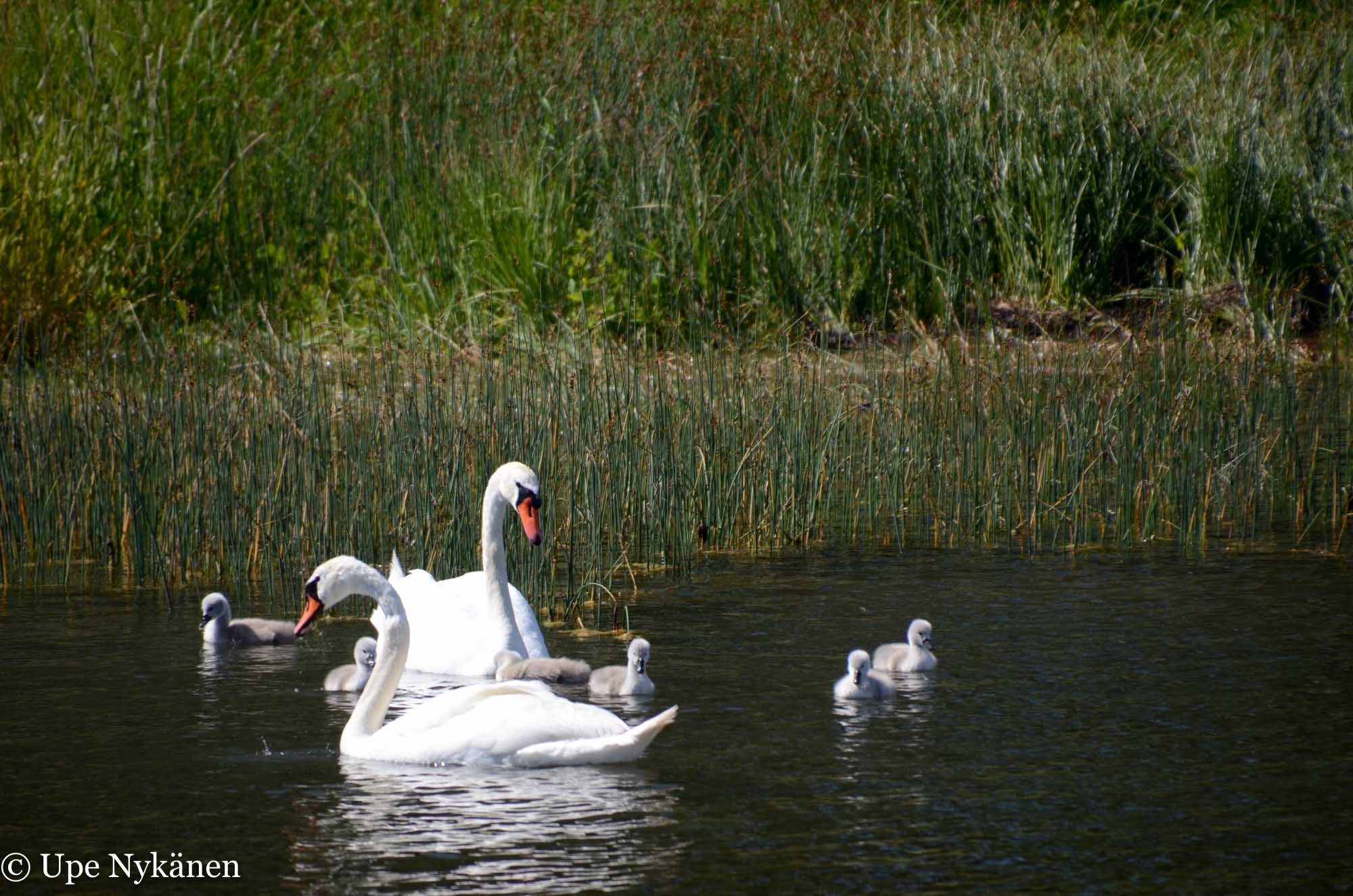
After my scenic snack break, I did another small tour of Fågelboet and finally came across some birds! From behind the protected cove flashed bright white and then a couple of sturdy orange beaks at the end of long necks appeared. A swan family with their large brood were swimming peacefully, the fluffy cygnets close to their parents. The mother as well as the father pushed their smooth long necks under water. Food-time.
I returned back to the coastal path and wondered if the path marked with red painted dots would have led inland. For a little while, I followed the other path back in the direction that I had came from, but then emerged via a blueberry clump back on to the original path that I had followed to Fågelboet. I was in no rush back to the car park, as the other side was still unexplored.
So I returned to the Varlaxudden campfire pit and turned my eyes to the right, the direction of the pilot station. The spectacular rocks drew me towards them like a magnet and I squeezed between two big boulders onto a narrow path that led towards the smooth rocks of Skvättan. If the way had been accessible via sandy beach, it would have been fun to wade to the rocks, but instead there were lots of slippery stones and I wouldn’t have managed the journey without slipping and falling into the water.
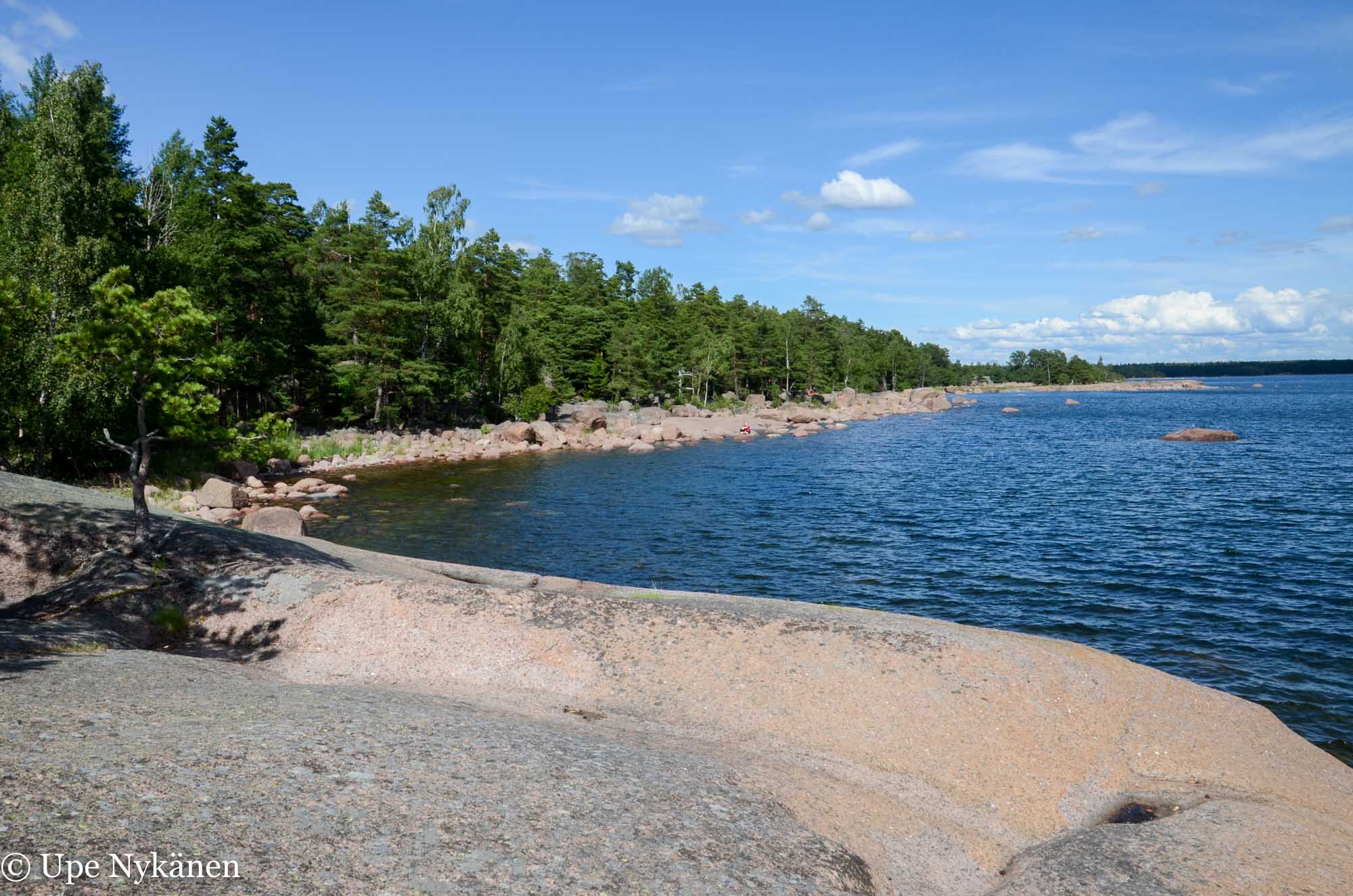
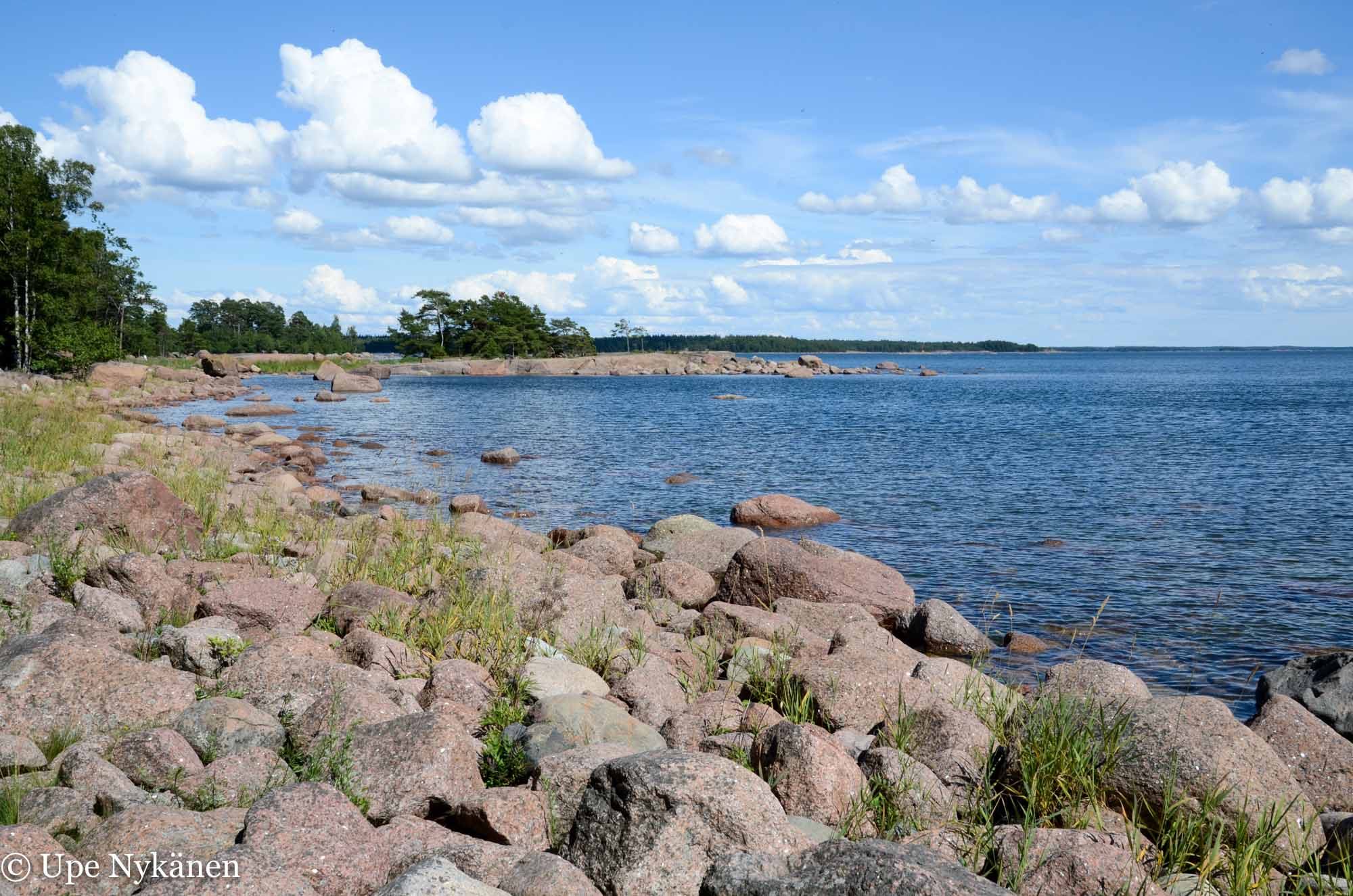
The path belonging to the recreational area’s western side began to fade away as it led me over smooth rocks, their soft forms created by the sea’s waves. Walking on these rocks you don’t even need a path. Again, you can think about all the things that were brought forth by the land rising. Over the course of thousands of years sea water has churned many metres above its current height and honed these particular rocks until they were unusually smooth.
These smooth rocks don’t belong to the official Varlaxudden recreational area, but to the state. No matter how much I would have liked to, you can’t go around Emäsalo’s southern tip by foot, as a fence gets in the way. The island’s southernmost point is part of the state’s pilot station and the protected area of the navy begins from there meaning that any other activity is limited. There are 18 of these protected areas altogether in the Gulf of Finland and the Archipelago Sea, which belong to the Finnish State.
With one final glance, it was then time to return to Porvoo. The beautiful seascape, gentle wind, sunshine and space to breathe let my thoughts soar. Varlaxudden is excellent for families taking a day trip or having a picnic, but is also perfect for visitors who just want to stop and be. You don’t have to clock up kilometres here. The area is also a good place to venture off the path to pick berries or mushrooms for example, as you’re never far from either the coast or the road, which means that finding your way back is easy.
Location and Directions:
Varlaxudden recreation area is about 25 kilometers from the centre of Porvoo on the most direct route. The Emäsalo Road, from Emäsalo’s northern tip to Varlaxudden’s car park (Address: Emäsalontie 1420), is about 15 kilometers long. The road is in good condition but it is narrow, so cyclists and motorists must take care to notice and leave room for each other. One can usually park their car with ease at Varlaxudden’s car park, except for on the busiest summer days.
You could also cycle to Varlaxudden or get the bus. The bus stop is on Emäsalo Road (Emäsalontie) just before the pilot station, but the bus service (Porvoo to Emäsalo) is available only from Monday to Friday, and even then is limited. If cycling or driving, you can stop for coffee and snacks at the friendly village shop in Bengstby, Emäsalontie 715, which is about halfway.
Map ETRS-TM35FIN -coordinates N 6675112 E 424294
The author stayed at Ida-Maria Bed & Breakfast, courtesy of Porvoo’s travel office VisitPorvoo.fi
Translated by Becky Hastings.
Related Content


Leave a Reply
Want to join the discussion?Feel free to contribute!