THREE ISLANDS, TWO NATURE TRAILS AND A LILY POND: EKENÄS ARCHIPELAGO NATIONAL PARK IS PARADISE FOR PADDLERS
➡ Paddling distance 20km
? 2 Campfire spots: Fladalandet ja Modermagan
ℹ Area information
ℹ Ekenäs Archipelago National Park
? Departure point on the map
Everyone I know has some kind of a ‘soul landscape’ – a landscape in which they feel they truly belong. I know people who feel at their most alive in mountains. I know many, who feel most at peace resting on a green bed of moss or wandering in the woods. My heart beats stronger and steadier than ever when I’m in the archipelago of the Baltic Sea.
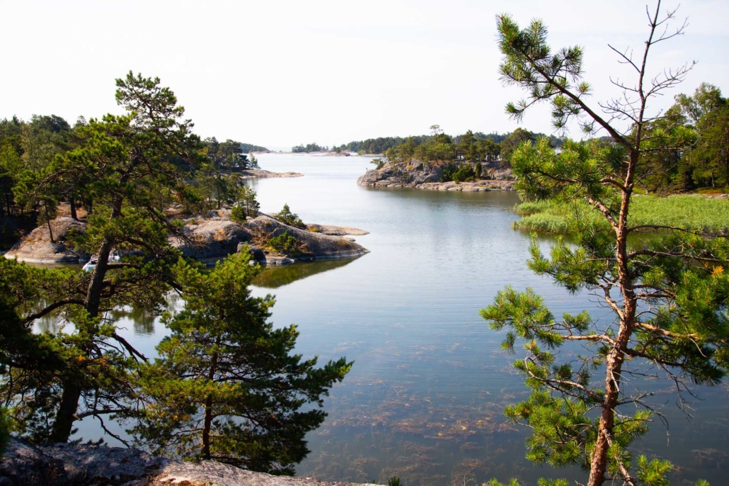
Ekenäs Archipelago National Park includes lush coastal inner archipelago as well as more rocky and exposed outer archipelago right up to Jussarö lighthouse. Ekenäs Archipelago National Park is a great paddling location. There’s enough to explore for a multi-day trip, but if you’re pushed for time, a lot can be packed into two days. My friend and I decided on a two day route that took us around three islands.
Planning a three island tour
If you’ve completed a paddling course and want to try sea kayaking for the first time, Ekenäs Archipelago National Park is the perfect place to start. Our three island tour is relatively easy to navigate with a sheltered route but all the atmosphere of sea kayaking – the feeling of distance, wind and waves. If for any reason you need to suddenly get to shore, land is never far away.
Ekenäs Archipelago National Park’s 52 square kilometres is made up of many islands, big and small. We chose the inner coastal islands of Älgö, Fladalandet and Mordemagan, which provided the most sheltered route, as well as services to make camp life easier, such as dry toilets and designated campfire and tent sites. Another thing that helped make up our minds was access to marked nature trails, so that we could go stretch our kayak-cramped legs. A map of the overall area is available for download Metsähallitus’s Outdoor.fi page.
A strong and experienced paddler could complete our three island tour in one day – the route’s length is around 20 kilometres with 4-6 hrs of total paddling time, depending on paddling speed and wind. However, we wanted to paddle at a relaxed pace, spend the night in the national park and enjoy peaceful island life, so a two day trip suited our needs better.
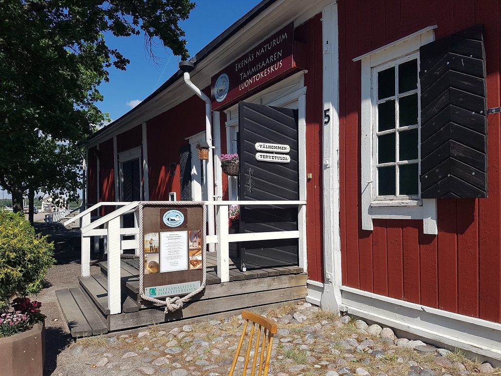
Before heading out to sea, we went to the national park’s nature centre, which is next to the guest harbour, to absorb some of the archipelago vibe. The exhibition, which tells you about archipelago life and nature as well as protection of the Baltic sea, is primarily designed for children, but there is plenty for adults to learn too. Near the entrance you can pick up a more general map of the national park, which we took along as a spare.
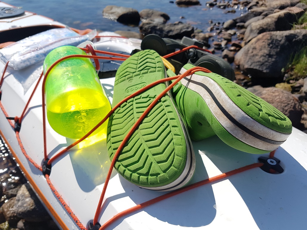
A good departure point for a kayaking trip is Sommarö Stranden, which is actually 13km from Tammisaari. There’s a restaurant and a small shop, if you want to have something to eat before heading out or have a last minute panic about having packed enough food. There’s a small stretch of beach, as well as a concrete slope, from which kajaks are easy to launch into the water and you can leave your car at the guest harbour.
The three island tour can be done clockwise or anti-clockwise. Check the weather forecast and wind direction before choosing which way to go. Even though the route follows a sheltered route between islands, the wind can still have considerable impact on your paddling. And if you want to sway in a hammock at night, make sure you check which islands have trees and which side they’re on!
Älgö’s Nature Trail and Rödjan’s fishing hut
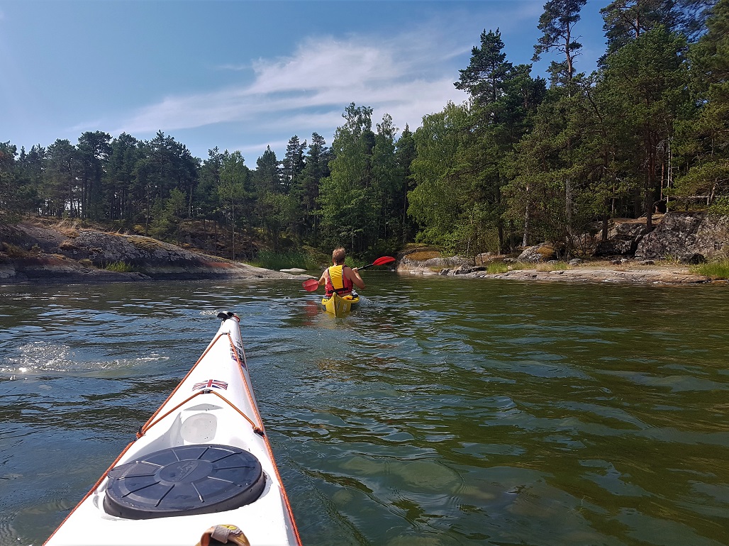
From Sommarö Stranden we decided to paddle around Älgö island anti-clockwise, aiming for Rödjan fisherman’s hut and the starting point for the nature trail. We were accompanied by an easterly wind and the island sheltered us for the first part. After paddling for an hour, we stopped, carried the kayaks onto the rocks, had something to eat and drink and went for a swim.
We navigated with the help of a marine map and an app on our phones. My friend had the nature centre’s free area map, which is not detailed enough for navigation on its own, but is helpful if you want a quick overview of where you are in relation to the rest of the national park. Mostly we followed the coast of Älgö, but after the stretch of water marked as Mörnsfärd on the island’s north west side, it makes more sense to go around the west sides of Heimosholmen and Halsholmen.
Even though the coastal inner archipelago is mostly sheltered and relatively safe, remember that you’re still at the mercy of the sea and the elements. The weather and direction of the wind can change suddenly and visibility can drop to nothing. This is all worth keeping in mind even on an easy, relaxed paddling trip. Make sure you always know where you are on the map. The route crosses a few boat channels, so be aware and careful of fast-moving boats and the waves that they create.
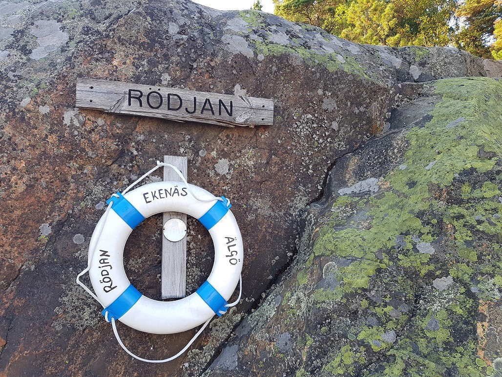
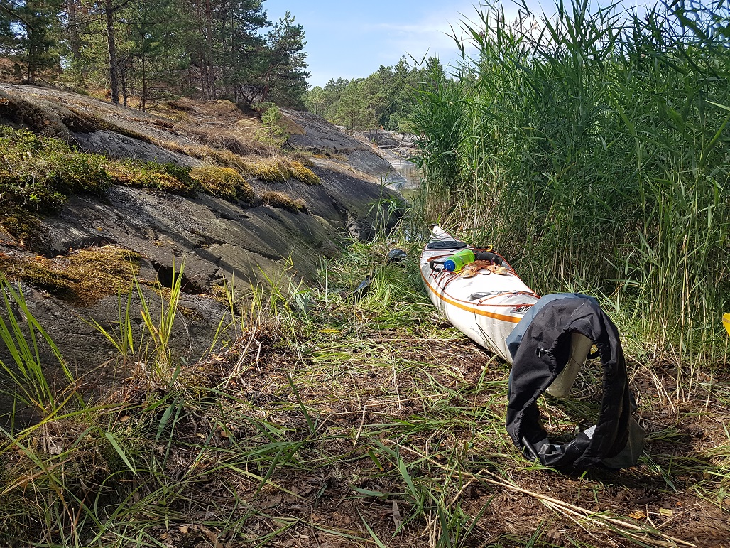
After about 2,5 hours of paddling, we reached Rödjan. The journey was about 10 km. By the time we arrived, we were already hungry and also quite tired. At the guest harbour there were a couple of beautiful wooden sailing boats and a larger motorboat at the fisherman’s hut. There were a couple of places for kayaks on the right hand side of the fishing hut, on the beach in the nook of the rocks. After we had already spread out our picnic, we realised that we had picked a bad spot, right in the middle of the nature trail’s starting point!
In the postbox at the beginning of the trail, there’s an interesting information pamphlet that tells you about the island’s history, which you can borrow while you walk. For thousands of years, Älgö lay under continental ice, and then water until the land rose. Seals have lounged about on the low outer islands, which have over time become Älgö’s high rocks.
Älgö’s nature trail has a lot of steep climbs and descents. Along the route you can see many bays which become overgrown, different forest types and Älgö’s inner lake. Only half a kilometre along from the starting point is the observation tower, with a view that stretches out across the national park.
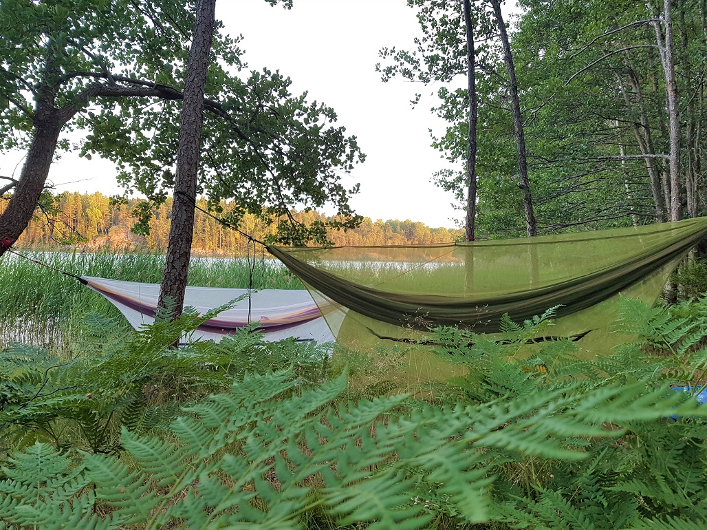
After an hour we arrived back at Rödjan’s fisherman’s hut and thought about whether we should continue to the next island. But the evening was drawing in and the idea of getting into our hammocks felt much more appealing than that of paddling. We found the official camping spot on the left of the guest harbour (looking out to sea). The rays of the evening sun danced on the ferns on the leaves, and water lapped on the rocks. This spot had good places for tents as well as perfect trees for hammocks, so the decision was made quickly. We moved the kayaks to a different beach, hung our hammocks in the trees and had strawberries and cream for our evening snack.
Out into the open via Fladalandet bay and fascinating coves
We enjoyed our breakfast in the sun on the rocks, about 50 metres west of our camping spot. After packing our kayaks, we navigated towards Fladalandet, which was just under an hour’s paddling away.
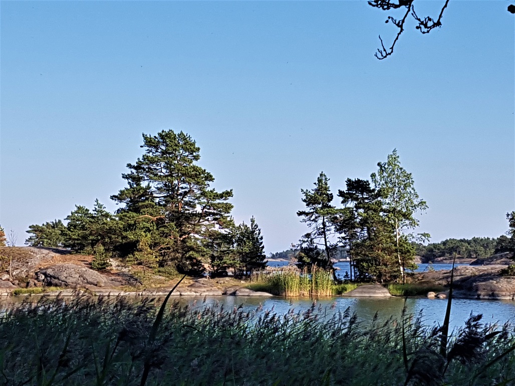
Even though we didn’t go ashore, it’s definitely worth paddling around Fladalandet! On the northern edge is a natural harbour and lots of narrow bays and coves that go deep into the island which can only be reached by kayak or paddleboard. I recommend going to explore each one, for they are all different and interesting in their own way. In windy weather, Fladalandet’s bays provide many sheltered places to come ashore.

On Fladalandet’s south side, is open sea. If you have time and the weather allows, then it’s worth taking a detour to the outer archipelago, for example via Stora Björkskar. But do check which islands you can land on during the summer on the national park’s general map . Many islands are protected due to nesting birds from 1.4-31.7. If you have experience paddling in the open sea, then reserve an extra day and paddle to Jussarö lighthouse island.
A surprise find on Modermagan
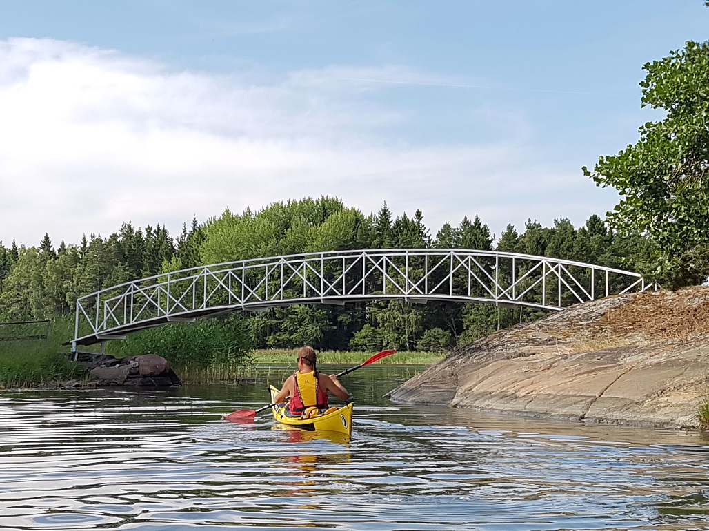
During our trip we stayed in the inner archipelago, and after Fladalandet our third island destination was Modermagan. It only takes about half an hour to paddle between the two islands, which we did easily in a light wind. Over the boat channel we paddled a bit faster. There was a lot of boat traffic around midday on the summer’s day. Being so close to the water’s surface, a kayak can’t necessarily be seen from a fast-moving motor boat, so paddlers need to take responsibility for themselves and be aware of boats.
On the southern side of Modermagan, a bay opens out from the inside of the island, into which we paddled. We got some advice on where to shore from a couple of paddlers coming towards us from the opposite direction. At the base of the bay, behind the last reed bed is a shallow beach, which is hidden by the reeds. If you keep paddling along edge of the rocks nearest the reeds, you will find a place to come ashore.
The bay has sheltered places for boats, and even the tent spots are out of the wind. There’s a nice atmosphere on Modermagan. It’s a laid-back holiday island, where you can stay and swim and enjoy camp life for a second day if you wish. We headed out onto the nature trail, which amused us with its signposts. I don’t know who writes and illustrates these, but thank you wherever you are. The sign about mosquito’s paradise made us laugh.
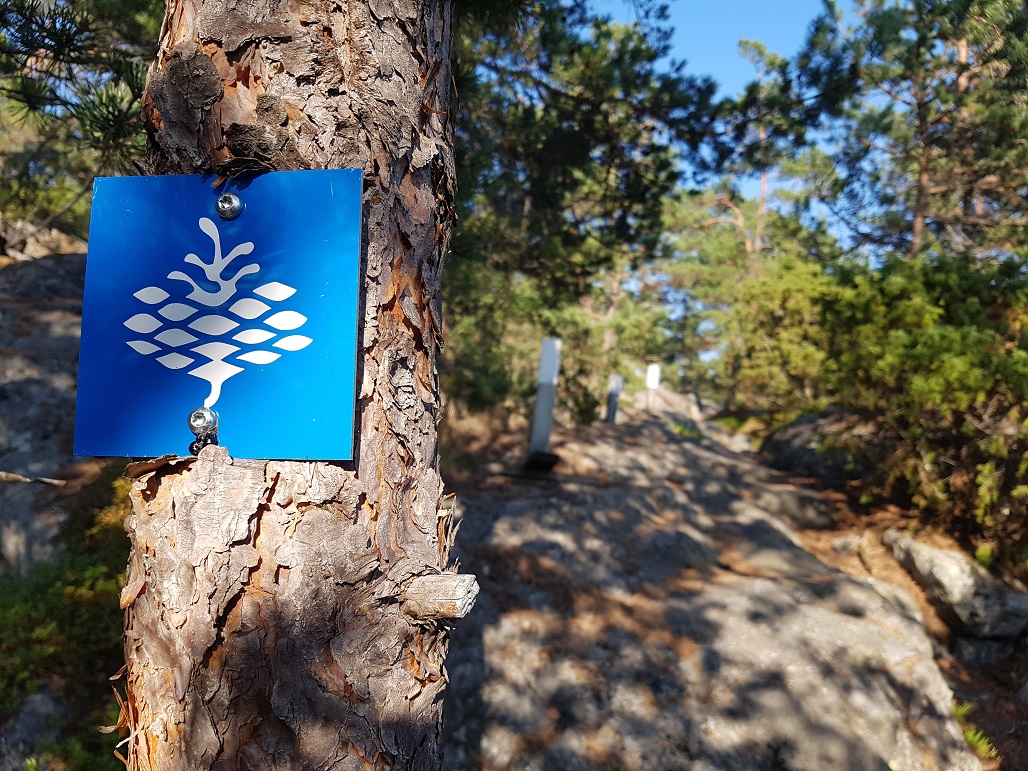
Both Modermagan’s and Älgö’s nature trails are easy to follow. The Rödjan trail on Älgö is marked with blue pinecone shields and Modermagan’s with white wooden posts. Both trails are quite hilly and demand good basic fitness as well as healthy feet.
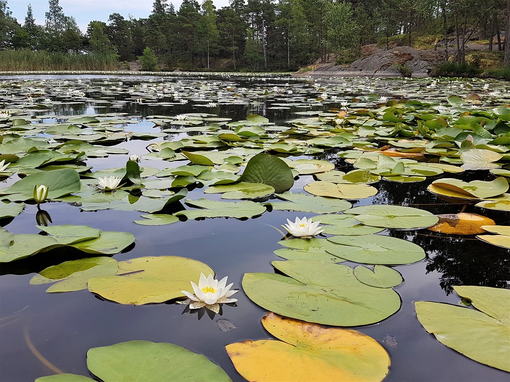
Just as we thought that Modermagan’s nature trail had ended, a pond appeared in front of us. I’ve never seen so many waterlilies. Archipelago nature is usually quite rocky and bare, so this lily pond stuck out by contrast. It was as if in a fairytale. The only thing missing was a frog prince looking for his princess. You can also swim in the pond, something that we tried and tested.
We went back to our kayaks, had a light meal and exchanged greetings with some boaters. Afterwards we paddled back along Älgö’s east side. In calm, favourable conditions, the journey should only take an hour and a half.
Our car was waiting for us at Sommarö Stranden. We emptied our kayaks and lifted them onto the roof of the car. With our souls feeling so fully restored and recharged, it felt like in only two days we had experienced two weeks of summer and archipelago.
Article by Mia Sinisalo
Translation: Becky Hastings
Related Content


Leave a Reply
Want to join the discussion?Feel free to contribute!