
One of Finland’s Most Famous National Landscapes: Imatrankoski rapids
Finland boasts 27 official national landscapes, some of which are vast areas—like the Utsjoki Valley—while others are more specific points of interest, such as Imatrankoski rapids. Imatrankoski riverbed is located right in the heart of Imatra’s town center.
- Location on the Map
- Arriving by public transport: Imatra is accessible by both train and bus.
- Arriving by car: Address: Imatrankoskentie, Imatra.
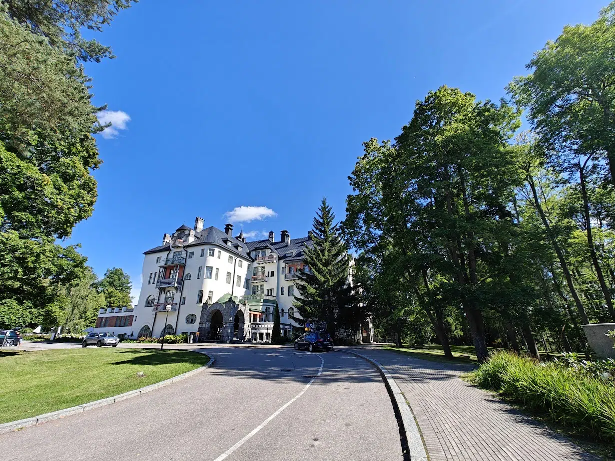
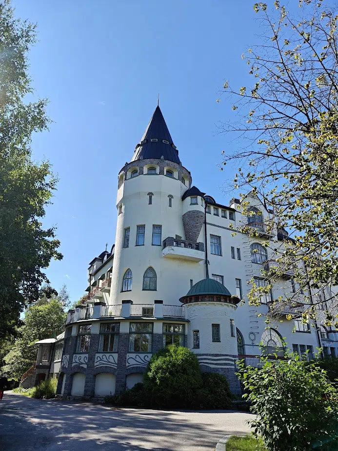
The compact town center of Imatra is a pleasant destination, perfect for stretching your legs, enjoying the outdoors, or indulging in a treat while passing through. It’s worth stopping in Imatra for a night, especially since the castle-like Valtionhotelli hotel towering right on the edge of the riverbed makes for a striking place to stay. This Art Nouveau-style castle, built in 1903, stands in a park-like setting and serves as a notable landmark for those heading to the rapids.
In summer, be sure to enjoy some ice cream around the castle grounds and admire the floral displays and the broader beauty of the park.
The castle was originally built as a hotel because Imatrankoski, when it flowed freely, was such a famous attraction that people came to admire it from as far away as Europe and Russia. Over the years, the hotel has also served as a military hospital, an army headquarters, and an anti-aircraft center, among other uses.
It has even been named the most beautiful building in Finland—what do you think?
From the corner of the hotel, a walking path in the park leads down to a viewing platform where you can observe the riverbed of Imatrankoski.
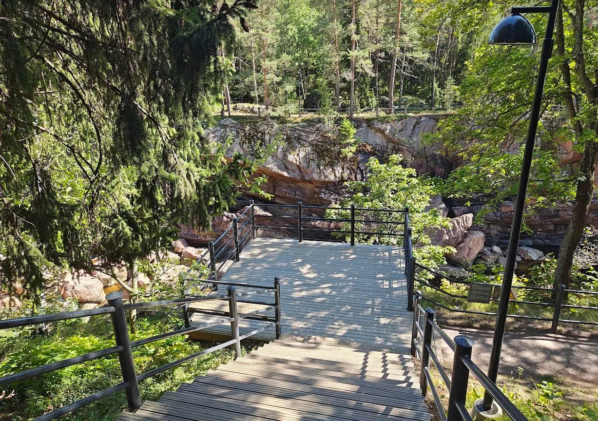
During our visit on a Sunday in August, the riverbed was dry and silent. Due to hydroelectric power generation, the Imatrankoski riverbed is usually dry unless the dam’s gates are opened, releasing a powerful, wild torrent of white water. These events are known as Rapid shows (koskinäytös). If you want to see the water raging, you can check the schedule of these shows online.
The Rapids show lasts approx. 16 minutes. Eight minutes after the flood gates are opened, the foams reach their peak with an average of 400 cubic metres of water per second flowing in the stream. In the summer rapid shows will be accompanied by music of Jean Sibelius and on Saturdays the Whitewater Symphony by the Osmo’s Cosmos band.
Above, a 360-degree video of the rapid show from Imatra’s official YouTube channel.
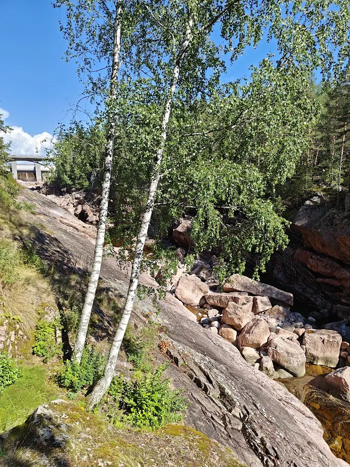
An information board at the viewing platform provides an overview of Imatrankoski’s origins. To sum it up: 5,700 years ago, the Great Saimaa lake flooded so much that the water broke through the Bar Ridge, creating an outflow channel now known as the Vuoksi River.
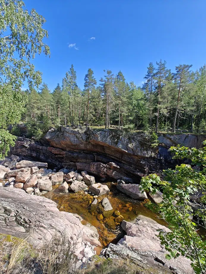
From the viewing platform, it’s pleasant to enjoy an ice cream cone while observing the riverbed and its shapes. Directly below, you can see round, smooth, kettle-like formations in the light-colored rock. On the opposite wall, jagged, wave-like, giant patterns catch your eye. Somewhere, water is trickling, but we can’t determine its source—the water at the bottom of the riverbed is completely still.
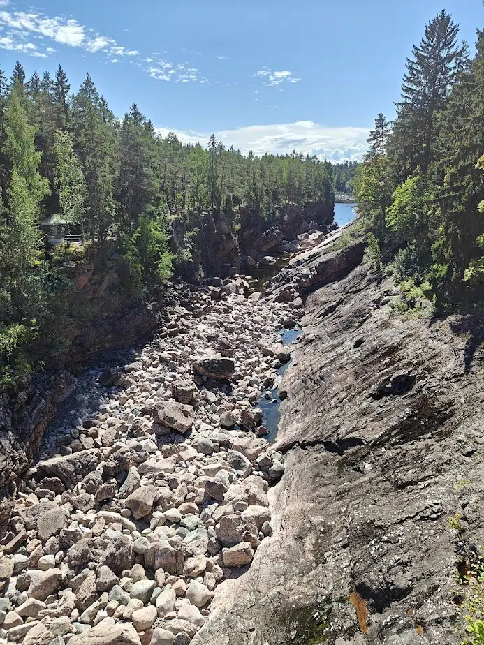
Finally, we move to the pedestrian pathway on Imatrankoskentie road to view the riverbed from directly above. The road is closed to cars during the rapid shows, but even now, it’s a relaxing spot to enjoy the scenery and the beautiful summer day over this national landscape.
Imatrankoski was dammed in the 1920s, and the national landscapes of Finland were selected only in the 1990s. National landscapes are not just meant to be particularly scenic Finnish views but also to tell stories of human history and culture. In this sense, the two faces of Imatrankoski—its dammed hydroelectric power and its roaring rapids—both fit well within the concept of a national landscape, each telling its own story.
But standing by the dam, I can never resist fantasizing about the free-flowing rivers of our land.
Related Content


Leave a Reply
Want to join the discussion?Feel free to contribute!