
Travel Destination: Vöyri, Hometown of the band KAJ – Part 1/4
Article: Mari and Mika Leijo
The municipality of Vöyri and its surrounding areas offer a wonderfully diverse region for nature lovers. We only managed to scratch the surface of what the area has to offer, even though we spent an entire week there from June 7 to 14, 2025. We still missed more than a dozen hiking trails! But during the week, we did get to enjoy many beautiful spots, which I’ll introduce in this article series. Among them are the ancient Vitmossen site, the coastal hiking trail on Västerö, the picturesque Kimo ironworks, and the scenic trail at Kovik.
We had a summer vacation week coming up in June, but no destination planned. Then, a music group called KAJ kept popping up in the news headlines. Apparently, the band members are from Vöyri, or Vörå in Swedish. What kind of place is that? On the Visit Vöyri website, I found a list of local hiking trails. The sheer length of the list was impressive—and just like that, our holiday destination was decided.
Quick facts!
- The municipality of Vöyri (Vörå) is bilingual: 81.5% of the population speaks Swedish as their mother tongue, while 11.8% speaks Finnish.
- Finland was part of the Kingdom of Sweden for 700 years.
- Vöyri also has its own local Finland-Swedish dialect.
- KAJ is, then, a Finnish band from a town where the majority speaks Swedish as their mother tongue.
- In 2025, they represented Sweden in the Eurovision Song Contest with the song Bara Bada Bastu.
Day 1
Along the way: Kyrönjoki National Landscape and Kaavontönkkä
13 km from Vöyri
- Vähäkyrö Church on the map
- Kaavontönkkä on the map
- Address: Kaavontönkkä, Vaasa
- Walking path to the burial site: 120 m one way
- Grill and swimming spot in the Kirkkolammi area
We set off from the Pirkanmaa region on Saturday morning with about 250 km ahead of us to Vöyri. For our afternoon coffee break, we found a charming spot at Café Kanttorila in Vähäkyrö, which is open during the summer.
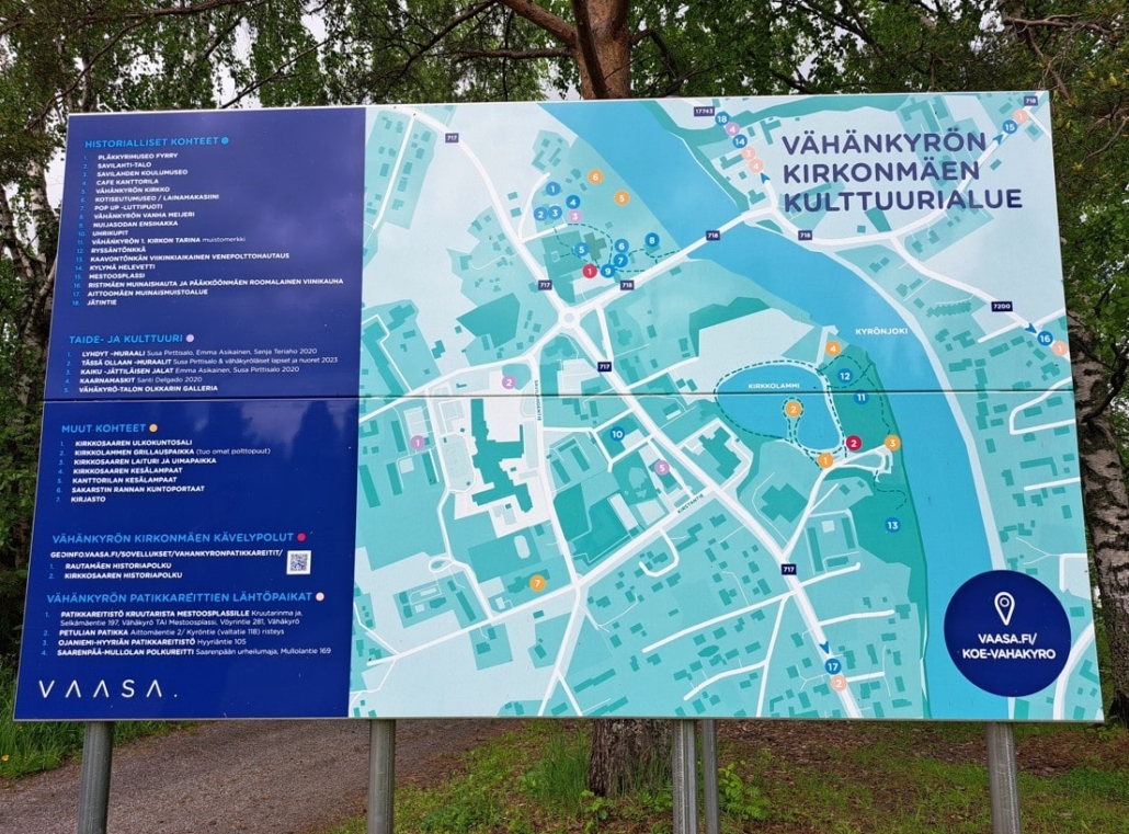
Located on the church hill by the banks of the Kyrönjoki River, the roughly 200-year-old Kanttorila shares a yard with the Tinsmith Museum. The 200 km-long Kyrönjoki River with its surrounding farmlands is one of Finland’s 27 national landscapes, and the church hill of Vähäkyrö is a nationally significant built cultural environment. When we arrived, the church parking lot was full of cars—and we soon found out why: a sign revealed there was a Viking Day event. After coffee and treats, we headed to find Kaavontönkkä, located in the Kirkkosaari recreational area.
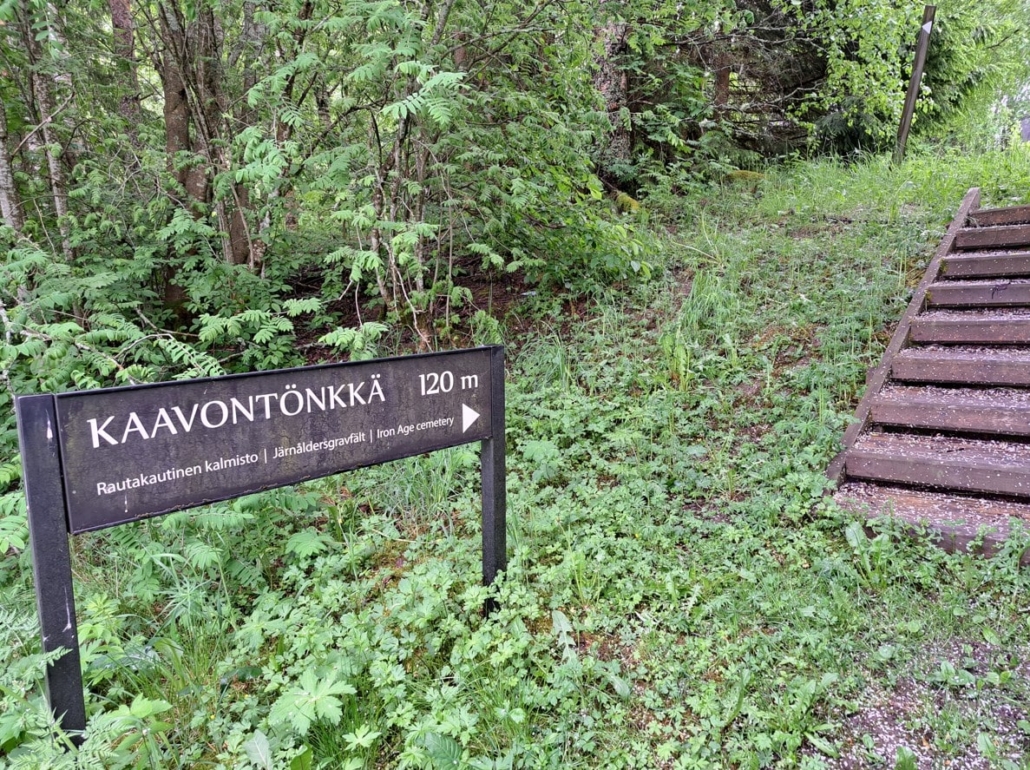
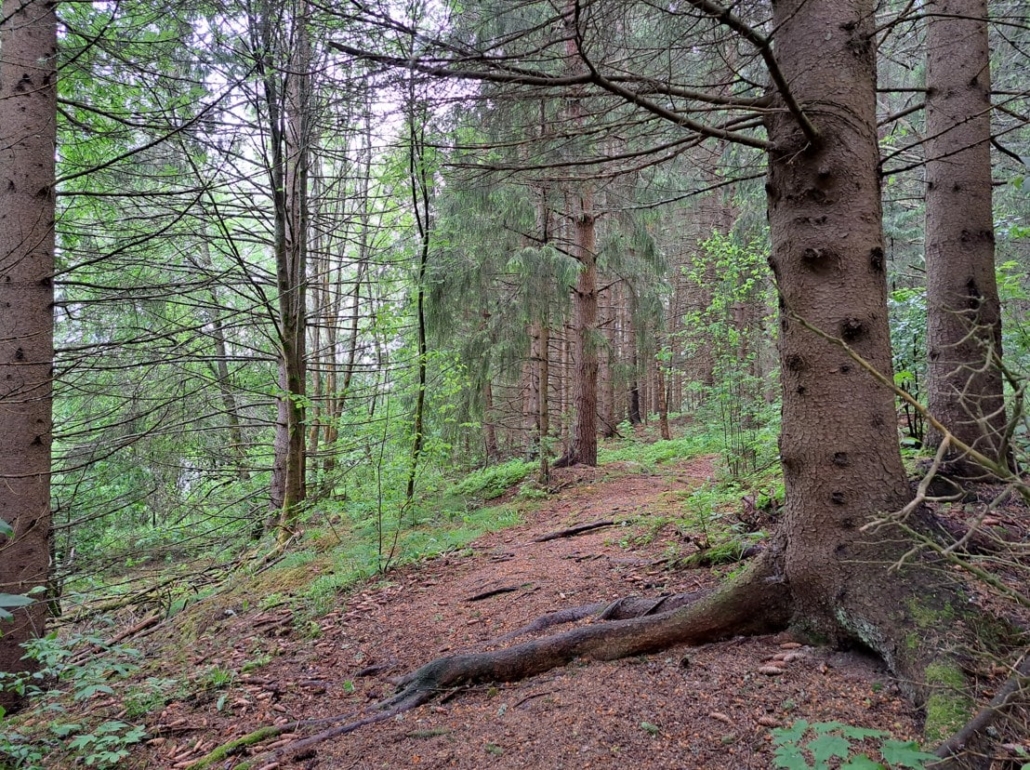
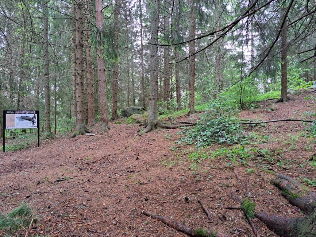
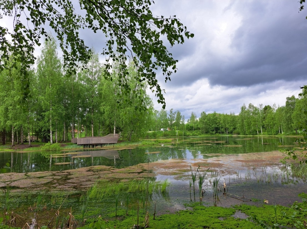
A sign pointing to the site can be found at the parking lot of the Kirkkosaari swimming pier, next to an old dance pavilion (address: Kaavontönkkä, Vaasa). The walk is about 120 meters. A clear but mysterious trail runs beneath tall spruce trees. In the shadowy forest, a sense of suspense builds—what might be waiting here?
Kaavontönkkä is a significant Iron Age burial site. It includes a cremation cemetery and a Viking-era boat burial. In addition to hundreds of iron rivets from the boat, grave goods included bladed weapons, tools, and jewelry. Among the charred remains in the cremation cemetery, several bear claws were found alongside human bones—possibly indicating that the deceased were wrapped in bearskins before being placed on the funeral pyre.
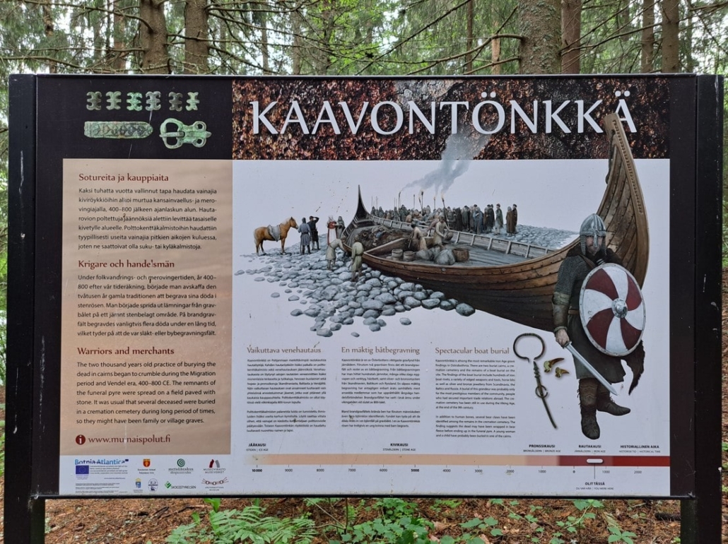
This place has long been a site of gathering and reflection. People once stood here to say their goodbyes, to send off their loved ones into the afterlife. What did they look like? How did they dress for funerals, express grief, offer comfort? Was there a feast afterward—and if so, what was it like? Where and how did those who held funerals here live, what was their daily life like? History never interested me in school, but this place sparks a curiosity that the information board happily feeds.
Near Kirkkolammi, you’ll also find a short hiking trail, a grill spot, and a swimming pier where you can take a dip in the Kyrönjoki River—just be mindful of the current.
Tuckor Village and Our Accommodation at Lillstugans Gästhem
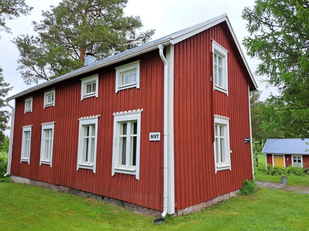
From Vähäkyrö, it was another 13 km to the center of Vöyri, where we stopped for groceries. From there, we continued about 8 km along Vöyrintie road to the village of Tuckor and our accommodation, Lillstugan, where we arrived around 4 p.m.
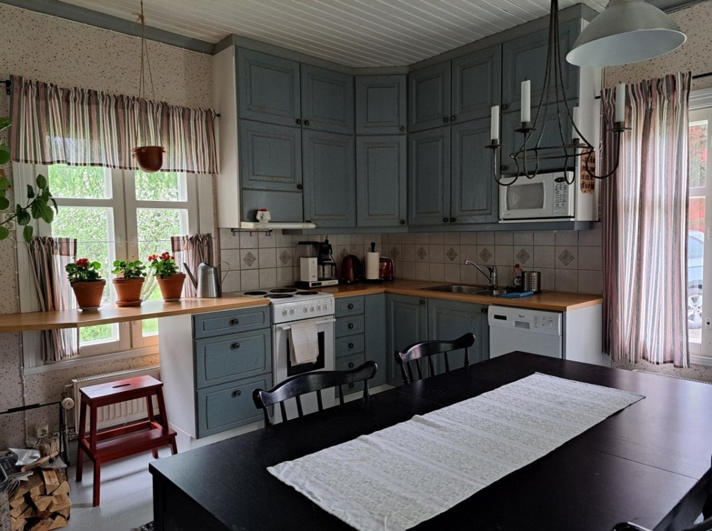
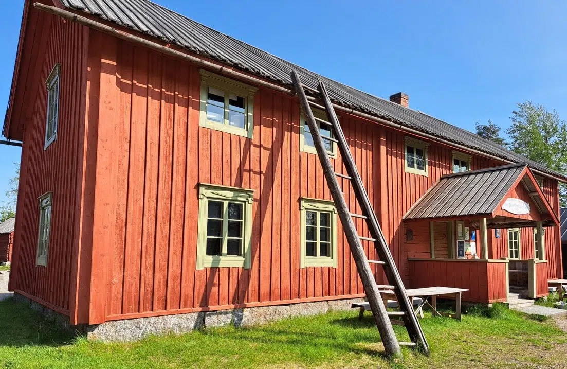
Our base turned out to be a beautifully restored and tastefully decorated Ostrobothnian house, about a hundred years old. The ground floor features a spacious kitchen and dining room, a large bathroom, and a single bedroom. Upstairs there are two double bedrooms. The yard included a brand-new sauna, which we were free to use whenever we pleased.
The friendly hosts lived in the same yard, where a few cats, some chickens, and a rooster wandered around. This idyllic accommodation on the edge of open fields was a peaceful nest, a perfect place to return to after a day of exploring. We spent our first evening cooking and enjoying the sauna.
Day 2
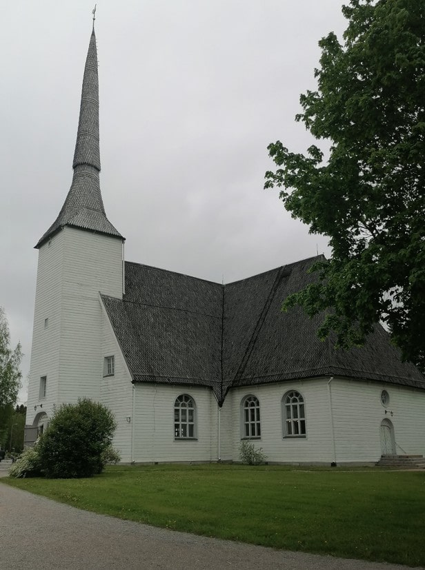
The Wooden Church of Vöyri
- Church on the map
- Lotlaxintie 36, Vöyri
Vöyri Church is the oldest wooden church in Finland still in active use. It was completed in 1626, and in preparation for its 400th anniversary celebration in autumn 2026, the church will undergo renovations for the next 14 months.
We happened to visit on the last day it was open, so we seized the opportunity to see the church interior before it closed for renovation. The church has a sharp steeple over 40 meters high, visible from afar.
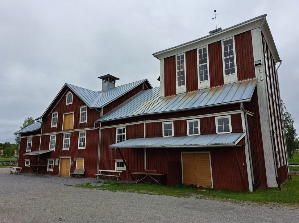
Rökiö Mill
- Location on the map
- Lotlaxvägen 9, Vöyri
By the nearby Vöyri River, a large building caught our attention—it turned out to be Rökiö Mill. Milling operations began there in 1923 and ended in 1986.
Today, the mill is owned by the Rökiö Library Association, which organizes various activities in the area. There’s a pétanque court in the yard, a photography museum upstairs in the Mill Cottage featuring works by local photographer Hägglund, and an agricultural exhibition inside the mill building.
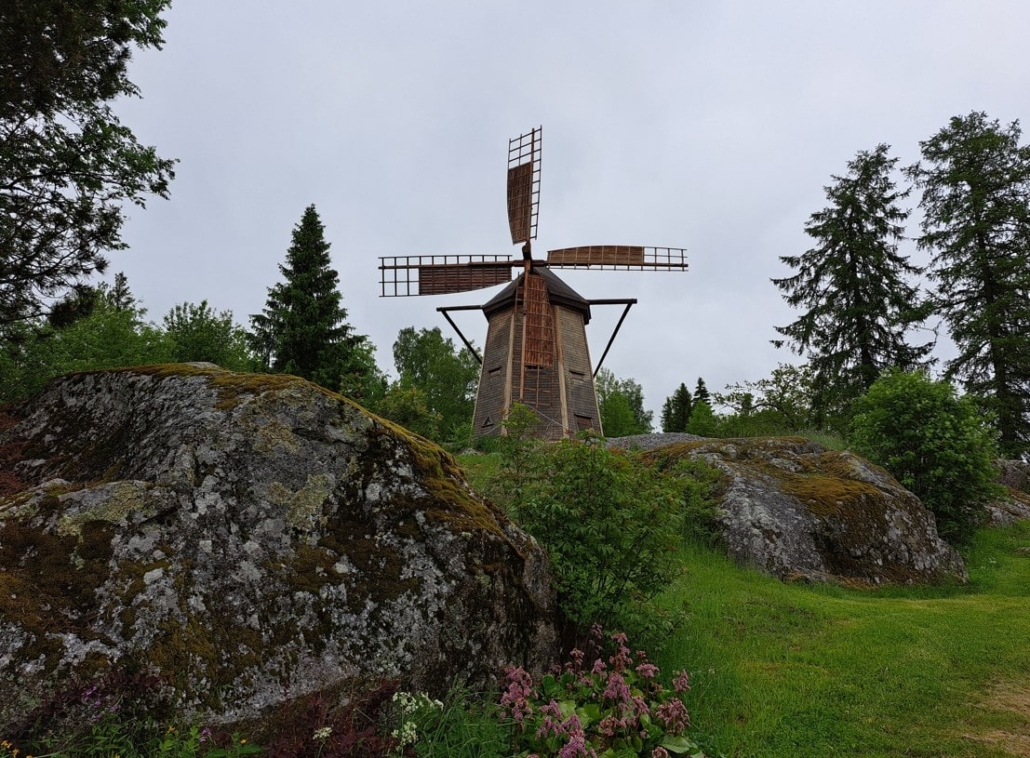
We had lunch at Elsas Kök, located on the Norrvalla campus. The site also hosts Finland’s only Swedish-language sports high school, as well as a course and camp center, hotel, swimming hall, gym, and mini golf course.
Boberget Hiking Trail
- 6.7 km loop trail
- Two shelters with fire pits
A hiking trail to Boberget starts on the sports campus behind the windmill. We didn’t get the chance to try it on this trip. The trail is a 6.7 km loop, with several shortcut options that allow you to shorten the route. There are two lean-tos with fire pits at the far ends of the oval-shaped loop. Here’s a map of the Boberget route.
The Ancient Vitmossen Site
- Location on the map
- Kuckusvägen 1148
- Out-and-back trail: 1.5 km each way; also a 5 km loop in the area
The rain began conveniently just after we’d settled in for a relaxing afternoon. Once it cleared up, we headed out around 7 p.m. to explore nearby Vitmossen. There’s a signposted turn from Kuckusvägen and space for a couple of cars to park along the road. The trailhead was just a short drive from our accommodation.
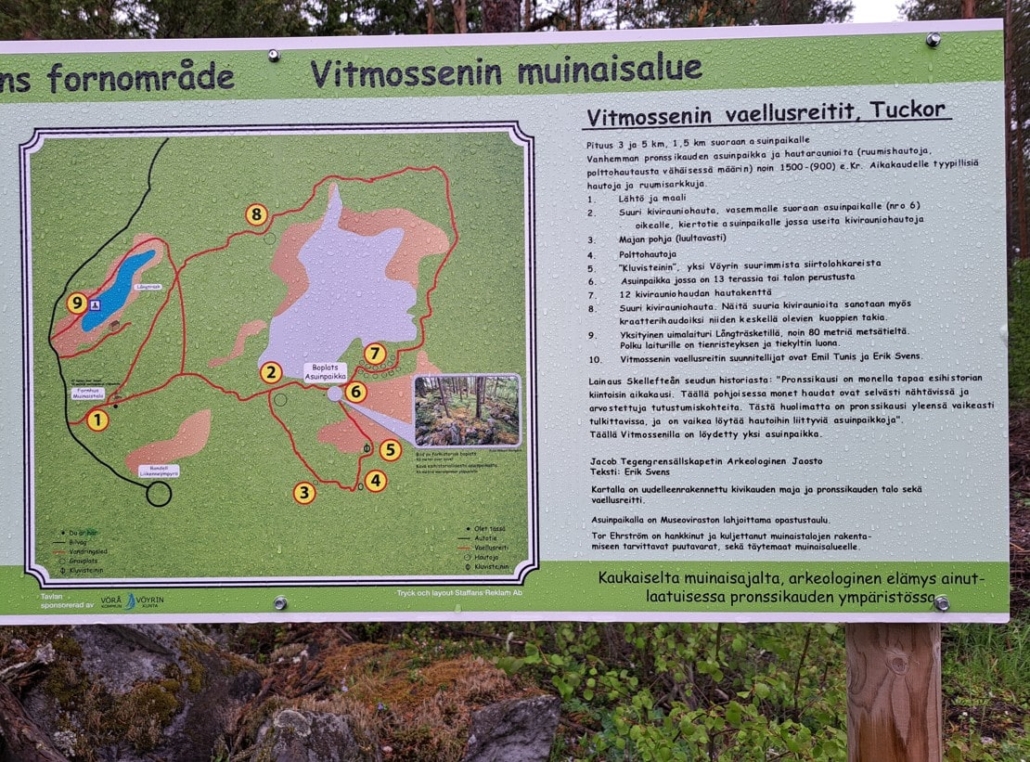
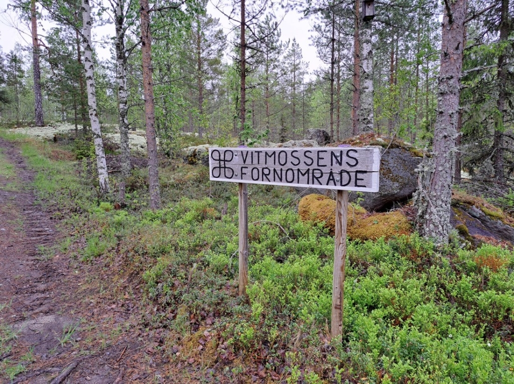
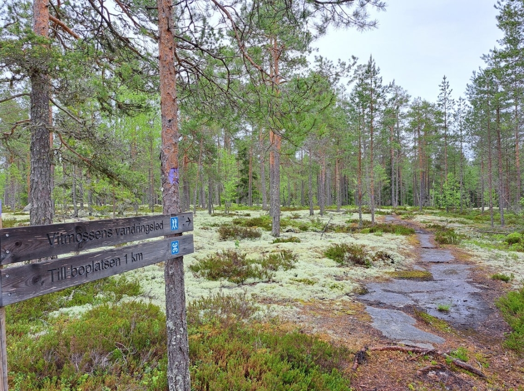
Vitmossen is home to one of Finland’s oldest discovered settlements, dating back to the Early Bronze Age. The shortest route to the site is 1.5 km, meaning a total walk of 3 km there and back. The area also features a 5 km circular trail.
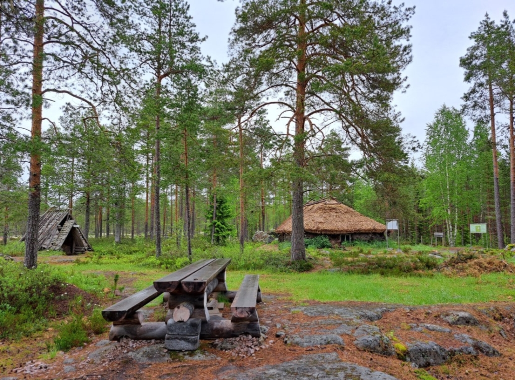
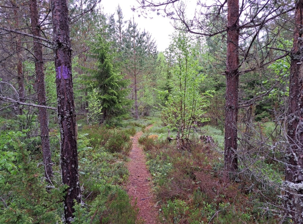
The first part of the path is wide and flat, leading to a clearing where you’ll find a replica of a Stone and Bronze Age dwelling. The clearing also features wooden wolves and bears—thankfully only carved ones—and a spot for a snack break.
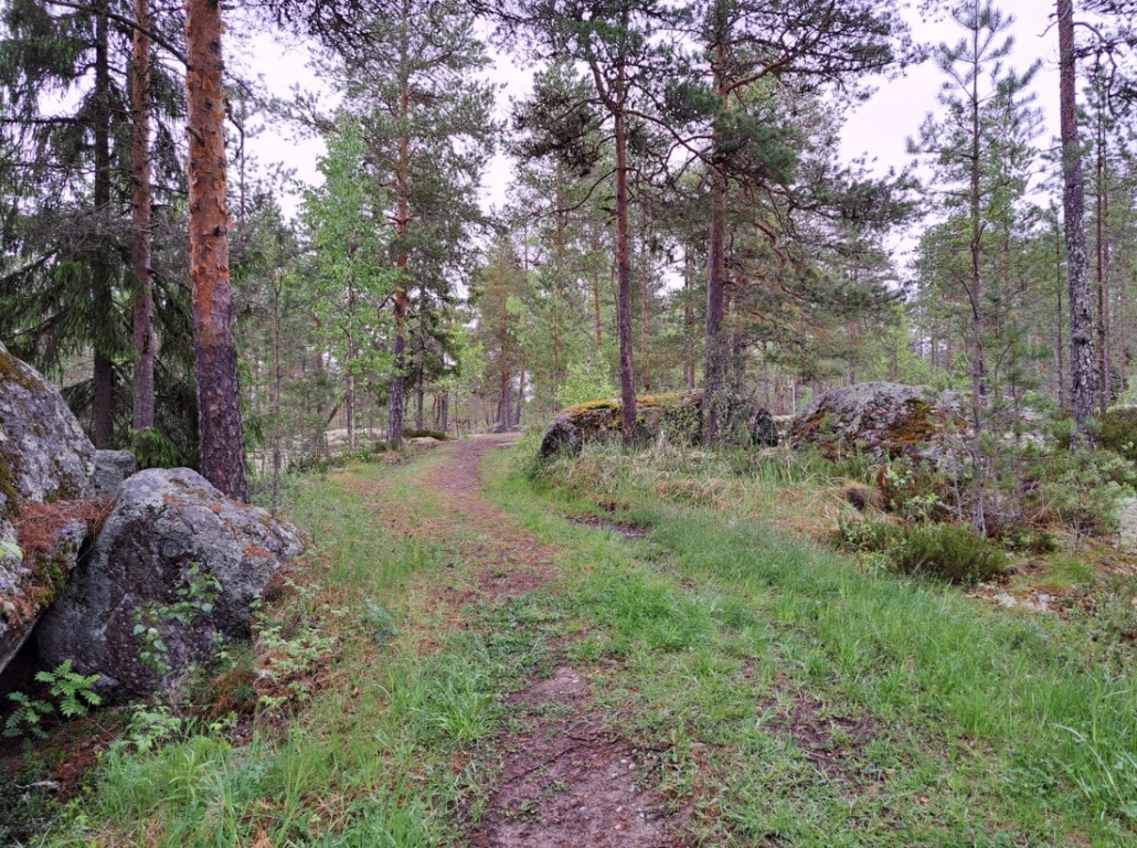
From there, the trail narrows but remains easy to follow. The first stretch runs over lichen-covered bedrock before dipping into the forest.
Damp from the rain, the reddish trail covered in pine needles winds delightfully through undergrowth glowing with early summer green.
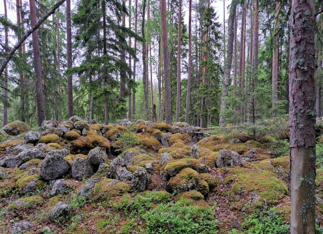
At the ancient settlement site, an information board explains that dozens of prehistoric graves and signs of settlement have been found in the area. Excavations revealed pottery shards and bone fragments, mostly seal bones. The site now lies 40 meters above sea level, but during the Stone and Bronze Ages (around 1500–1200 BCE), it was right on the coastline.
The findings suggest that this location served as a permanent base for several generations, with residents making their living from fishing, seal hunting, and birding.
You’ll find a route map and short descriptions of this and other trails in Vöyri on the Vöyri Hiking Trails page.
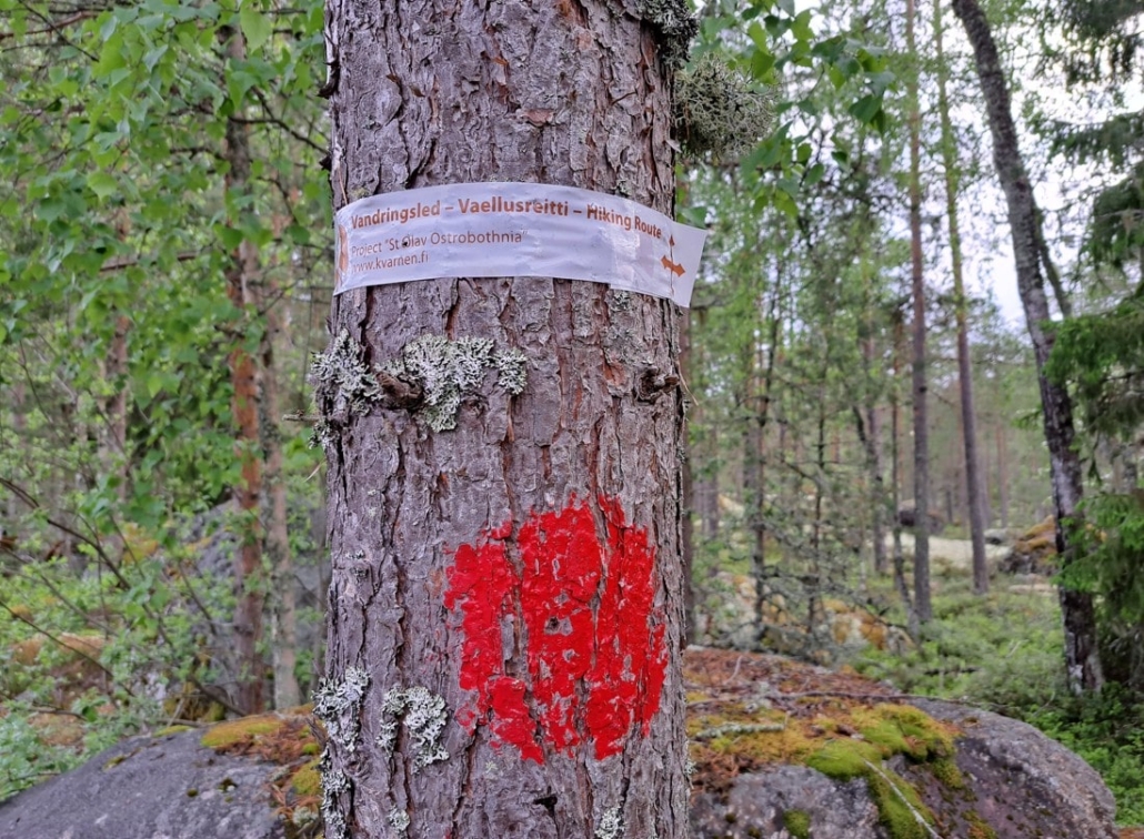
The St. Olav Coastal Route in Vöyri
As we returned to the car, I noticed that the St. Olav Coastal Route also passes through here. The northern branch leads from Kokkola to Vaasa, while the southern route comes from Siipyy to Vaasa, where one can catch a ferry to Sweden and continue along the St. Olav Path across Sweden to Trondheim in Norway.
I’ve walked the Olav Route from Turku to Eckerö in Åland, and from Åre in Sweden to Trondheim in Norway. I’d love to try out this Coastal Ostrobothnia section someday, too.
In the next part of the Vöyri article series, I’ll share about our time on the coastal hiking trail at Västerö and our visit to the Tottesund Manor.
Read next
Travel Destination: Vöyri, Hometown of the band KAJ – Part 2/4
Travel Destination: Vöyri, Hometown of the band KAJ – Part 3/4
Travel Destination: Vöyri, Hometown of the band KAJ – Part 4/4
Planning on visiting Finland? Here’s what you can expect!
Finland has 27 official national landscapes—here they are!
Related Content


Leave a Reply
Want to join the discussion?Feel free to contribute!