
Travel Destination: Vöyri, Hometown of the band KAJ – Part 2/4
Article: Mari and Mika Leijo
The municipality of Vöyri and its surrounding areas offer a wonderfully diverse region for nature lovers. We only managed to scratch the surface of what the area has to offer, even though we spent an entire week there from June 7 to 14, 2025. We still missed more than a dozen hiking trails! But during the week, we did get to enjoy many beautiful spots, which I’ll introduce in this article series. Among them are the ancient Vitmossen site, the coastal hiking trail on Västerö, the picturesque Kimo ironworks, and the scenic trail at Kovik.
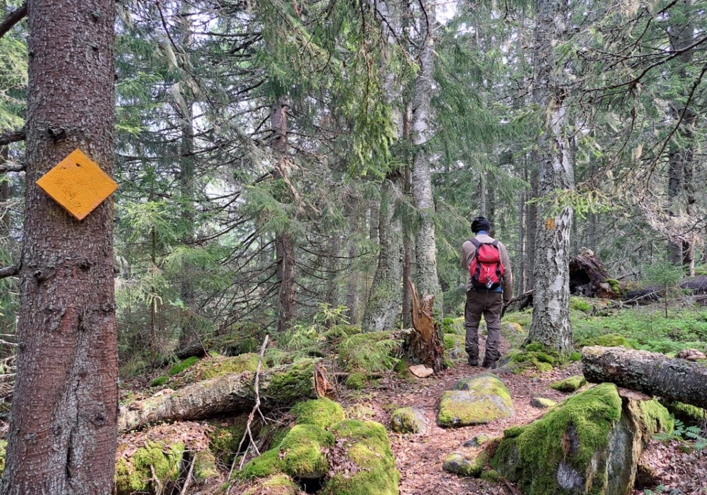
Day 3 of the hike
Västerö Trail, Maksamaa
- Parking area on the map
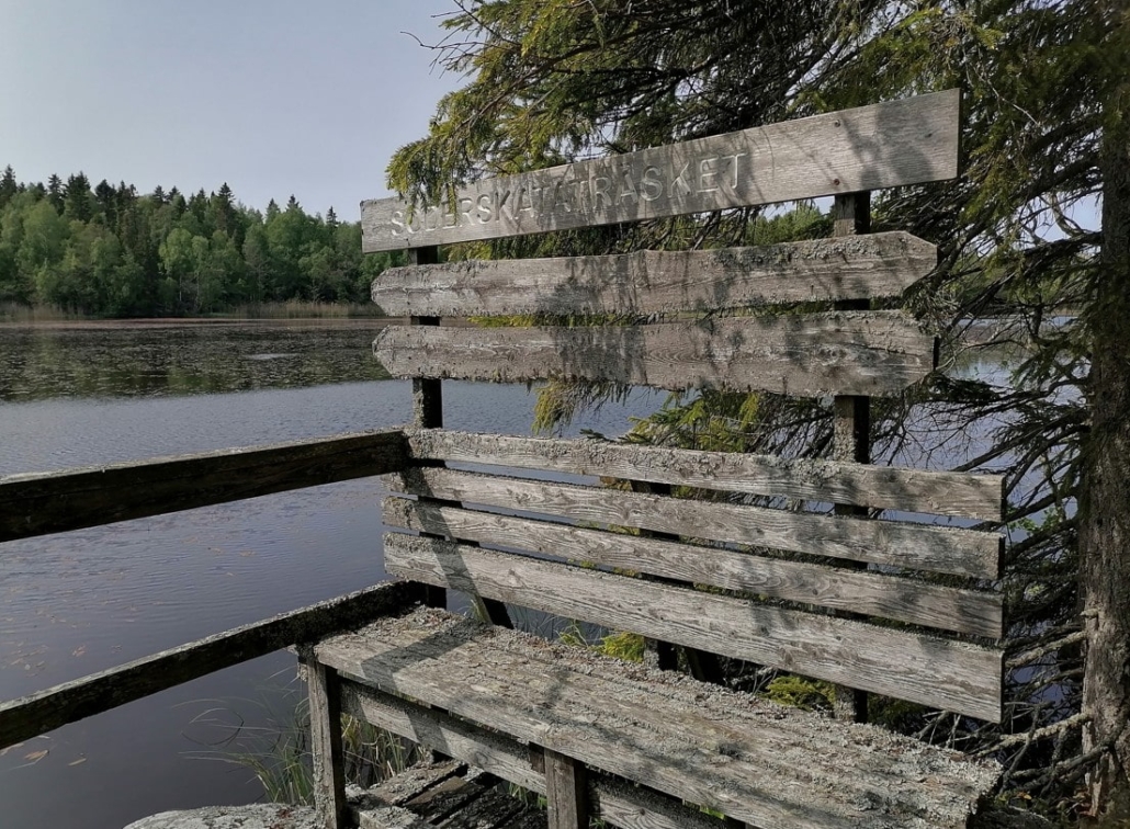
- Söderskatan, Vöyri
- Loop trail 4.6 km
- Campfire site: yes
On Monday, we headed to the coast, to Maxmo (Maksamaa). Maksamaa and Vöyri merged in 2007, so technically we stayed within Vöyri even though we traveled about 35 km northwest from our accommodation to the village of Västerö. There is a spacious parking area along Söderskatan road, as well as a trail map that you can print from the “Vöyri hiking trails” website.
The Vöyri archipelago is part of the Kvarken Archipelago, which is one of Finland’s 27 official national landscapes.

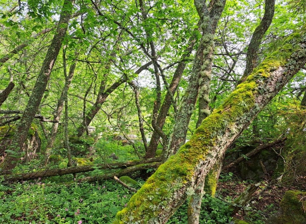
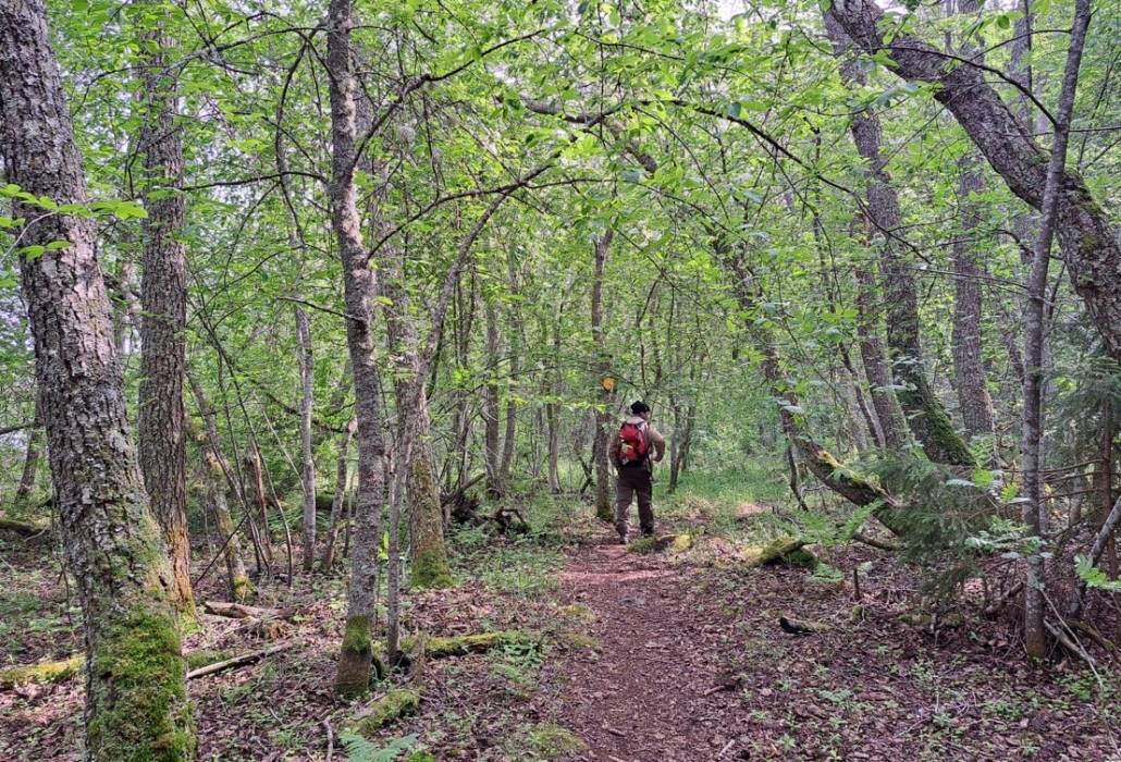
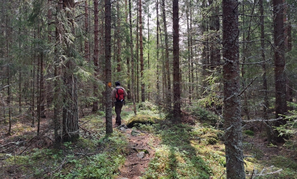
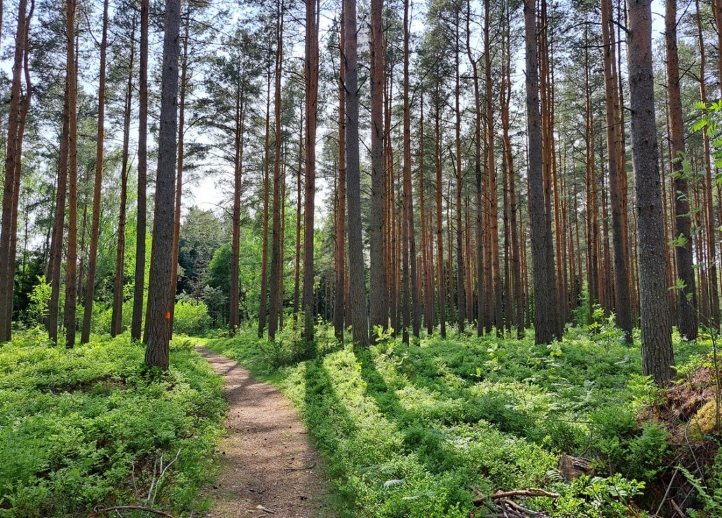
The area offers two loop trails and a connecting linear trail. In addition, a second linear trail leads north from the northern loop. We chose the southern loop trail, which is 4.6 km long. The route begins on a gravel road, which eventually ends as the path continues into coastal forest—a lush green world, just as overwhelmingly beautiful as early summer can be.
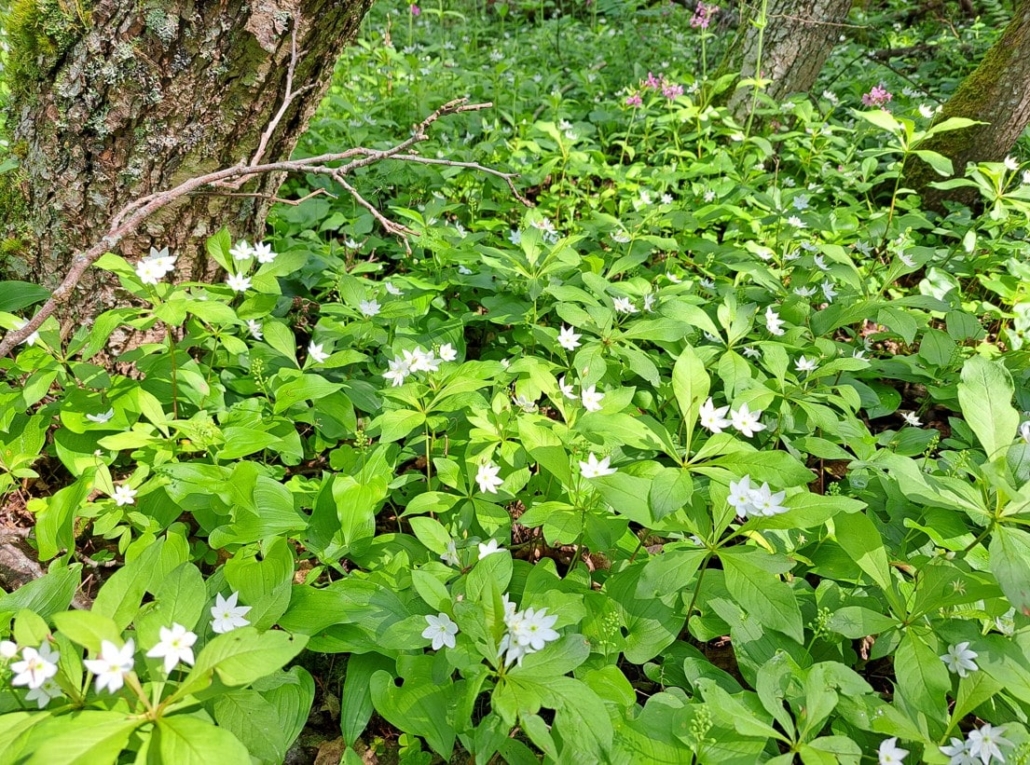
Large areas were blanketed in chickweed wintergreen. I’ve never seen this many before—there were plenty on other trails as well during this trip. I couldn’t help but smile; these flowers really do bring joy, light, and smiles.
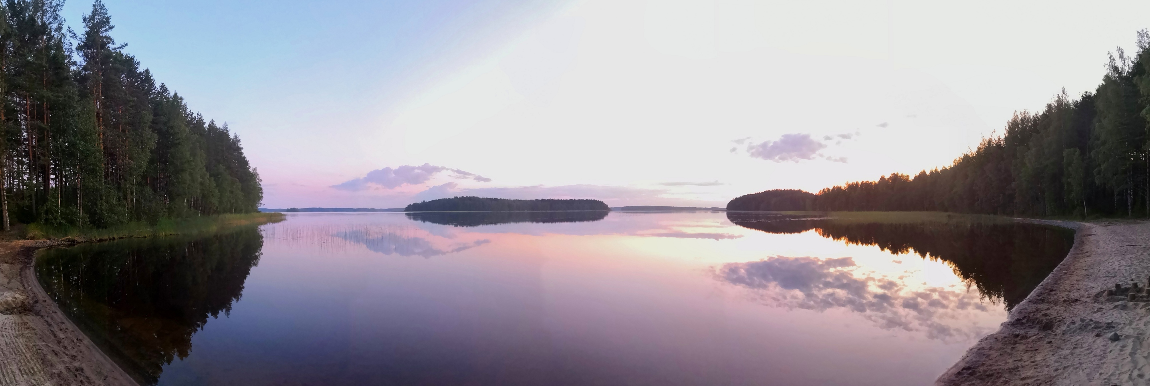
At Söderskatan, we sat on a board to enjoy our packed lunch and watch the cotton-like clouds floating above the horizon. A gentle breeze kept the few mosquitoes away. Only birdsong and silence could be heard. Ah, this was the moment I had longed for: sea view, sunshine, fair-weather clouds, a soft breeze, birds, and silence.
The trail continued through spruce forest at times, and at others under leafy canopies.
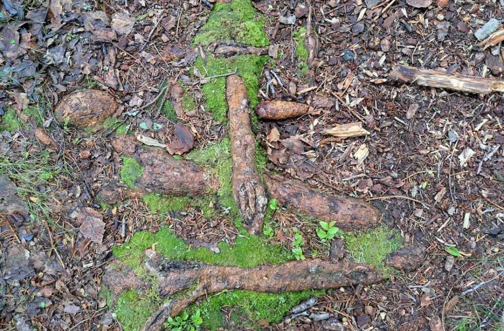
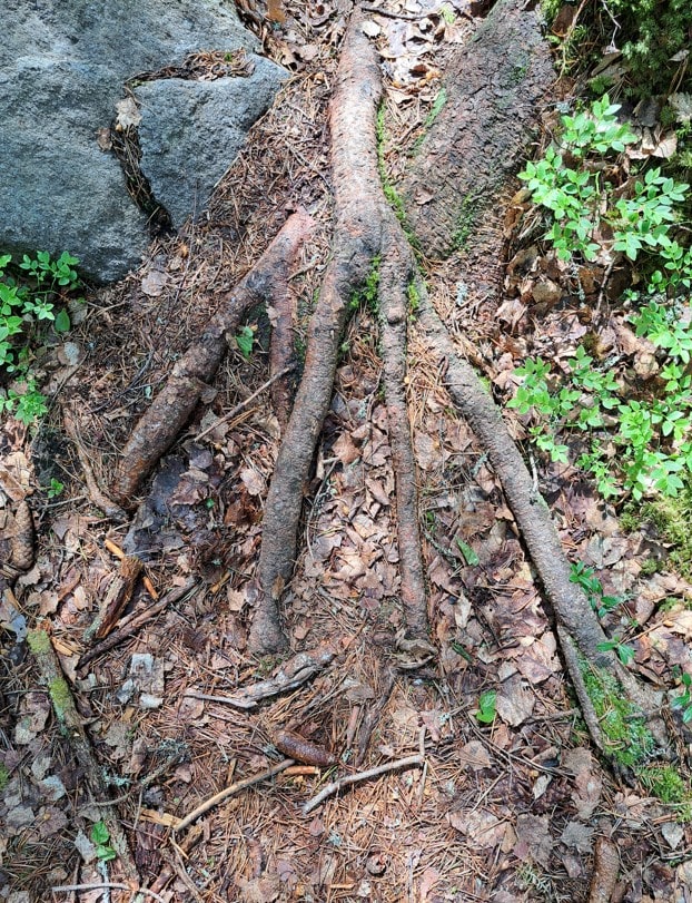
The tree roots stretched across the path in many directions.
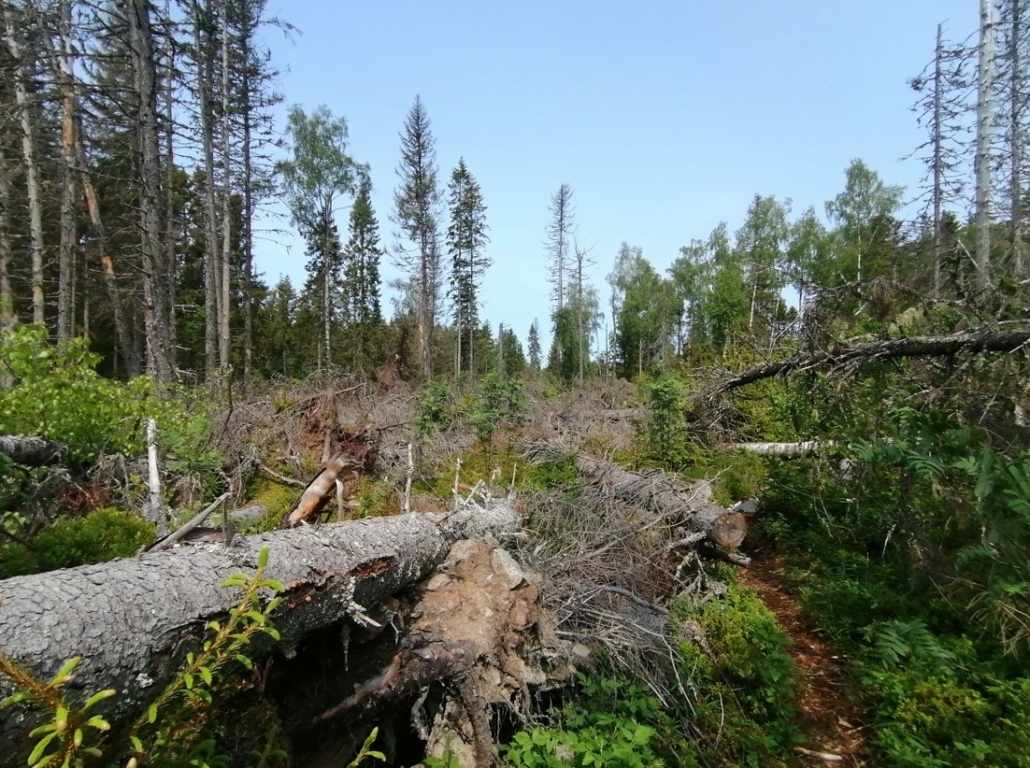
A storm had hit the trail, but it had been cleared so well that we didn’t need to climb over any trunks.
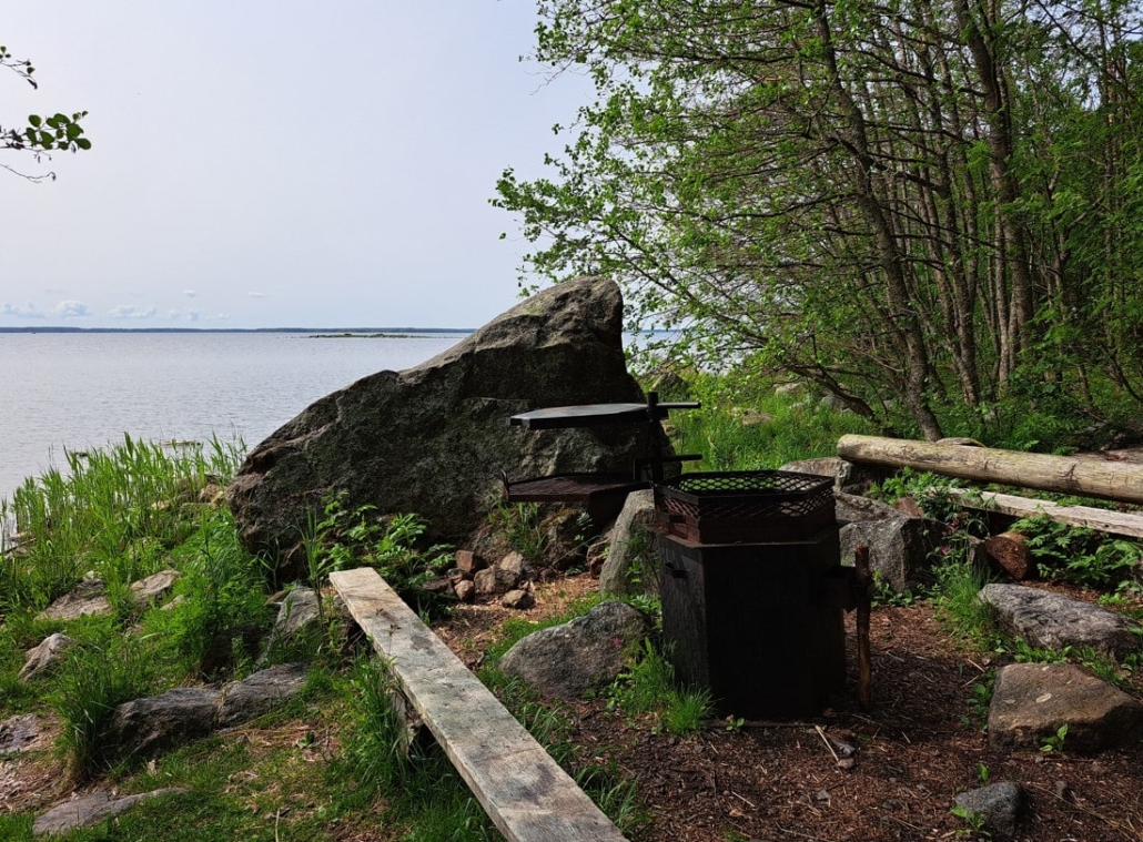
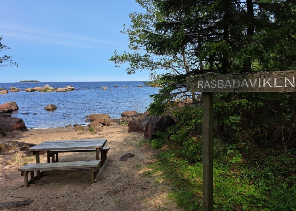
Räsbådaviken was the next rest stop. There was even a table with a spectacular view, but the chilly Kvarken wind made us seek shelter behind a large rock a little farther off.
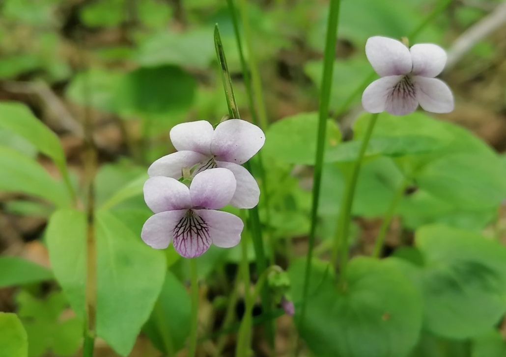
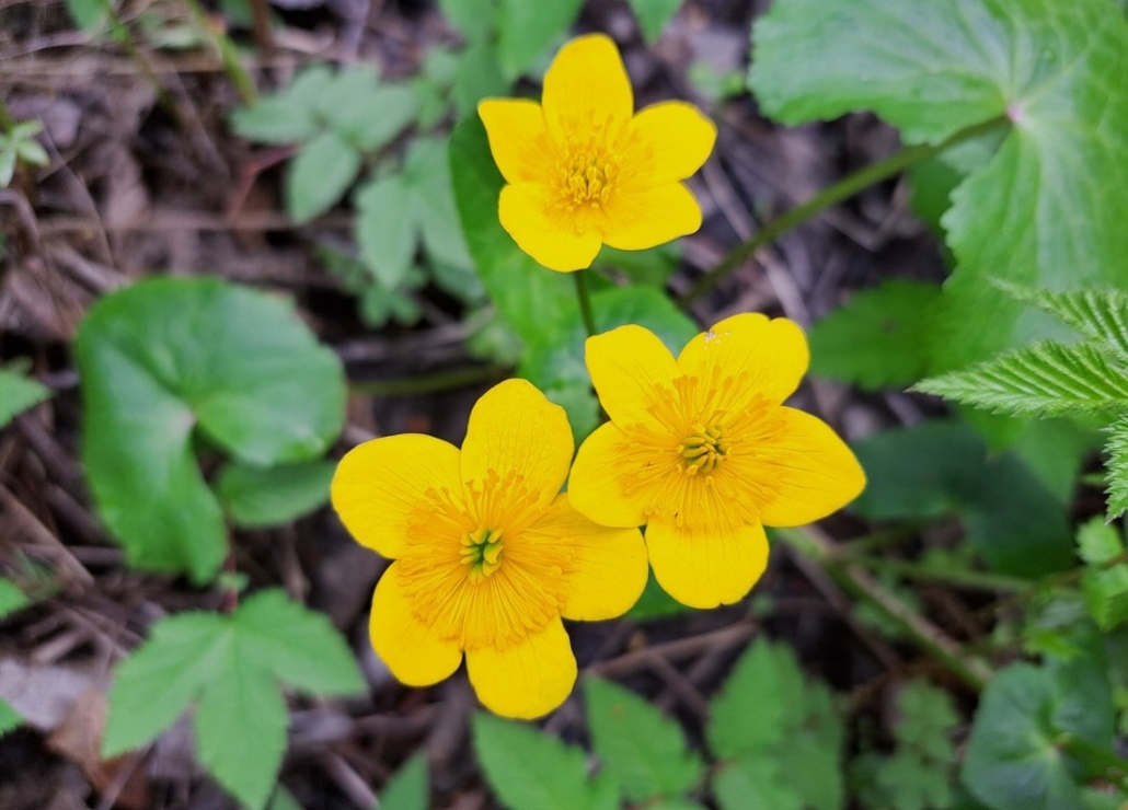
After our tea break, we continued toward the northernmost point of the southern loop. Marsh violets and kingcups delighted us along the way with their delicate and cheerful colors.
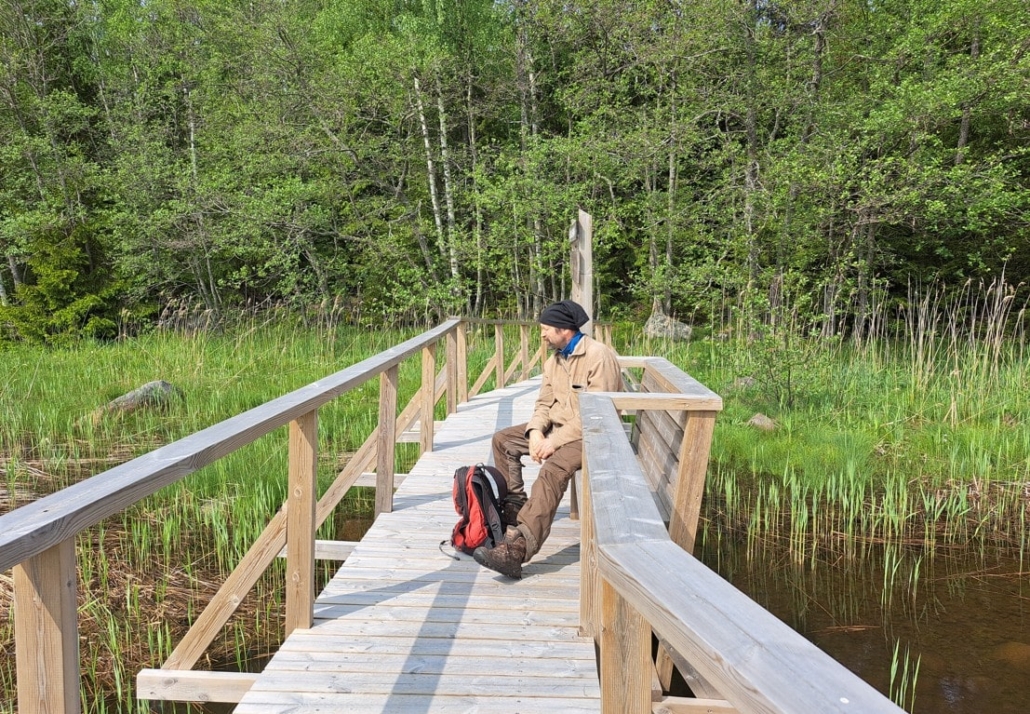
We took a short detour to check out the bridge heading north. Conveniently, there was a bench in the middle, where we paused to listen and watch the birds—and even spotted an eagle in flight.
We returned to our southern trail, which continued through a bright spruce forest.
The long arms of the tree roots continued reaching out for water and nutrients.
Soon the trail reached the shore of Lake Söderskataträsket, where we found a bench perfectly placed for listening to the silence and watching birds.
After that, we were soon back at the parking area.
Still recovering from a cold, my strength wasn’t quite up to exploring the other interesting trail sections on Västerö—those will have to wait for another time.
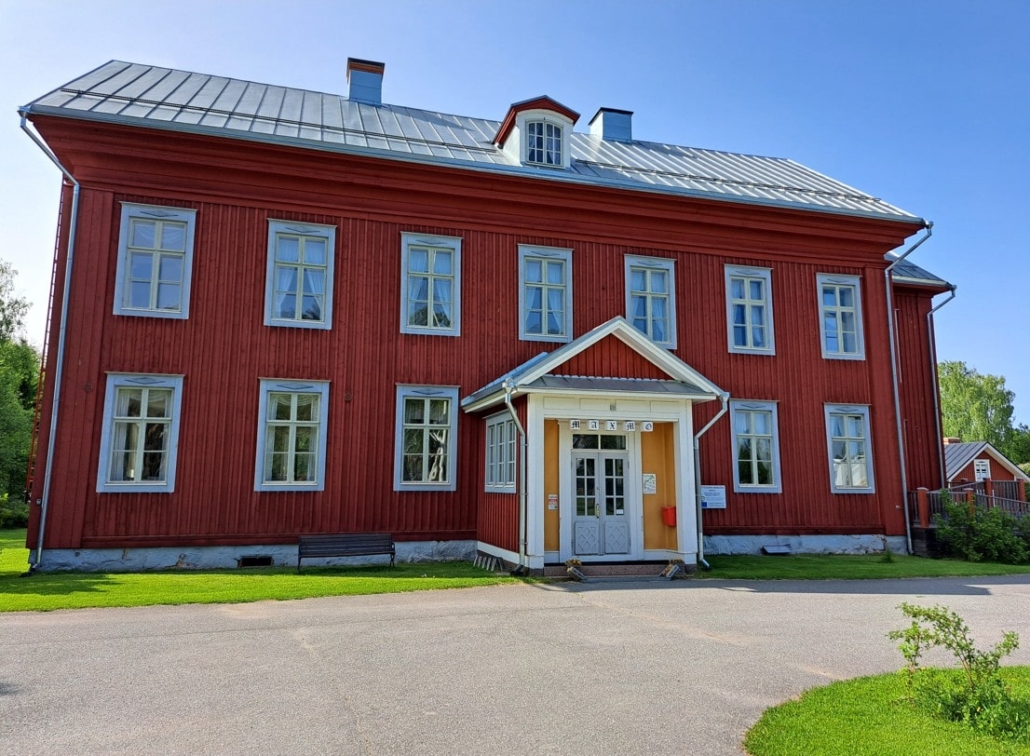
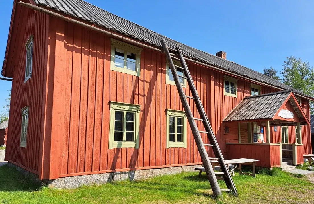
Tottesund Manor
- Location on the map
- Address: Tottesund 529, Maksamaa (Vöyri)
On our way back, we made a stop at Tottesund Manor. The current main building was commissioned by Colonel Gustaf von Numers in 1800, but the manor’s history dates back to the 1660s, when Count Claes Tott established a cavalry estate in Maksamaa. In 1947, the municipality of Maksamaa purchased the manor, which was later restored in the 1990s.
Today, the local heritage association takes care of practical matters related to the premises. The manor facilities are available for private events—just as composer Jean Sibelius once did when he held his wedding there with Aino Järnefelt on June 10, 1892, almost exactly 133 years ago.
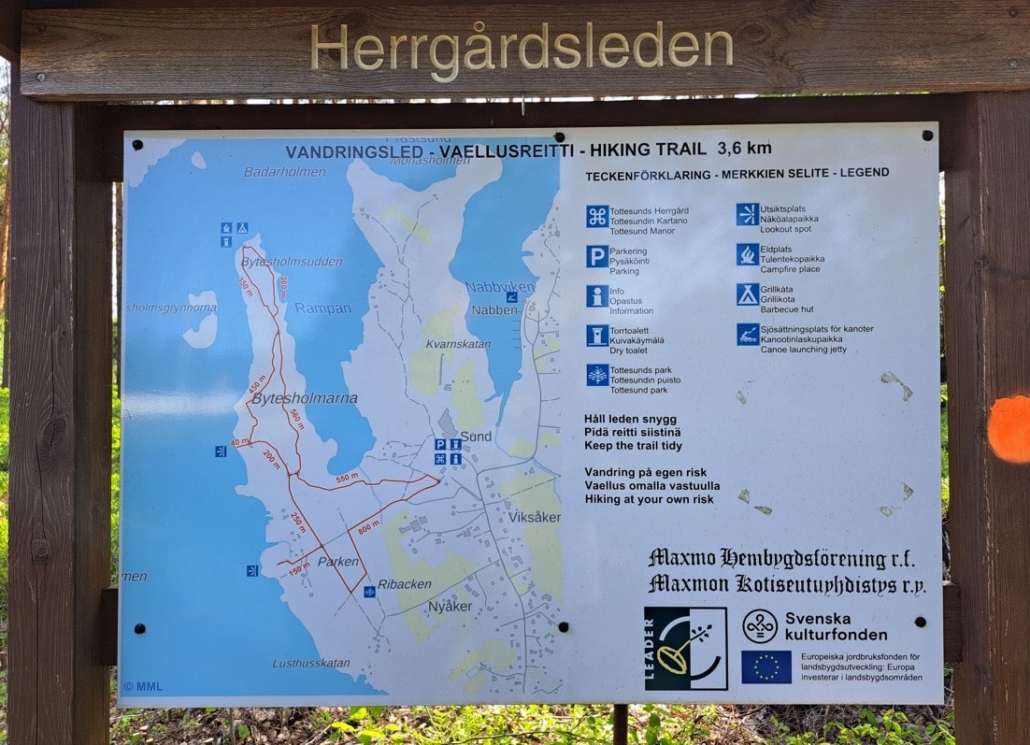
Herrgårdsleden Trail
- Starting point on the map
- Address: Tottesund 529, Maksamaa (Vöyri)
- 3.6 km
- Grill shelter
There’s space for several cars at the end of the main building, where the Herrgårdsleden Trail begins. The trail leads to the tip of the Bytesholmen peninsula, where you’ll find a grill shelter. The total trail length, which runs along both sides of the peninsula, is 3.6 km.
We went to take a look at the start of the trail. The arboretum founded by von Numers in 1800 was a popular attraction for a long time but has since fallen into decline. Still, along the path you can find oak trees, Siberian larches, curly birches, and information boards telling their stories.
In the evening, I read Axel Åhman’s book Salakuljettajan aarre (“The Smuggler’s Treasure“). Åhman grew up in Vöyri. Hmm, could there be some truth in the events described? What a thrilling adventure it would be—perhaps it really took place on the western coast of Västerö, where valuable cargo was once secretly transported…
Read next
Travel Destination: Vöyri, Hometown of the band KAJ – Part 1/4
Travel Destination: Vöyri, Hometown of the band KAJ – Part 3/4
Travel Destination: Vöyri, Hometown of the band KAJ – Part 4/4
Related Content


Leave a Reply
Want to join the discussion?Feel free to contribute!