
Travel Destination: Vöyri, Hometown of the band KAJ – Part 4/4
Article: Mari and Mika Leijo
The municipality of Vöyri and its surrounding areas offer a wonderfully diverse region for nature lovers. We only managed to scratch the surface of what the area has to offer, even though we spent an entire week there from June 7 to 14, 2025. But during the week, we did get to enjoy many beautiful spots, which I’ll introduce in this article series. Among them are the ancient Vitmossen site, the coastal hiking trail on Västerö, the picturesque Kimo ironworks, and the scenic trail at Kovik.
Day 6 of the hike
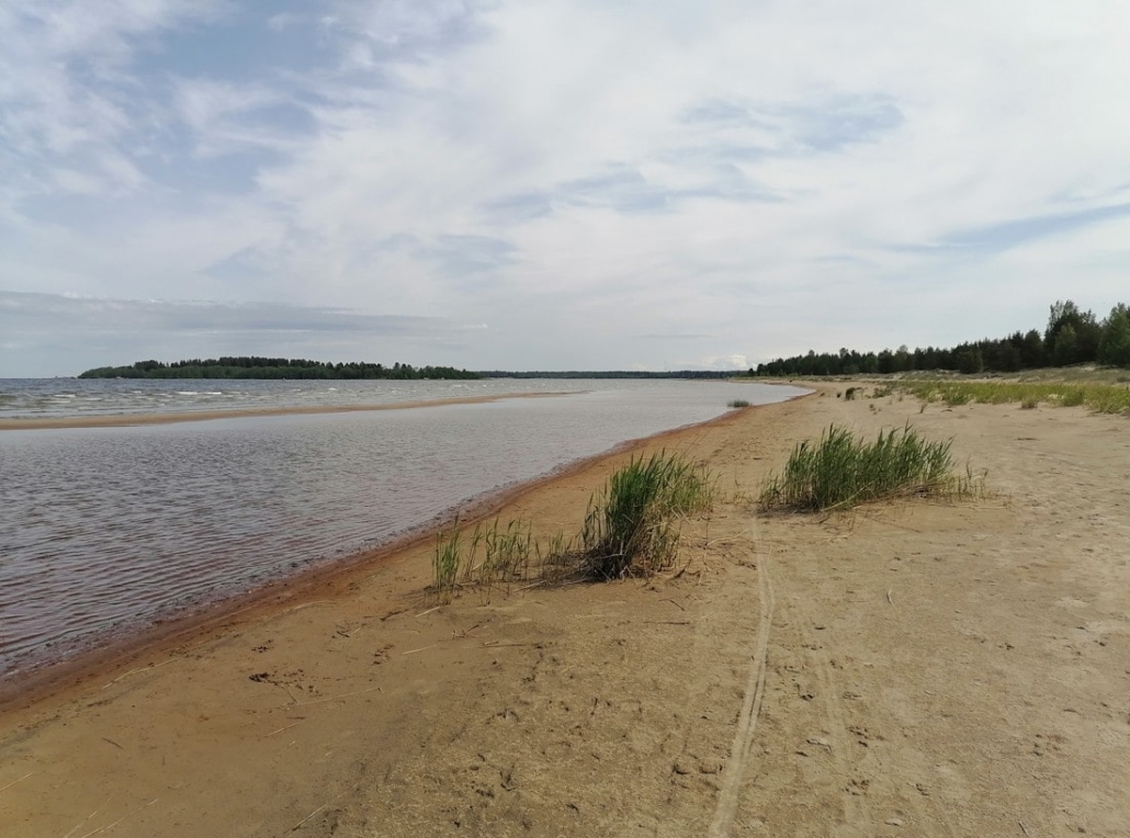
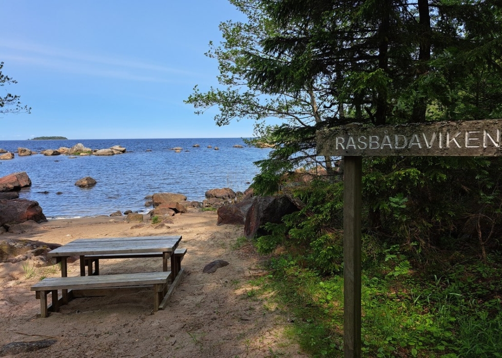
Storsand Beach, Nykarleby
- Location on the map
- Address: Storsandintie 348
- Hiking routes of 4, 5, 6, and 7 km
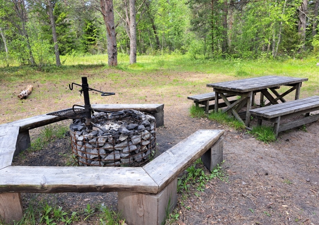
- Campfire site
On Thursday, we travelled about 40 km from our accommodation, Lillstugan in Vöyri, to Storsand in Nykarleby, where we found a long sandy beach opening northwards. The wind happened to be quite brisk and coming from the north, so I put on a second wool sweater to be able to stand for a while and admire the wide-open view. Needless to say, there was no one else on the beach.
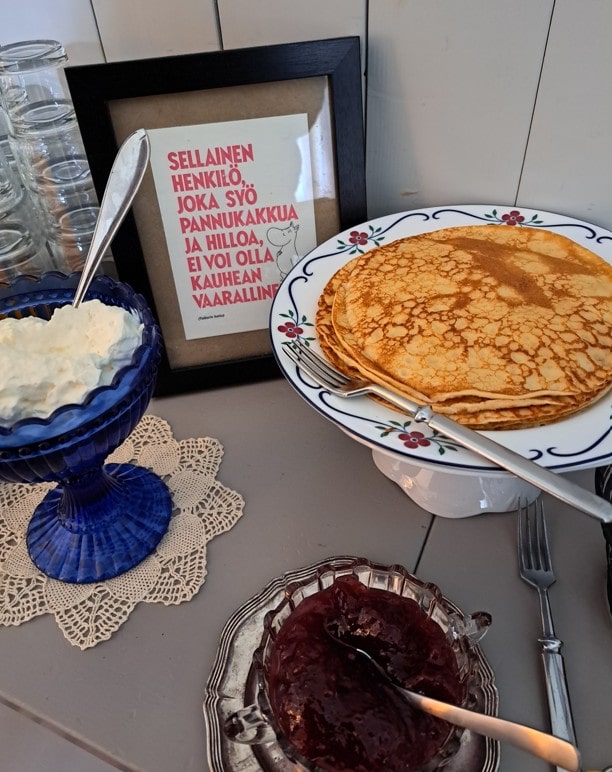
We moved on to the starting point of the hiking trails, where there was also the option of making a fire. Our sandwiches didn’t need heating, so we simply sat at a table for a while.
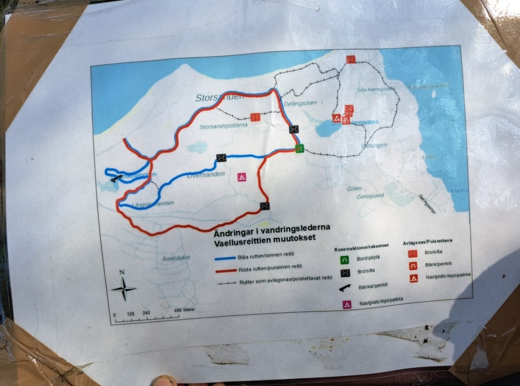
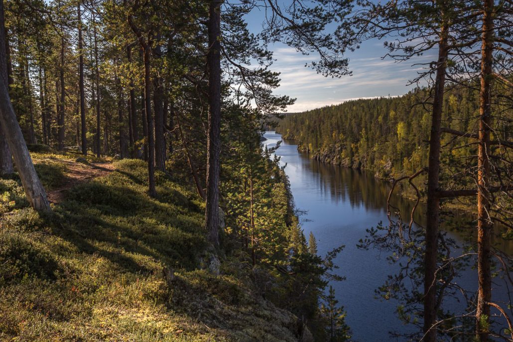
We had planned to follow the green trail. However, the map noted that the green route had been altered, though it could be found by following the arrows. Nowhere did it say whether the green trail’s length was still the same. We also didn’t notice a map showing the changes. We headed out, navigating partly by the map markings, partly by arrows in the terrain, and partly by the old route markers. We more or less followed the old green route.
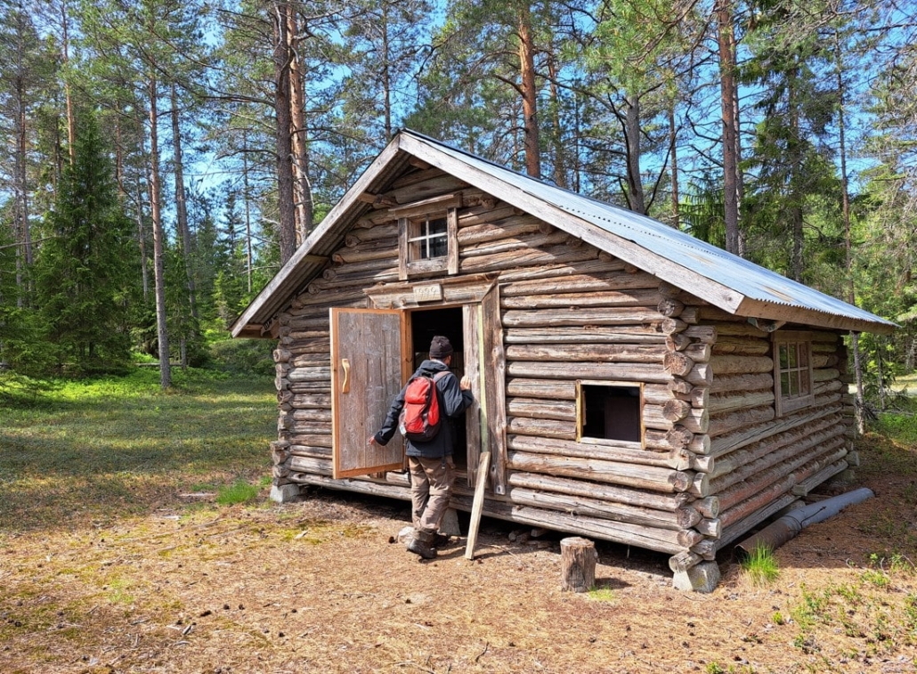
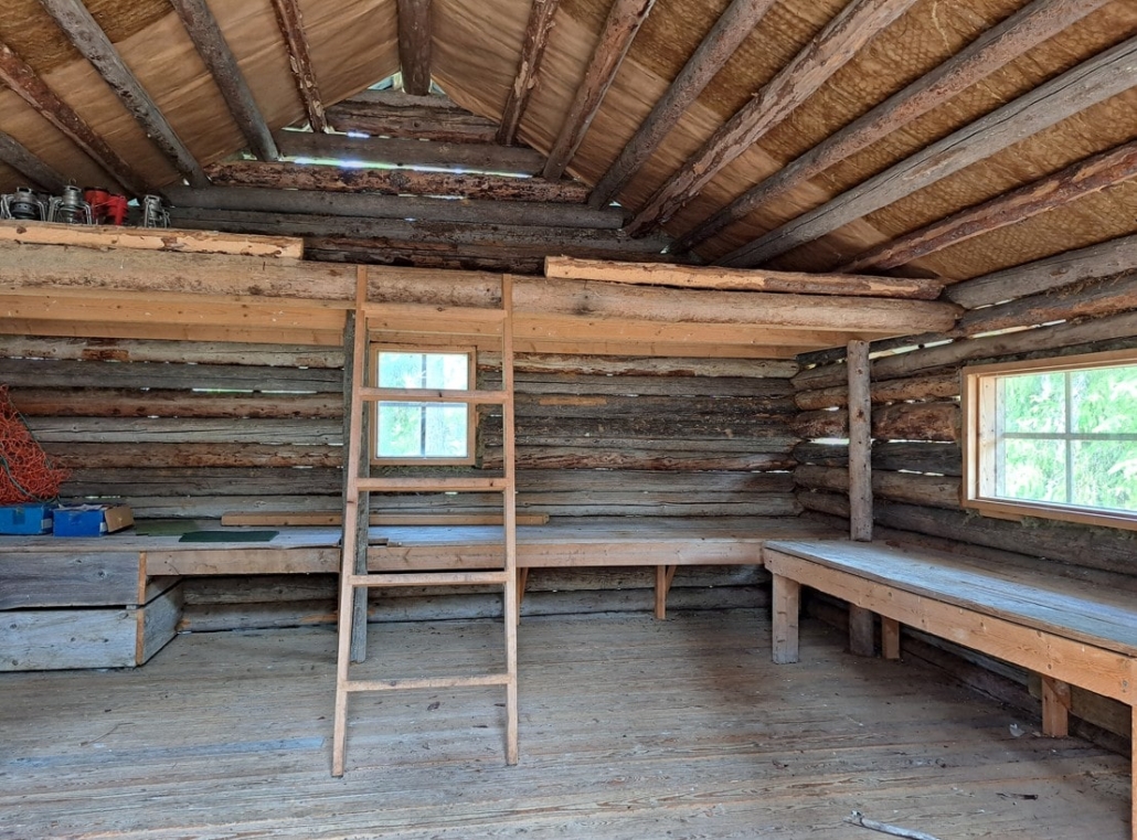
Along the way, we took a detour to the Rastplats Ladon rest spot, which was a 200-metre side trip from the main trail. There, we found a sandy clearing carpeted with lichen, with a couple of logs serving as seats. As the weather was beautiful, we sat there for quite some time enjoying the silence. Only the roar of the sea and the song of birds could be heard. At the edge of the clearing stood a tidy log hut—perfect for resting in bad weather.
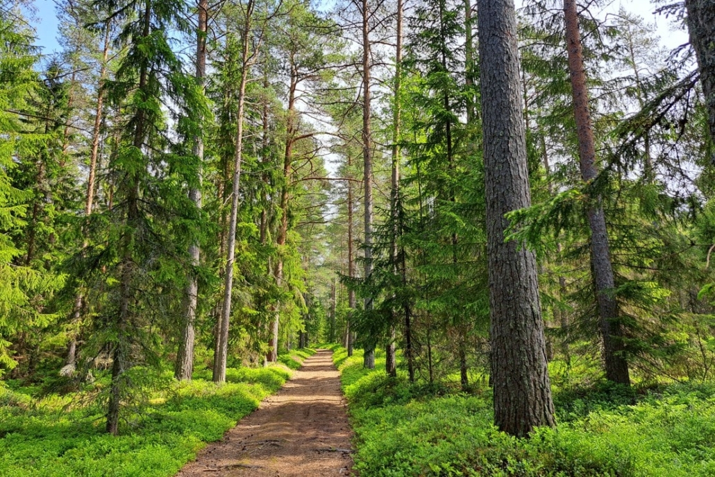
When we returned, I sat in the car eating my snack and looking at the trail map in front of me. Suddenly my eyes caught sight of a sheet of paper above the map, and I got out to check what it was. There it was—the map showing the changes to the hiking routes, and in the nearby post box, the same map in a larger format. The map revealed that some bridges had been removed from the old routes, and that was indeed noticeable… Had we seen this before heading out, we would have stayed on the marked trails. The terrain is excellent for walking, and the forests are bright, so it’s certainly a pleasure to walk the paths there.
The Oravainen Battlefield
- Location on the map
- Address: Taistelutantereentie 130, Vöyri
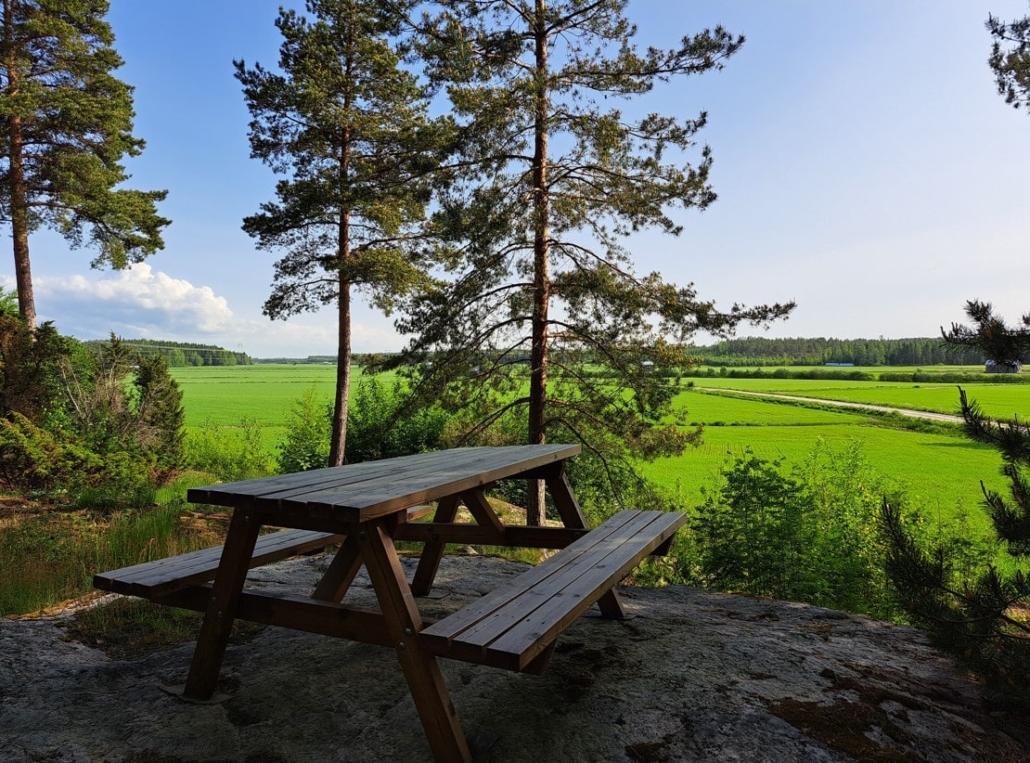
On our way back to the accommodation, we stopped at the Oravainen Battlefield (Taistelutantereentie 130). Here, on 14 September 1808, the Russian troops faced the Swedish-Finnish army. The battle was fierce, and about 1,800 soldiers lost their lives on the field. From the hill where Major General Adlercreutz led the battle, one can now sit at a table and look out over the green, well-kept fields below.
Johan Ludvig Runeberg wrote about the Battle of Oravainen in verse in his work The Tales of Ensign Stål. Next to the battlefield stands today the Ensign Stål Centre, open in summer. The area includes the transferred quartermaster’s residence from a nearby village and several other old buildings. The Oravainen Historical Society presents the course of the war and the soldiers’ living conditions on guided tours.
Day 7 – the final day of the hike
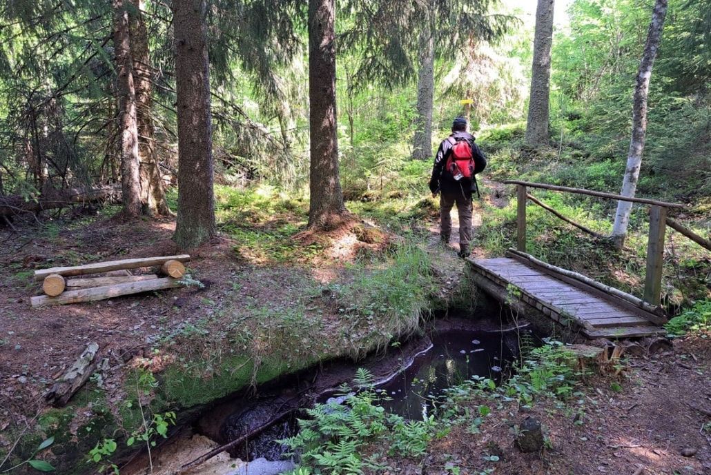
Kovik Hiking Trail, Kovik vandringsleden
- Location on the map
- Address: Kovik byväg 121
- 3 km circular route
- Campfires prohibited, take all rubbish out of nature
Driving along Vöyrintie road, I had noticed a roadside sign for “Kovik vandringsleden“, which I had not found on Vöyri’s website. Of course, I had to go and see it. When the village houses ended, a trail map soon appeared by the roadside (Kovik byväg 121), along with a small parking area for a few cars. This was only a couple of kilometres from our accommodation. The route has existed for 40 years, but its official opening took place this very week!
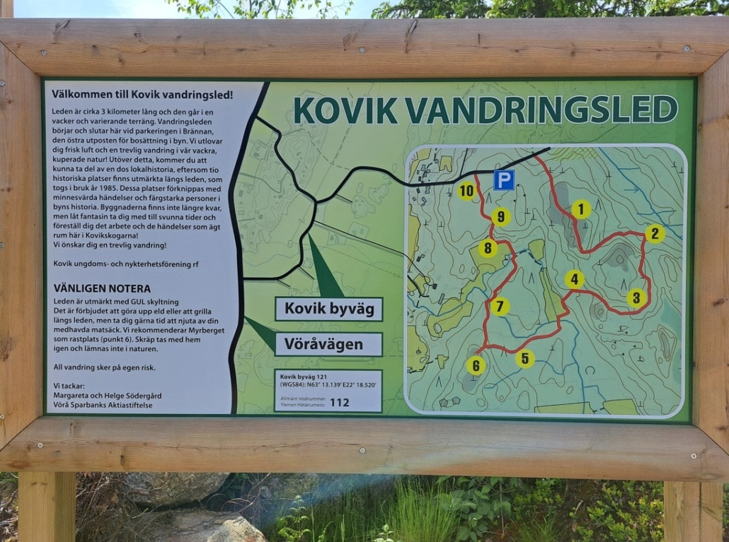
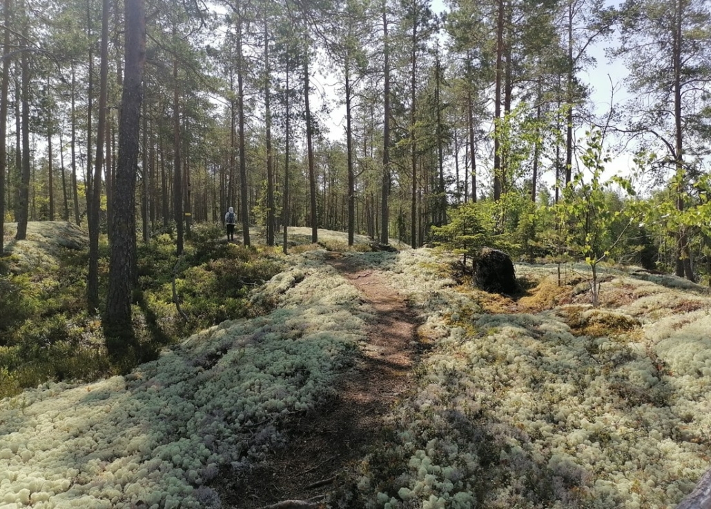
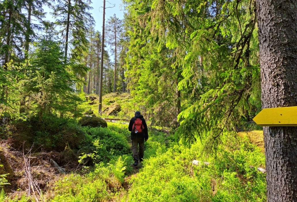
The three-kilometre trail runs through varied terrain, with ten information boards along the way telling the history of the village. Early on, we reached cliffs covered in lichen.
The yellow trail markers were highly visible and placed frequently.
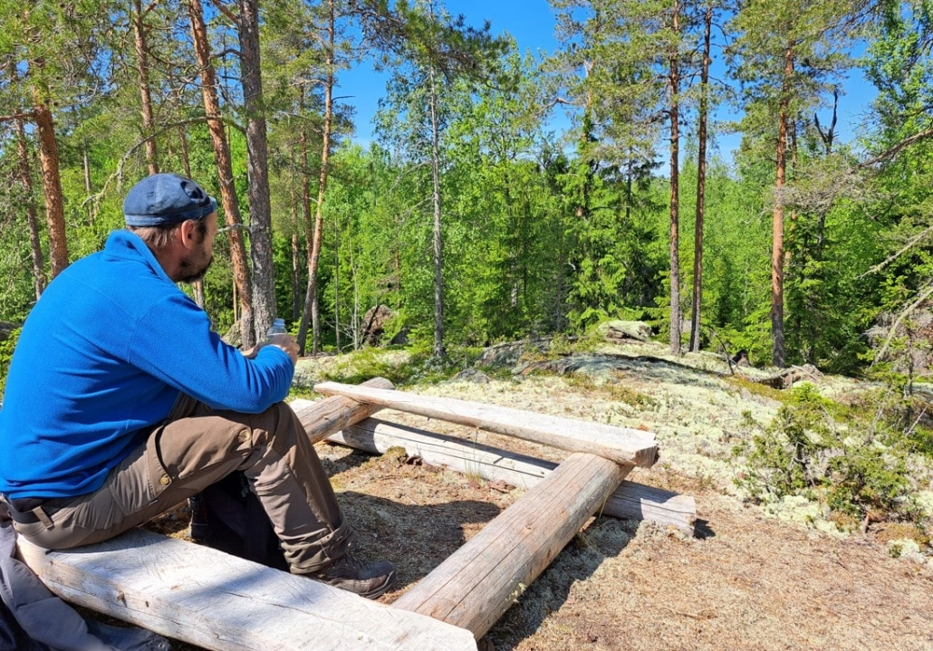
The recommended rest spot was Myrberget (near point 6), and the dance rock there made a perfect place to sit for a while. Lighting fires is prohibited on the trail, and hiking is rubbish-free.
Bridges have been built over the streams. An information board told that a mill once located here was mentioned as early as the 1770s. Vegetation has since covered what remains of the ruins, but the babbling of the brook was lively.
The Kovik hiking trail was truly charming and worth recommending. We didn’t see anyone along the route, but another car had appeared in the parking area in the meantime.
The week had passed, and Friday had arrived. We spent the evening in the sauna and packing our things. On Saturday morning, after breakfast, we headed home.
There was so much to see in Vöyri that a week was only enough to scratch the surface. My thoughts have lingered on Vöyri even back home, as my morning reading has been the first part of the Botnia Trilogy by Ann-Luise Bertell, who grew up in Vöyri. The book is based on the life of the author’s maternal grandmother but is purely fictional. The story follows young Vöyri-born Maria to Canada in the hope of a better life and brings her back about twenty years later. Many left—more than half of all Finnish emigrants came from Ostrobothnia—and this has left its mark not only on those who left but also on those who stayed.
Read next
Travel Destination: Vöyri, Hometown of the band KAJ – Part 1/4
Travel Destination: Vöyri, Hometown of the band KAJ – Part 2/4
Travel Destination: Vöyri, Hometown of the band KAJ – Part 3/4
Related Content


 Tupaswilla
Leave a Reply
Want to join the discussion?Feel free to contribute!