
Discover Evo: Southern Finland’s Hidden Wilderness Gem for Hikers
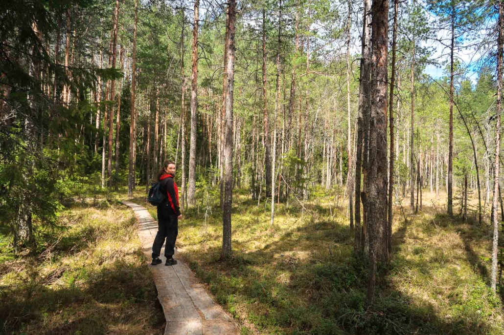
Evo hiking area is located in Southern Finland, less than a two-hour drive north of Helsinki, in the Hämeenlinna and Padasjoki region. Evo is known among Finnish hikers for its forests, which are dotted with numerous forest ponds. Evo is suitable for both beginner and more experienced hikers in Finland, as it offers short circular trails of just a few kilometers as well as the Ilvesvaellus hiking trail network, which is up to 70 kilometers long in total, and can be hiked in sections of your choice. You can stay overnight in a lean-to or cabin rented from the city of Hämeenlinna, or, if you prefer, sleep in your own tent or hammock. Evo’s emblematic animal is the lynx, but you are more likely to spot signs of beavers, which are plentiful in the area.
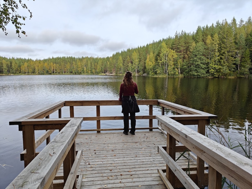
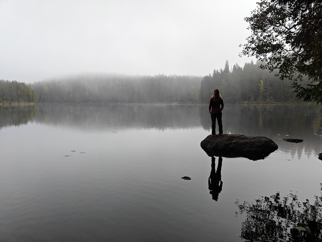
I wasn’t quite sure what to expect when I traveled to the Evo hiking area. The stories from Evo’s nature trails had seemed very forested, with hardly any water bodies appearing in the pictures. I was about to be surprised. As the dirt road narrowed, cell service disappeared, though there were still kilometers to go to the heart of the area. Suddenly, I began to see enchanting forest ponds, grand spruce forests bursting with lush moss, and large boulders by the roadside. Hazel grouses took flight. Had I just passed through some kind of teleport from the main road into the wilderness?
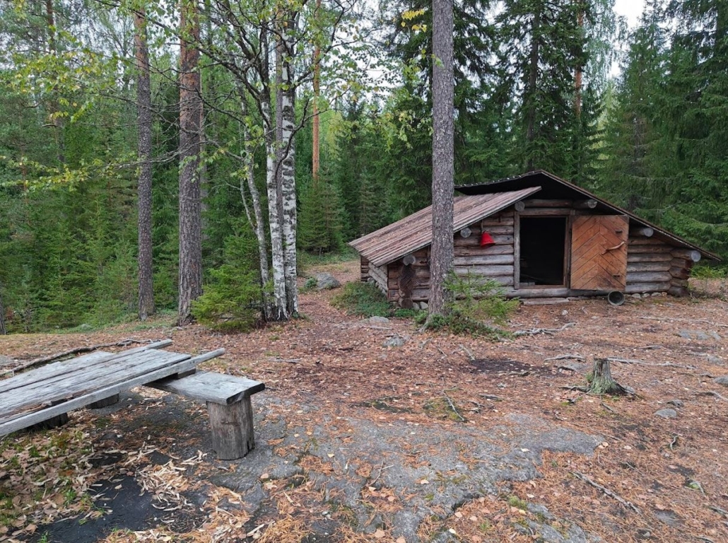
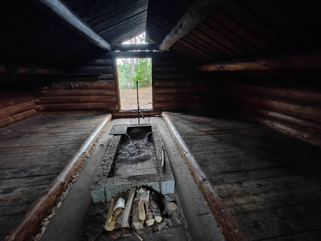
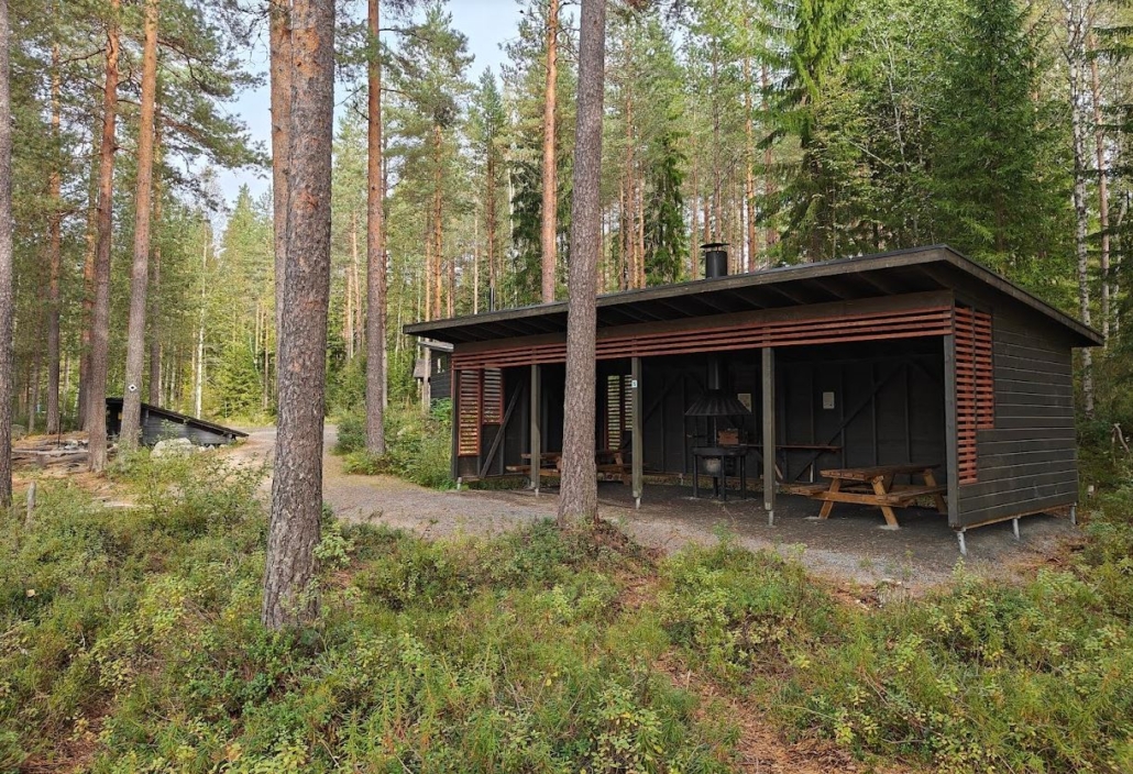
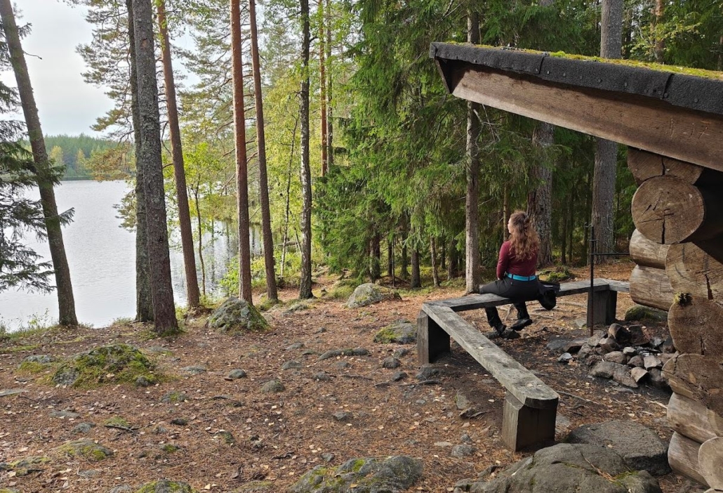
While preparing this summary for you, my accommodation in Evo is a peculiar lean-to hut named Erakkomurju (Hermit’s Hut) on the shores of Lake Koveronjärvi. There are two lean-tos by this lake, but Erakkomurju is a reservable lean-to that guarantees perfect peace. An almost invisible path leads quietly from the small roadside to the cliff rising by the pond’s shore, and upon arrival, I can be sure that no one will find this place by accident.
The key, retrieved from the Hämeenlinna city service point, slips into the lock, and the door opens. The firewood awaits at the edge of the fireplace, and there is plenty of space on both sides to spread out the gear. We’re on a glamping trip with heavy gourmet supplies since the walk from the car took only a few minutes. A Whatsapp message home goes through, barely making it through the weak network. Ah, what a cozy wilderness base!
Evo in Brief
Traversing Evo from one end to the other, even by car, isn’t a quick dash. This surprised me, and I found myself marveling at how extensive the area seemed even while driving – on foot, the region certainly offers plenty of ways to pass the time. The area is multifaceted, merging in the east with the Tarus hiking area, which seems to have grown into Evo and where Erakkomurju is technically located. Narrow, quiet dirt roads and the hiking trail network known as Ilvesvaellus (Lynx Trek) connect the various corners of Evo.
In a nutshell, it can be said:
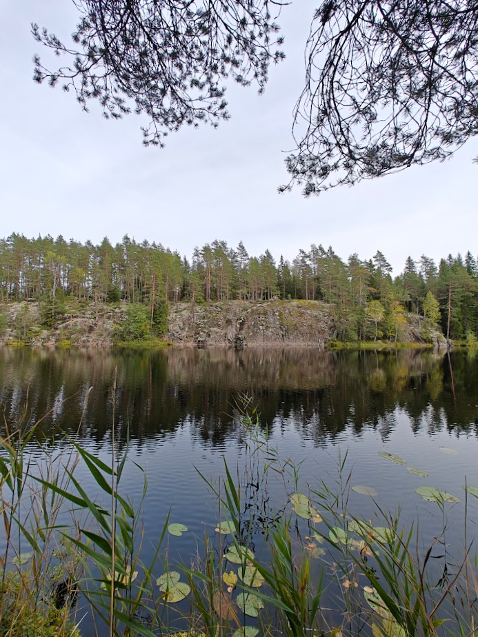
- About Evo’s nature: The Ice Age shaped Evo into a region that sits higher than its surroundings. There are plenty of ponds and terrain features, with steepness present also on the trails. Evo’s waters are primarily dark humic lakes or ponds, not very large but exceptionally beautiful with their wilderness-like shores. There are hardly any mires, but plenty of forests.
- About Evo’s trails: Evo features many short or relatively short circular trails and the extensive Ilvesvaellus hiking trail network that stretches up to 70 kilometers. In contrast to the demanding rugged and steep sections, Evo also has accessible destinations, as we will later see. So, whether you are a seasoned hiker, a day tripper, or someone with a stroller or walker, Evo suits you.
- About Evo’s rest areas: There are an astonishing number of lean-tos and other rest spots. Even a small forest pond may have a couple of lean-tos, and there is no skimping on the number of piers either. There are numerous different types and sizes of accommodations available, both for general use and for private rental.
- About Evo’s various areas: In addition to the state-owned hiking area, Evo includes, among others, various nature reserves, the Defense Forces training area, and the Evo Teaching Forest, which various organizations use for teaching, research, and experimentation.
- Access to Evo: Evo has numerous parking areas in different parts, and local buses also reach Evo from Hämeenlinna (with a change at Lammi bus station).
How to Get to Evo?
The Evo area has numerous parking areas throughout, where you can leave your car. For instance, it takes 40 minutes to drive from Hämeenlinna to the relatively central Luutajoki parking area, while the eastern Tarus hiking area can be reached from Lahti by car in about 45 minutes. If you visit, say, Päijänne National Park and would like a contrast to the vast lake’s open views, Evo is an excellent option nearby.
You can also reach Evo by public transport. Bus line 802 runs from Hämeenlinna’s city center to Lammi bus station, where you need to switch to bus 868, which goes to Evo. Timetables can be found in the Hämeenlinna route planner by entering Hämeenlinna as the departure point and Evo as the destination, and vice versa. The bus services cater mainly to the students of the Häme University of Applied Sciences Evo campus, so the schedules primarily follow the school timetable.
What to Experience in Evo?
I’ve compiled a list of Evo tips for you – the places you should see and the experiences you shouldn’t miss in Evo. Since the area is vast and perhaps not so easy to grasp, this list aims to help you pick the best spots whether you want to stop by for just half an hour, spend the entire week, or take a weekend trip to Evo. The list is especially useful if you’re visiting Evo for the first time, but even a seasoned Evo visitor should check it out – you might find something completely new for yourself!
Tip! The internet connection in Evo is unreliable, often working poorly or not at all. We noticed that even phone calls sometimes didn’t get through. So, don’t plan on checking maps or looking up information online during your trip. Download Evo’s PDF map on your phone beforehand, or if you need more detailed maps, obtain or download a hiking or topographic map of the area. Available options include the Ilvesvaellus Hiking Map and the Evo-Päijänne Hiking Map.
The Best Destinations in Evo
The Shoreline Trails of Niemisjärvi lakes
- Parking area on the map
- Address: Niemisjärventie 281, Hämeenlinna
- Trail network: approx. 4 km, partly accessible
- Rest spots: several fireplaces, lean-tos, and a cooking shelter.
- Other: rental cabins, equipment rental, beach, café (Pikku-Apaja).
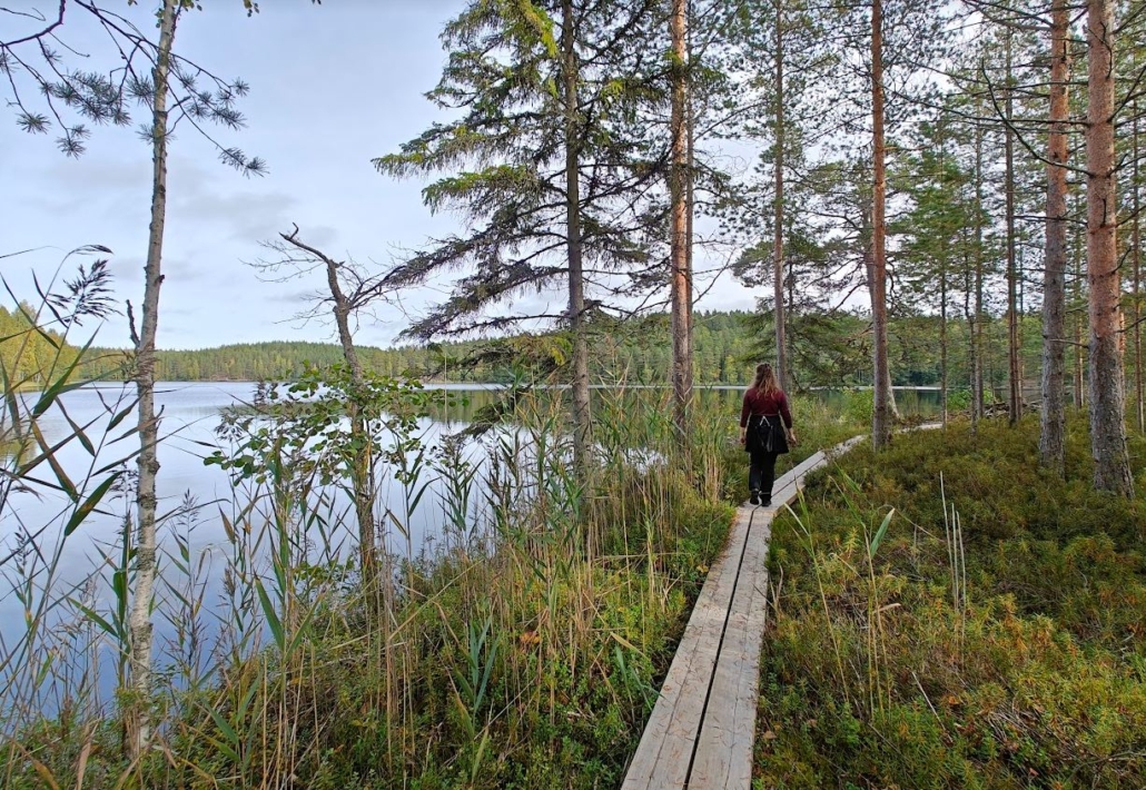
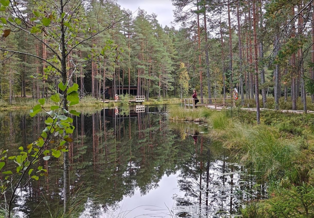
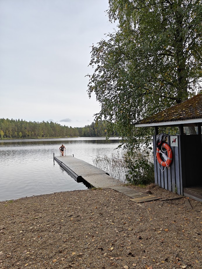
The beautiful and relatively compact, yet serene area of Niemisjärvi lakes is an excellent choice for a first-time visitor to Evo. It’s a chain of three small lakes, with a path running along the shoreline. This pond trio topped my list of favorites in Evo both for its waterscapes and trails – well, the other half of the shared top spot goes to the much wilder Sorsakolu area, which is introduced further down.
The shoreline trails of Niemisjärvi lakes offer accessible sections that continue northward to Vähä-Koukkujärvi pond, as well as boardwalks and needle-covered paths. Lean-tos and fireplaces are scattered throughout. The views across the ponds delight with their natural beauty, while on the opposite side, the moss-covered tall forests leave a lasting impression. How beautiful it is here! You can’t get lost if you simply follow the shoreline.
Right near the parking area of Niemisjärvi lakes, you’ll find a cooking shelter and a beach with changing cabins and piers, an accessible toilet, and a wide range of other useful services for hikers, including water and recycling points. A company called Pikku-Apaja runs a kiosk café, equipment rental, camper parking, and cabin rental in the area.
The Accessible Trail of Vähä Koukkujärvi
- Parking area on the map
- Address: Kalliojärventie, Hämeenlinna
- Accessible trail around the lake: 500 m
- Additional route: accessible trail from Vähä Koukkujärvi pond along the eastern shore of Ylinen Niemisjärvi lake, 1 km each way
- Services: cooking shelter, accessible piers, toilet, and lean-to (not accessible)
The most breathtaking destination for accessible hiking in Evo is definitely Vähä Koukkujärvi pond. It’s wonderful to have such hiking spots that do not require one to be agile and nimble, but where one can use a wheelchair or come with grandparents or a baby in a stroller to relax in the wilderness tranquility. There are parking areas near Vähä Koukkujärvi, but if you prefer a longer accessible walk, you can leave your car at the previously mentioned Niemisjärvi parking area and take the approximately one-kilometer accessible trail that runs along the eastern shore of Ylinen Niemisjärvi lake to reach Vähä Koukkujärvi pond.
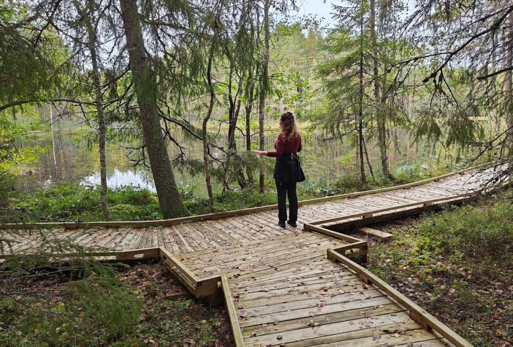
At Vähä Koukkujärvi, a wooden, wheelchair-friendly trail circles the forest pond for about half a kilometer. Along the way, there is a large accessible cooking shelter, a small lean-to, several accessible piers, and a floating bridge. The scenery is beautiful and forested, and the peace of the pond is profound. Larger roads are far away from here; this destination is deep in Evo’s wilderness but is still easily accessible thanks to a small dirt road.
Kalliojärvi
- Location on the map
- Address: Kalliojärventie, Hämeenlinna
- Rest spots: lean-to and cooking shelter
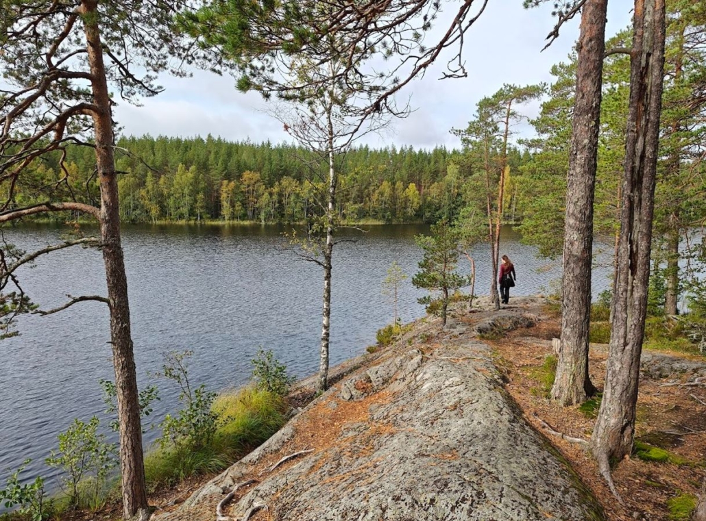
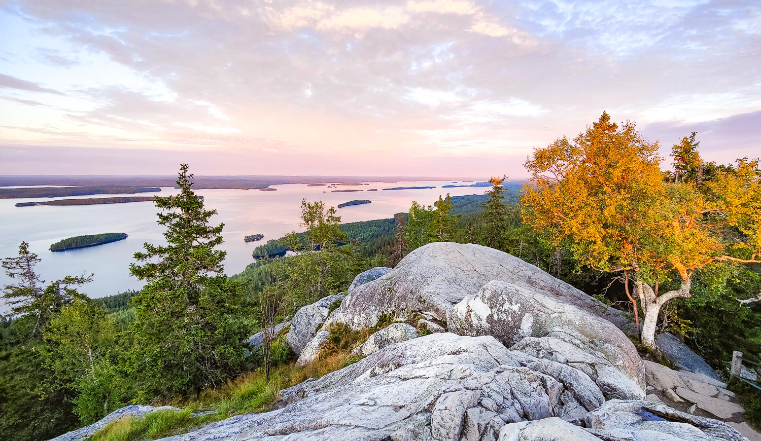
I love places where there’s a view over a body of water from a high cliff – and surely, many others do as well. In Evo, we found just such a spot along the same Kalliojärventie road where Vähä Koukkujärvi is also located.
Kalliojärvi is an elongated dark pond, surrounded by the Ilvesvaellus trail. There is a lean-to by the shore midway along the pond, and at the northern end, you’ll find a cooking shelter. Both are located along a narrow, quiet, remote dirt road, making them easily accessible yet secluded.
From the lean-to, you can see the steep cliff rising on the opposite side of the pond. It’s well worth climbing up to the top of the cliff to admire the stunning view. The scenery from the top opens directly to the west, making it an ideal spot for sunset watching. On the other hand, the sun rising from behind combined with morning mist over the pond would surely create a magical moment here as well.
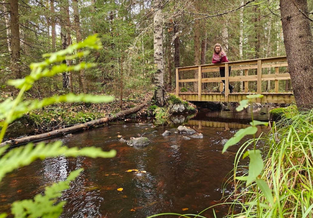
Luutajoki Trout Trail (Luutajoen taimenpolku)
- Location on the map
- Address: Ruuhijärventie 3, Hämeenlinna
- Trail: 1 km
- Rest spots: Benches, no campfire spot
Main road 53, Padasjoentie/Hämeenlinnantie, connects Hämeenlinna and Padasjoki, passing right through Evo. The Luutajoki Trout Trail, which can be accessed directly from the main road, offers a lovely stop and refreshing outdoor break, even for those in a bit of a hurry. It’s a dive into nature from the midst of traffic – a relaxing moment amidst the forest and especially the flowing water.
The parking area has a water point and a map of Evo, and the nature trail heads straight into the forest. The path follows the beautiful Luutajoki river, making a loop through two bridges at the end of the trail. The entire Luutajoki river is six kilometers long, and this nature trail offers a half-kilometer taste of its beauty.
As the sunlight penetrates the forest and reaches the reddish-brown water of the Luutajoki river, the river’s stones and aquatic plants become visible. We admired the sight and absorbed the scents and tranquility of nature. The soothing gurgle of the flowing water is almost hypnotic to watch and listen to.
Information boards along the trail introduce visitors to the natural features of Luutajoki and the forest management practices of the area, shedding light on its history. In addition to trout, the river is said to host pike, burbot, and even occasionally eels! According to the board, eels in this river can grow up to half a meter in length. I wondered if this would be a good spot to come to in October–November with a flashlight to try and spot spawning trout and other fish in the dark?
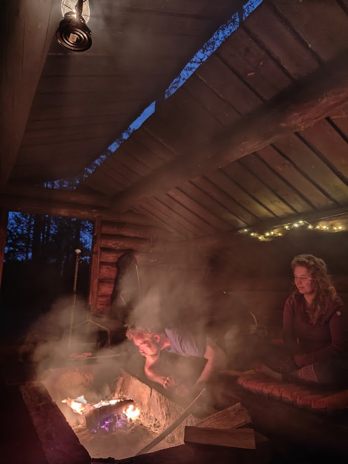
After a rewarding day on the trail, it felt wonderful to retreat to the comfort of Erakkomurju lean-to at Koveronjärvi’s shore. It was lovely to stretch out and give our legs some rest. Throughout the evening, we kept the fire going while preparing our meals. As evening turned into night, we let the fire die out, not even attempting to keep it as warmth overnight. Our three-season sleeping bags ensured that we stayed warm throughout the night.
In the morning, a thick mist had settled over Evo. After a calm morning routine, it was time to head toward the nearby Haarajärvi parking area and Sorsakolu.
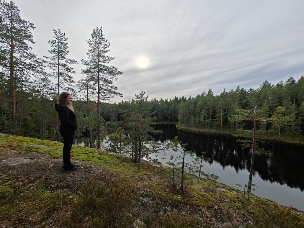
Sorsakolu Area
- Parking area on the map (Haarajärvi)
- Trail network: Ilvesvaellus
- Rest spots: Two lean-tos
In the eastern part of Evo, at the junction of nature reserves, you’ll find enchanting forests on steep hills and lakes such as Sorsajärvi, Hakojärvi, Eväjärvi, Haarajärvi, and Savijärvi. The Ilvesvaellus hiking trail network follows the shores of these lakes and traverses their species-rich forests. The journey conveniently begins at the Haarajärvi lake parking area, where you’ll find an Evo map and additional information for hikers. The distance to the Sorsakolu lean-to is 1.9 km in one direction. It may not sound long, but the hills add a challenge.
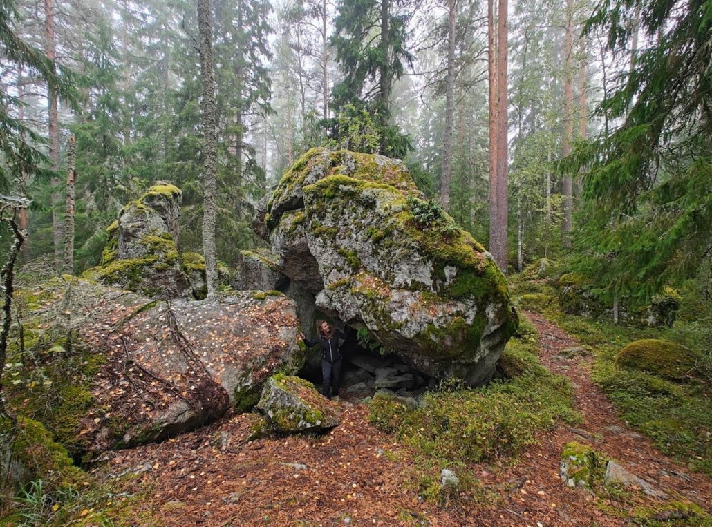
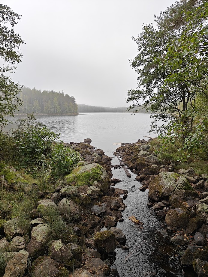
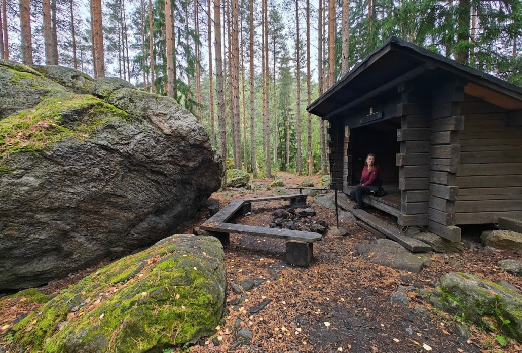
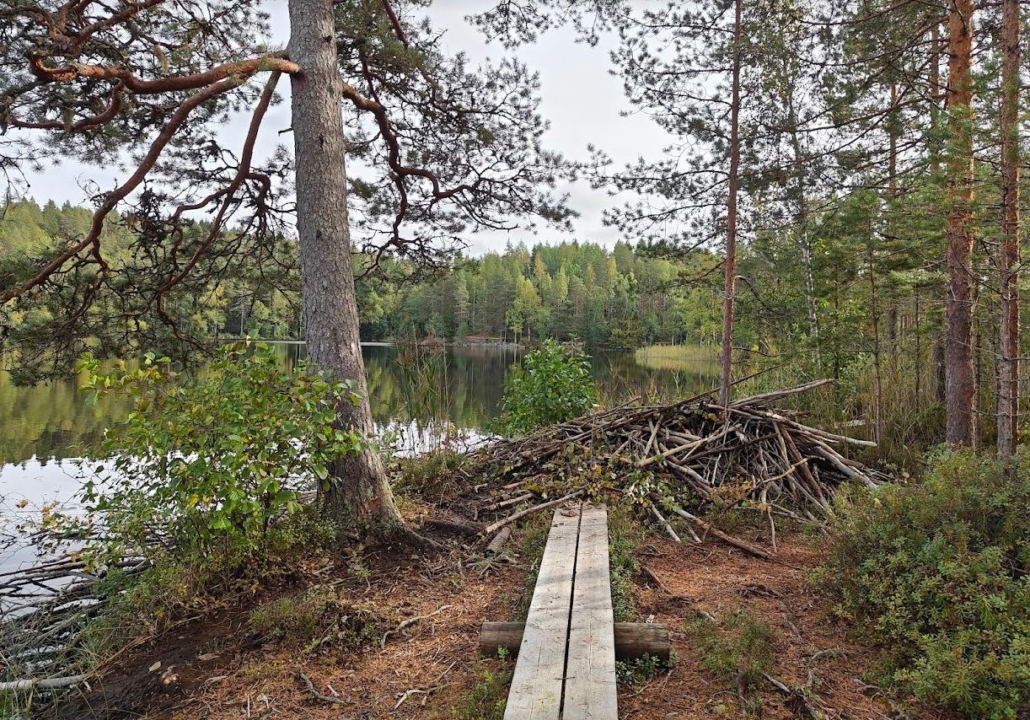
On the shore of Sorsajärvi, you’ll find two lean-tos. One of them, Sorsakolu, is exceptionally located at the junction of two lakes, Sorsajärvi and Savijärvi. In front of the lean-to is a large erratic boulder, and beside it, a wooden bridge under which water rushes from one lake to the other through its rocky channel. We noticed that the water had brought along some trees felled by beavers, with the marks of their sharp teeth clearly visible.
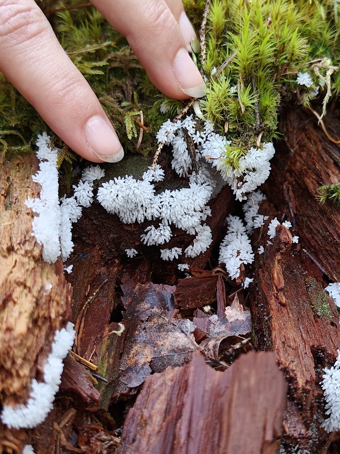
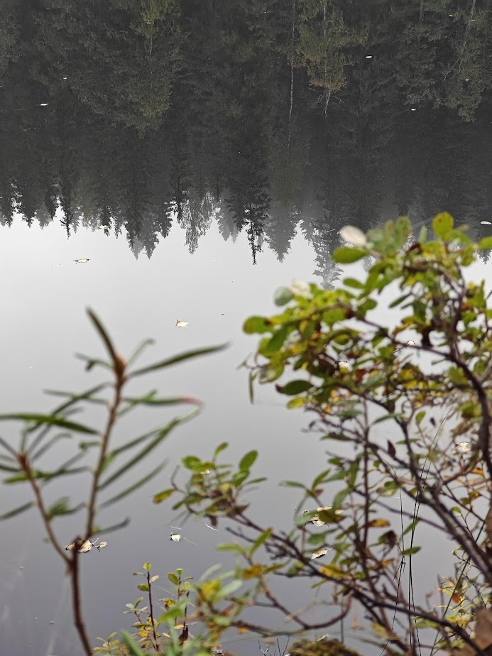
The sense of peace here is palpable. We didn’t encounter another soul but made some interesting nature observations: we witnessed a red-throated loon in flight, found a slime mold named Nukkanen (Ceratiomyxa fruticulosa) on a piece of decaying wood, spotted some delicious edible mushrooms, and saw hazel grouse take flight ahead of us. During our trip, a thick blanket of fog started to dissipate under the warm September sun, with increasingly brighter rays of light filtering through the mist and reaching the forest floor.
Hakovuori
- Location on the map
- Trail from the road: 500 m/one way
- No services
The Ilvesvaellus trail also leads to the top of Hakovuori hill, and we recommend stopping by there as well. We noticed a signpost along Talvilammentie road saying “Hakovuori 0.5 km” with enough space for a couple of cars to park nearby. So, off we went!
The hill rises so deep within the forest that we almost walked right into it before noticing the grey rock face soaring vertically towards the sky amidst the trees. The view was impressive even from below, and the short but steep climb to the top made the experience complete. There are no water bodies visible in the scenery, but the uninterrupted and beautiful, unlogged, partially protected forest offered our eyes and minds a place to rest. We had deliberately waited for the fog to clear before climbing the hill, but once at the top, I thought that this place could be absolutely magical in foggy weather when the shapes of the trees stand out as misty silhouettes.
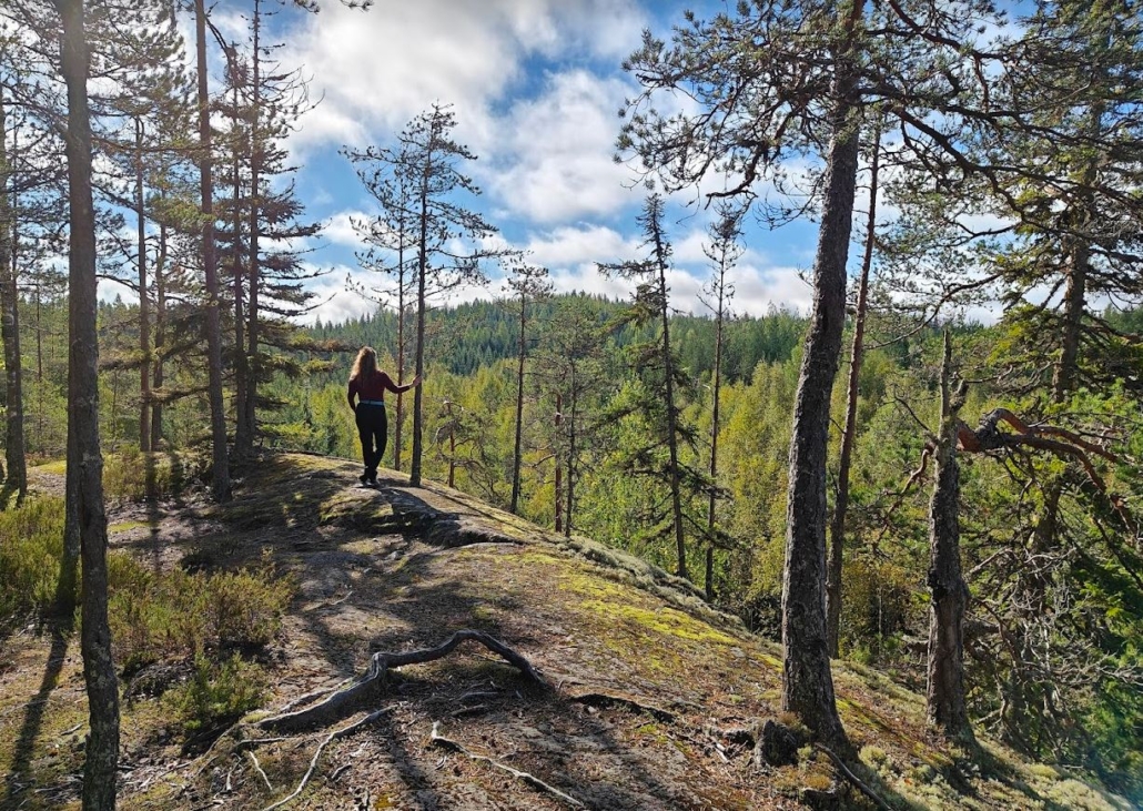
The Ilvesvaellus trail marked with lynx paw prints leads to Hakovuori, but there are no services, such as campfire spots, at the hill, and making fire is not allowed. The view opens up westwards from the top, making it a wonderful spot to have a thermos of coffee or tea in good company with a friend or partner while watching the sunset. Note that the drop-off from the edge is sheer – caution is strongly advised.
What to Do in Evo?
Evo’s versatility offers plenty of opportunities to spend time based on your own interests, mood, hiking skills, and the season. As a swimmer, I found my favorite spot, my friend fell in love with the large boulders, and I thought of my spouse when I noticed that Evo has tens of kilometers of mountain biking trails (PDF map).
Below are some activities that we warmly recommend experiencing in Evo. The places and trails listed above provide excellent settings for the following pursuits!
Tip! In winter, swap your hiking boots for snowshoes and consider whether a rented cabin might be a better overnight option than a lean-to when the frost hits Evo. With minimal light pollution, the shores of Evo’s ponds are perfect for stargazing. Check the winter maintenance status of the roads and parking areas in advance from the City of Hämeenlinna.
Picnic Break
A glance at Evo’s map (Luontoon.fi, PDF) reveals that you don’t have to hike far to find the nearest campfire spot. Often, it’s not just a simple fire ring, but a lean-to or a cooking shelter. For example, at Niemisjärvi lakes, there are several options within a few hundred meters.
Enjoy a peaceful picnic break in Evo. Whether you pack light or embrace glamping as we did, complete with battery-operated seasonal lights, and take just a few steps or hike several kilometers, the facilities for outdoor dining are first-class.
Please remember – both in Evo and elsewhere – that making fires is only permitted at managed, official campfire spots, and you are only allowed to burn wood designated for that purpose. Even at official campfire spots, forest fire warnings may temporarily prohibit their use. In such cases, the solution is a sparkless camping stove (not a twig stove) or ready-to-eat food that you can pack in a food thermos to keep it hot or cold as needed.
Overnight Stay in Evo
The City of Hämeenlinna has several spots in Evo that it rents out to hikers. There are three reservable lean-tos: Erakkomurju, where we stayed, Ukkoherra, and Vonkamies. Additionally, the city offers the Kelkute Cottage, Kristianinkämppä Cottage, and the Luppo smoke sauna made from deadwood logs. Reservations are made in advance online and paid via online banking. Pictures, more information about each location, and the booking calendar can be found on the City of Hämeenlinna’s website.
Camping in a tent or hammock should be focused on specific areas designated for camping, which in Evo can be found at Niemisjärvi to the west, Valkea Mustajärvi in the center, and Kovero in the Tarus area. You can also set up your camp near the lean-tos.
Evo is an excellent destination not only for a getaway from everyday life in the middle of nature but also for testing, practicing, and fine-tuning your hiking and camping skills. The Ilvesvaellus trail network allows for long hikes without making it difficult to cut the hike short if needed. You can test how well your backpack carries on hilly terrain, break in your new hiking boots, and see if you have mastered essential wilderness skills without necessarily being too far from your car or civilization. One crucial wilderness skill is leaving no trace – remember to carry your trash out of the wilderness in Evo as well. It’s a good idea to bring a plastic bag for this purpose, so you can sort the contents for recycling after your trip.
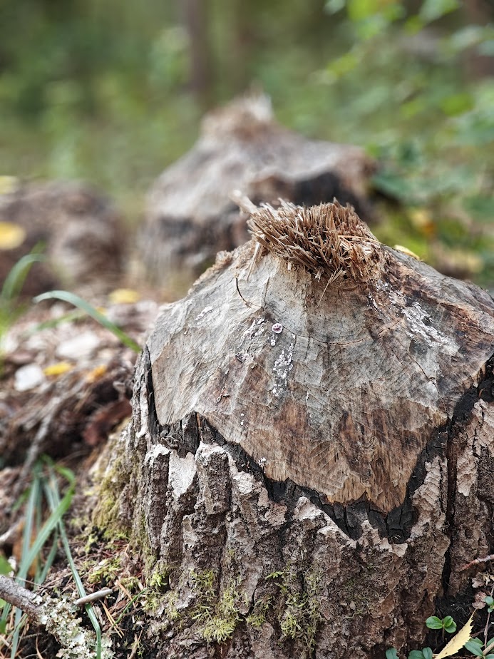
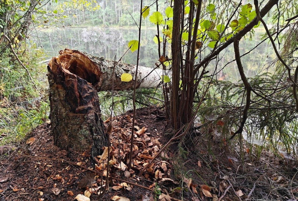
Look Out for Signs of Beavers
The lynx and the beaver are the most characteristic animals of Evo. If you are lucky, you may find lynx tracks in the snow during winter, but it is much more likely to spot the work of beavers. We didn’t specifically set out to look for them, but we still came across trees gnawed through and even a beaver lodge with a clear muddy trail leading to it from the lake. Keep your eyes peeled, and with some luck, you might spot a beaver yourself!
Beavers are industrious residents of Evo, and they have the means and strength to create all sorts of situations. It is not uncommon for a trail to be flooded or even a road to be impassable due to typical beaver activities. Therefore, packing rubber boots and planning alternative routes might not be a bad idea.
Enjoy Evo’s Waters, Silence, and Bounty
Main road 53 is quite a busy route, but as you travel along the smaller roads deeper into different corners of Evo, the silence becomes almost deafening. I don’t remember experiencing silence as profound as Evo’s in a long time, especially in autumn when the birds are not chirping much. Only the occasional pecking of a woodpecker high up in a tree could break the wilderness’s stillness. At our Erakkomurju lean-to, the only sounds were our chatter, the crackling of the fire, and the rustling of a mouse at six in the morning. In the Sorsakolu area, the soundscape was exclusively in the hands of us and the birds; no background hum was audible. The silence was so perfect that it was hard not to notice it.
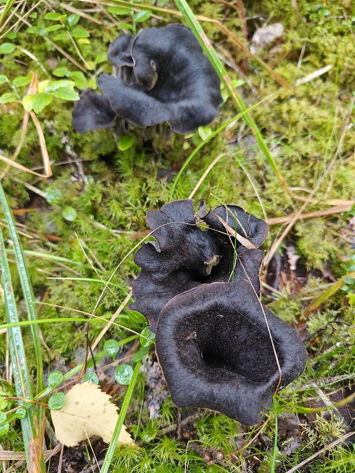
In autumn, it’s wise to take a mushroom basket with you on your hike. We encountered black trumpets, chanterelles, and funnel chanterelles all growing side by side in harmony. A fall break in Evo at just the right time could be a great way to fill your winter reserves of mushrooms and berries while letting your mind and body indulge in a pleasant, relaxing foraging activity.
The shores of Evo’s ponds are mostly in their natural state – rocky and full of shoreline vegetation. However, you can easily go swimming from the northern shore of Alinen Niemisjärvi, where you’ll find a sandy beach, a pier, and a changing booth. On the northern curve of Alinen Rautjärvi, directly beside the road, there is even a natural sandy beach. This beach has a picnic table but no changing booth.
Ilvesvaellus Trail
The Ilvesvaellus trail should not be confused with the Häme Ilves Trail, as they are two separate trail systems in the Häme region. The Häme Ilves Trail (250 km in total) connects various destinations in southwestern Häme, including the Torronsuo and Liesjärvi National Parks. The Ilvesvaellus trail network, on the other hand, winds through the Evo area, covering a total distance of 70 km.
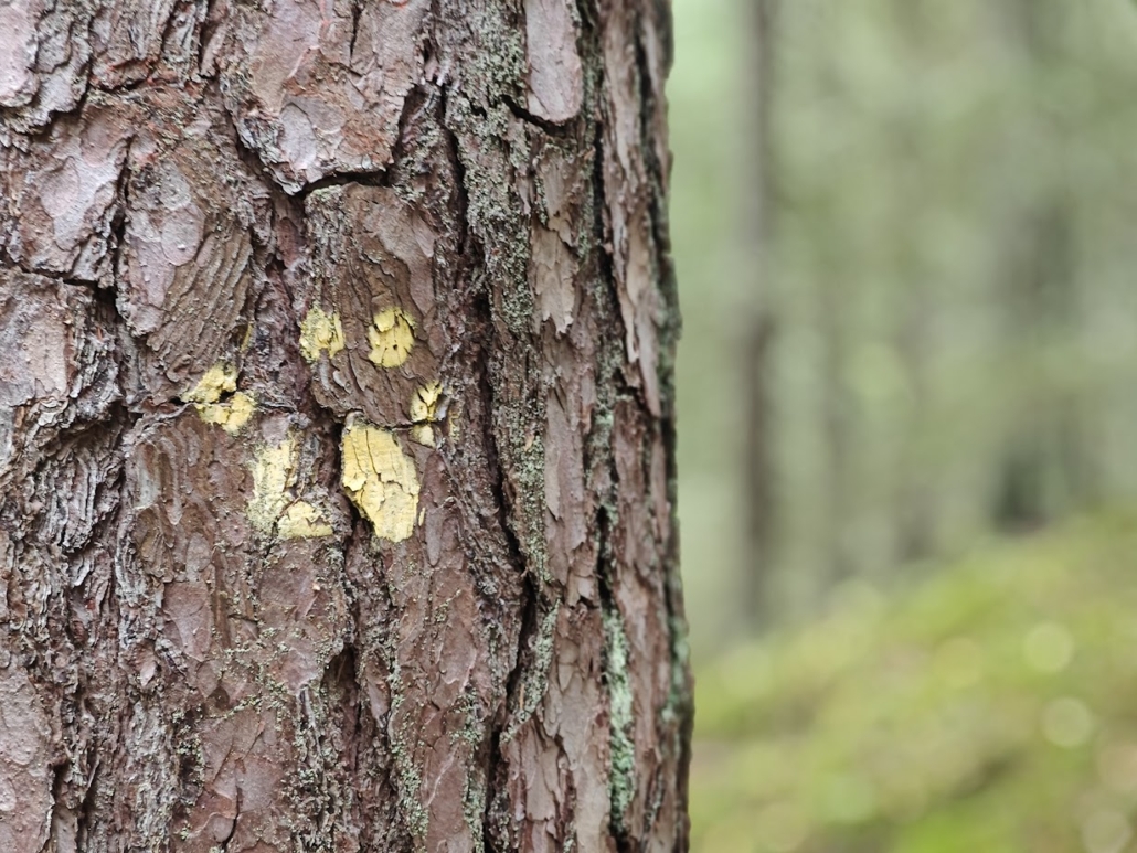
The Ilvesvaellus trail connects all parts of Evo. You can, for instance, hike from Niemisjärvi in the west across the entire area, meandering either through the south past Rautjärvi or further north via Ruuhijärvi and Valkea Mustajärvi towards the east, to the Sorsajärvi region, and onward to the Tarus hiking area. The trail is marked with lynx paw prints, either painted directly on the tree bark or attached as separate circular signs. For hikers craving an extended adventure, the Ilvesvaellus is a fantastic option, rivalling the more traditional autumn hiking destinations of Lapland.
Evo’s Nature Trails
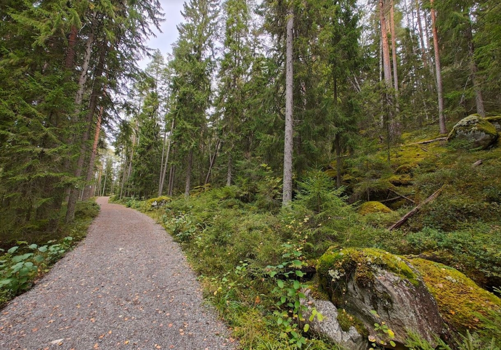
In addition to the trails mentioned above, the Evo area also has nature trails – circular routes of about 3–6 kilometers that mainly run on dry ground. These include the loops of Harjupolku, Niemisjärvi, Karhulenkki and Savottapolku.
Get to know Evo’s nature trails in more detail by checking out the introductions by Mika Markkanen (only in Finnish):
- Syrjänalunen – a picturesque pond and a trail running along a magnificent ridge in Evo’s hiking area (Harjupolku)
- On diverse forest paths: Exploring the Karhulenkki trail in Evo
- Exploring the primeval forests of Evo’s hiking area: Niemisjärvi Nature Trail
- Experience the life of bygone loggers on the Savottapolku trail in Evo’s hiking area in Padasjoki
As we were leaving Evo, my friend and I reflected on Hämeenlinna’s offerings. This was our third trip to Hämeenlinna this year, and from the very first destination in the spring, we’ve realized that every visit has exceeded our expectations. It was true for Ahvenisto and for the Vanajavesi waterfront trail — English translations for these two will be published shortly — and once again, it was true for Evo. We got so much more than we ever could have guessed, and once again, we found ourselves wondering how Hämeenlinna’s nature spots had managed to stay off our hiking radar all these years, even though we have explored the Finnish outdoors quite extensively.
Fortunately, that has now changed, and we cannot help but give our wholehearted and sincere recommendations for the nature destinations in Hämeenlinna!
Read also
Put this on Your Bucket List: Aulanko is A Winter Gem in Jean Sibelius’ Hometown, Hämeenlinna
A journey into the past: Digitrail leads you to the best parts of Aulanko
Related Content


Leave a Reply
Want to join the discussion?Feel free to contribute!