Day Trip in Raasepori: Karjaa’s Hidden Gems for Your Bucket List
In commercial collaboration with Visit Raseborg
Brimming with small-town charm and celebrating its 700th anniversary, Karjaa (Karis) is home to a delightful collection of day-trip destinations: there’s something for everyone, whether you’re a laid-back sun-seeker, an adventurer yearning for the peace of a forest lake, or a history enthusiast. Karjaa, located in Raasepori (Raseborg), is directly accessible by train from Helsinki and Turku, and orange city bikes are waiting right at the train station — in other words, everything you need for a day trip or a weekend in Karjaa is already in place. I spent a May day in Karjaa gathering wonderful destination tips to suit all tastes. Here are my experiences and recommendations!
From the list below, you can pick tips and information about destinations according to your own interests. The list includes highlights from:
- easy and beautiful park and swimming beach spots
- historical sites
- wilderness lakes
- functionalist architecture and flea markets
I got around between the destinations both by car and on foot, and many of the tips listed below are reachable from the train station simply by walking. With the exception of the trailless wilderness lakes, all the destinations are also accessible by bike along light traffic routes, quiet roads and country lanes.
I’ll note the distance from the train station to each destination. If you have your own bike and plan to arrive in Karjaa by train, make sure to book a spot for your bike on the train (not all services have bicycle spaces). Read more on the VR website.
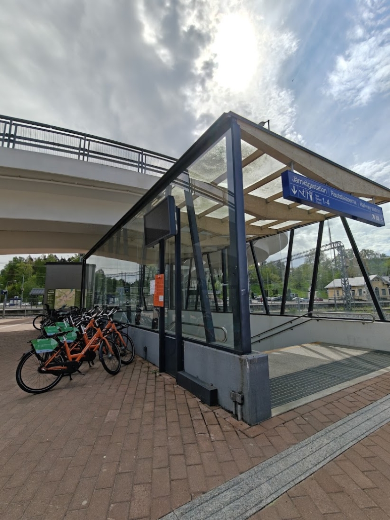
Tip: If you arrive in Karjaa without your own transport, it’s well worth making use of the city bikes. In Karjaa, the city bikes are parked right in front of the train station, in the bend of the pedestrian overpass.
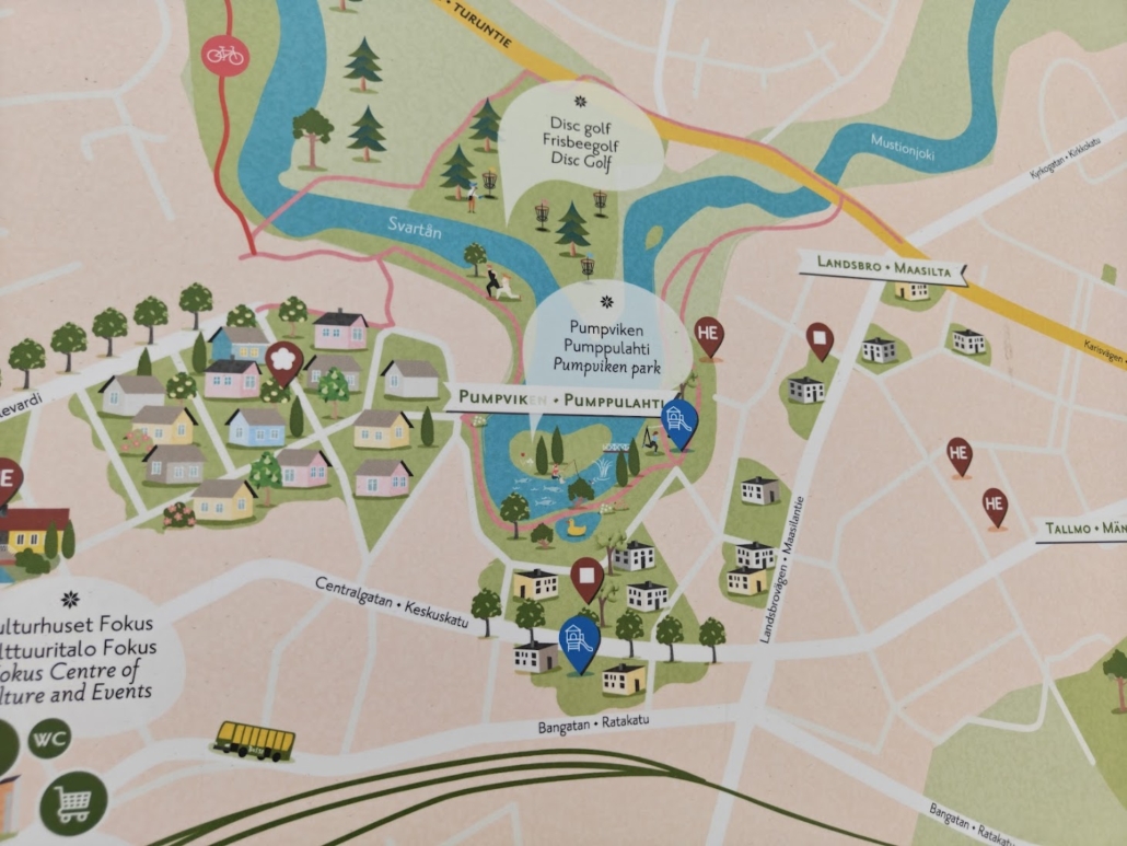
1. Pumpviken Park & the functionalist architecture of Karjaa
- Location on map
- Distance from train station: 1 km each way
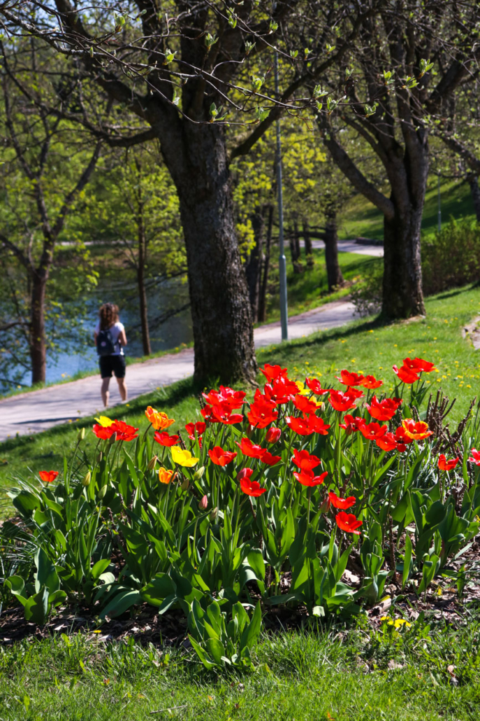
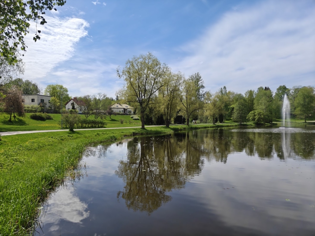
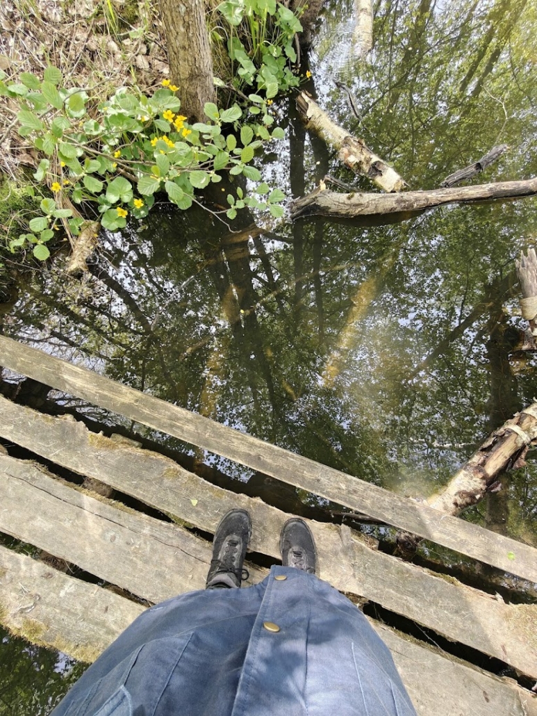
If you’re only going to experience one place in Karjaa, Pumpviken is the right choice for soaking in the beauty of flowers, trees and water. At Pumpviken, the Mustionjoki river bends to form a curve with a small island in the middle. A wooden bridge leads to the island, and the area features sun loungers where you can stretch out and enjoy life with a fountain murmuring nearby.
I’ve visited Karjaa many times, but since architecture has always been unfamiliar territory for me, I didn’t know that Karjaa is called the functionalist architecture capital of Finland. On this trip, however, I was better informed and could appreciate the abundance of functionalist buildings around Pumpviken. The bright sunny day didn’t make it easy to look at my phone, but I managed to browse the locations of the buildings on the website kansanfunkis.fi. I recommend checking it out before or during your visit if the subject interests you!
More tips for Karjaa town centre
2. Several flea markets in a small area
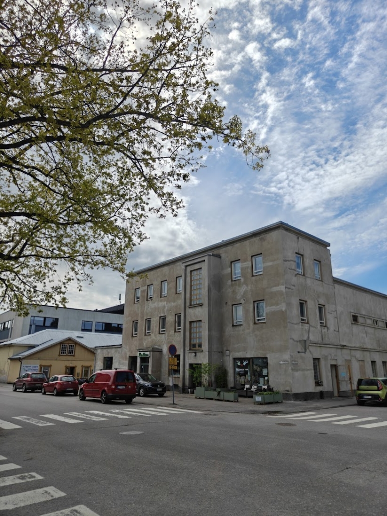
Near the train station I took a short walk through the town centre (ice cream in hand, of course!) and a couple of things caught my attention that I want to mention. Cultural Center Fokus stood out as a modern giant in the middle of the town centre, and it was lovely to watch people sitting around it, deep in conversation. How wonderful that it’s summer and you can sit outside again! The Bio Pallas cinema appeared to be housed in a large functionalist building, and the internet told me that films have been shown here for over a hundred years, since 1923.
What caught my attention most of all, though, were the flea markets. For a moment it felt like wherever I looked within a few steps, there was a flea market. One right next to Bio Pallas, and several more just beside it. I knew I had a long day of exploring ahead and couldn’t lose myself browsing the flea market finds right now. I made a mental note, however, that next time I’d come here purely to go flea market hunting at my leisure. Along Nils Grabbenkatu, Keskuskatu, Kauppiaankatu and Papinnevankatu roads I can count at least six or seven flea markets or second-hand shops within just a few hundred metres.
3. Billnäs ironworks village is right next door
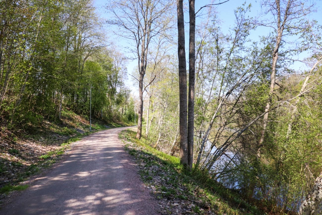
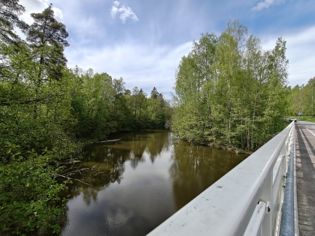
Billnäs is a picturesque ironworks village in Raasepori, over 380 years old. These two places, Karjaa and Billnäs, are genuinely side by side. If you head straight from the train station to Billnäs, the distance is 2.8 km each way. From the shores of Pumpviken, however, a lovely light traffic route begins that leads to Billnäs, and I recommend strolling along it. From Pumpviken to Billnäs is only three kilometres, and the route that follows the banks of the Mustionjoki river makes the journey beautiful and leisurely through scenic natural surroundings.
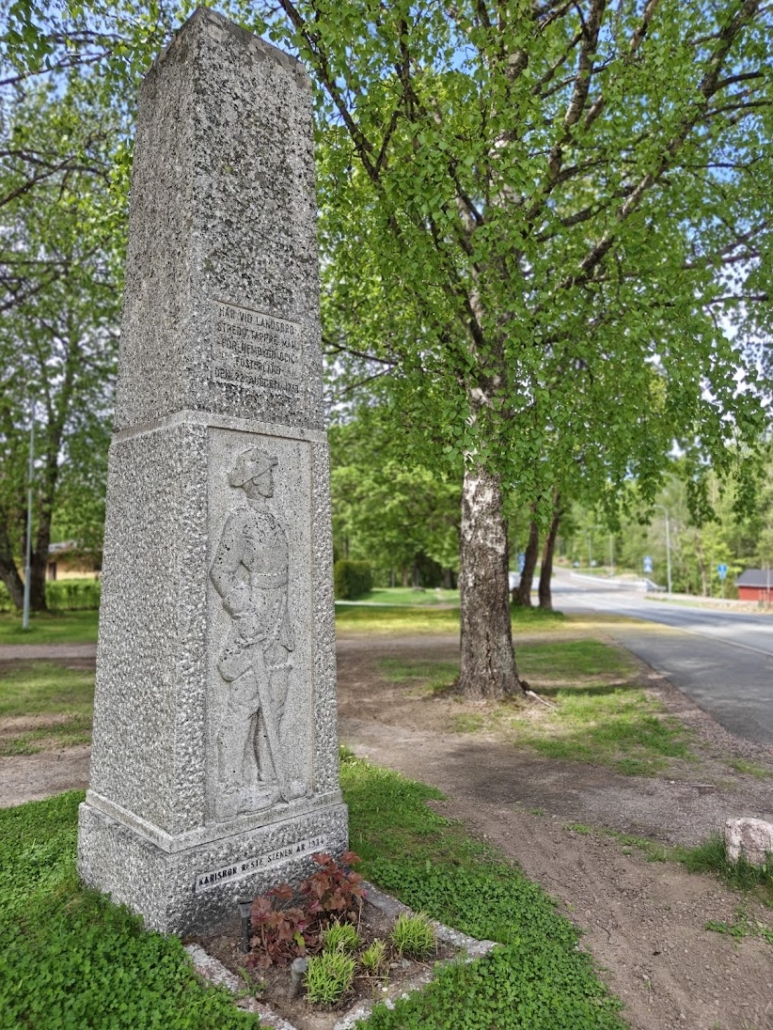
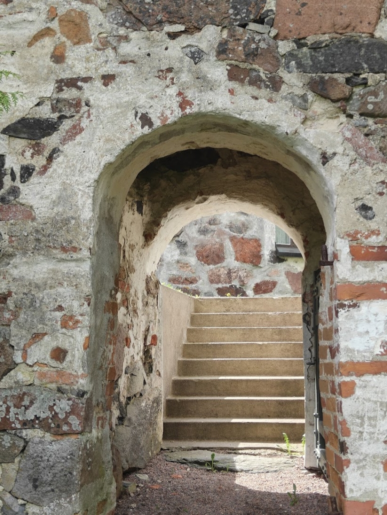
4. The Battle of Maasilta Memorial
- Location on map
- Vanha Turuntie 2, Karjaa
- Distance from train station: 1.5 km each way
On the outskirts of Pumpviken you’ll find the memorial to the Battle of Maasilta. The battle was fought in 1713 between Swedish and Russian forces. It was part of the Great Northern War (1700–1721). As a brief history recap: the young Charles XII (Carolus Rex) had become King of Sweden in 1697 as a mere teenager, and an enemy coalition including Russia and Denmark calculated that Sweden would be a weak opponent with such a young king. The coalition launched its offensive under Polish leadership in 1700, and the war that would last over 20 years began.
A battle was fought in Karjaa at Maasilta. I read with amazement an account in which a force of 500 Swedish soldiers attempted to stop a Russian army 13,800 men strong that was heading for Turku, with the front lines winding along the Mustionjoki. Quite a numerical advantage for the Russians? The Swedes were ultimately forced to retreat.
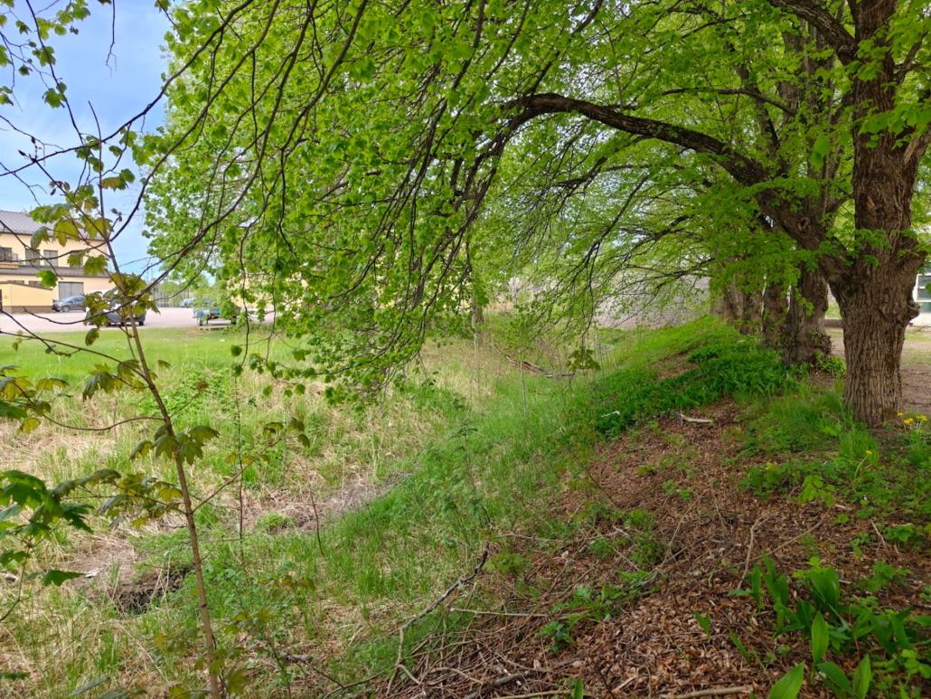
5. For serious history buffs: Grabbe Canal
- Location on map
- Along Kroggårdintie, roughly opposite the Fagervikintie junction
- Distance from train station: 1 km each way
If you’re a truly dedicated history lover, this one is for you — everyone else, I’d recommend prioritising the other destinations on the list! Grabbe Canal is a curiosity unique to Karjaa, an ancient relic most likely dating back to the medieval era of the 13th–14th century. The canal was once dug as a 500-metre transport channel at the lowest point of the Lohjanharju ridge. It’s considered possible that along this channel (apparently by hauling, since according to prevailing understanding there wasn’t enough water for actual navigation) limestone was transported from inland for the construction of Grabbacka castle and Raasepori Castle. The Grabbe Canal is surrounded by many question marks that we don’t yet have answers to. In any case, the canal takes its name from Måns Andersson Grabbe, who commissioned the construction of Grabbacka castle.
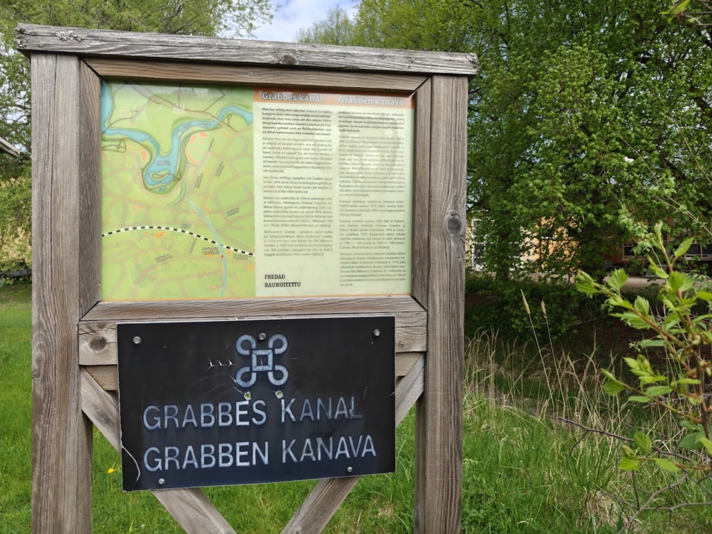
I knew that what remains of the Grabbe Canal is most clearly visible from Kroggårdintie road. After a little searching, I found the right spot roughly opposite the Fagervikintie junction. A hedge hides the stretch of canal behind it, but an information board lurking in its shelter gives a hint that the sought-after feature lies beyond the bushes. Don’t expect to see a dramatic moat: the view is much like an ordinary urban ditch. But knowing its ancient history makes the place feel special!
6. St Catherine’s Grey Stone Church
- Location on map
- Lärkkullantie 26
- Distance from train station: 2.6 km each way
Let’s linger a little longer in the realm of history. Consecrated in 1470 — still the Middle Ages! — St Catherine’s Church rises in a beautiful rural landscape on the shores of Kyrksjön lake, to the northeast of Karjaa town centre. I arrive in a park-like setting where the peace of the countryside reigns. A local bus drops off a cap-wearing schoolchild just as I’m walking closer to the church. Behind a meadow, the flowering and beautifully tended grounds of the Great Parsonage of Karjaa rise on a gentle hill.
Around the stone church, the air is scented with freshly cut grass, the crisp water of the May lake, and the wonderful, wonderful smell of tar, which I breathe in for a moment with my eyes properly closed. I walk around the church along the paths and peer at the Kyrksjön lake glinting in the background — a protected nature area, and in reality a widening of the Mustionjoki river.
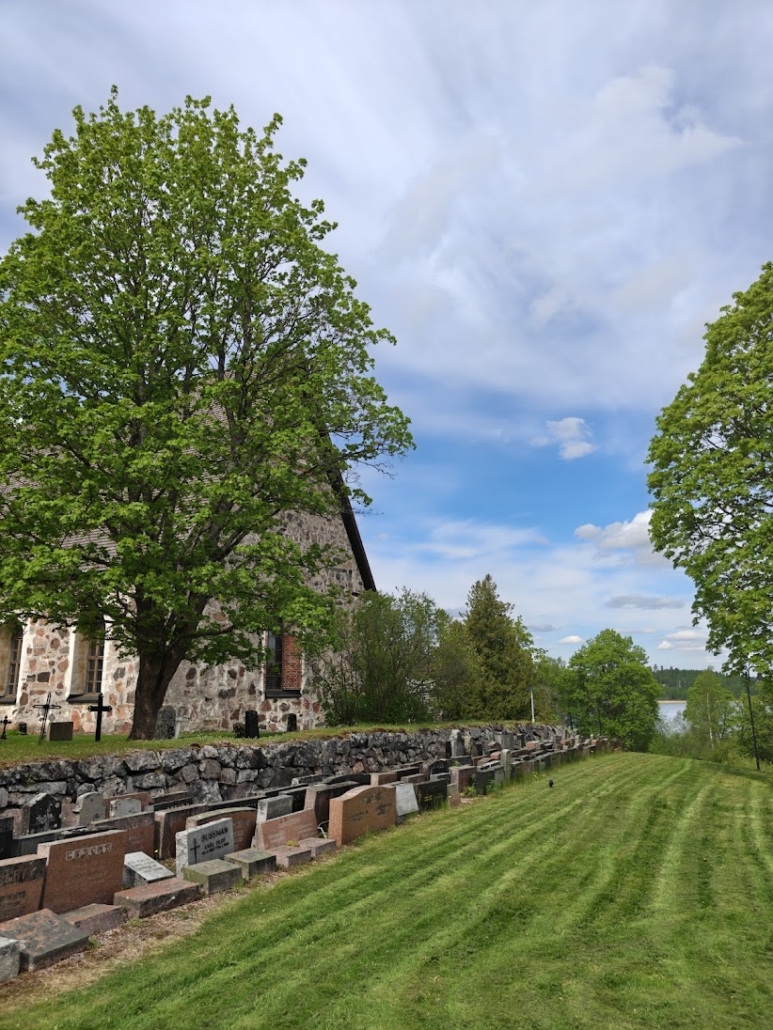
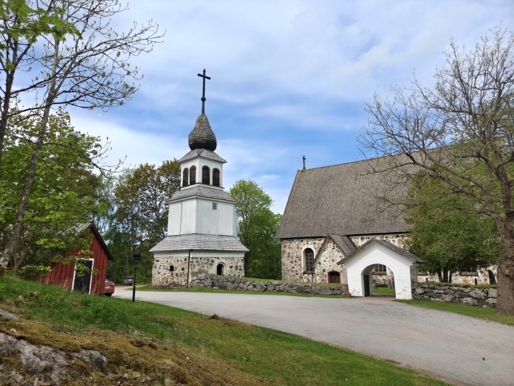
The sacristy of St Catherine’s Grey Stone Church dates back to the 1300s and the bell tower to the 1700s. There is something wonderfully calming about truly ancient buildings, especially stone ones. I stand in the churchyard and feel how time seems to come to a complete standstill in the middle of an otherwise hectic day. The feeling is lovely, gentle, soothing. My pulse slows, my breathing deepens, and a connection stretching back centuries sets my heart purring.
The church is open during services and events, and by arrangement with the caretaker.
Tip: If you set out from the train station to Pumpviken and the Maasilta memorial, you’re already more than halfway to the church.
Swimming beaches in Karjaa
A perfect day trip calls for a dip in natural water, to keep both body and mind fresh and relaxed at the same time. I was already starting to work up a sweat, so it was time to head for the shore. During the day I made for Svedja beach, and later in the evening, to round off the day’s exploring, I visited the shore of Skogängsgölen.
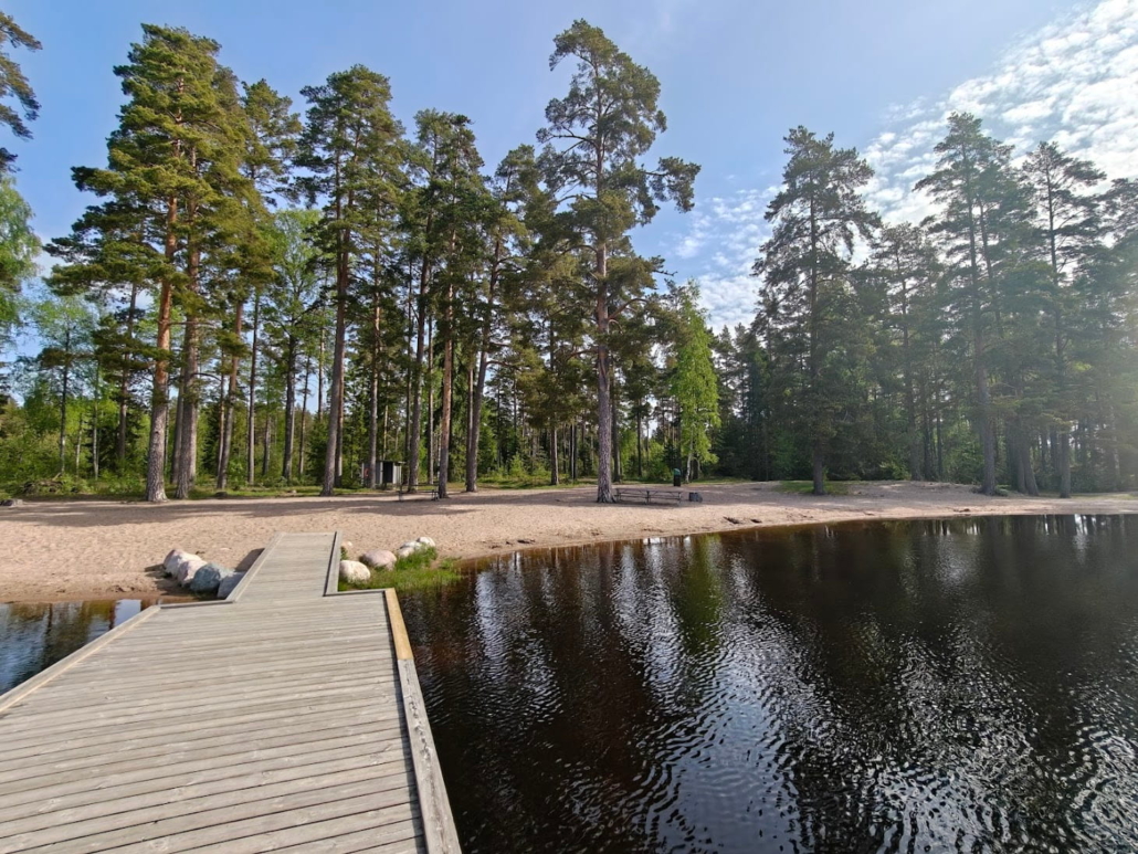
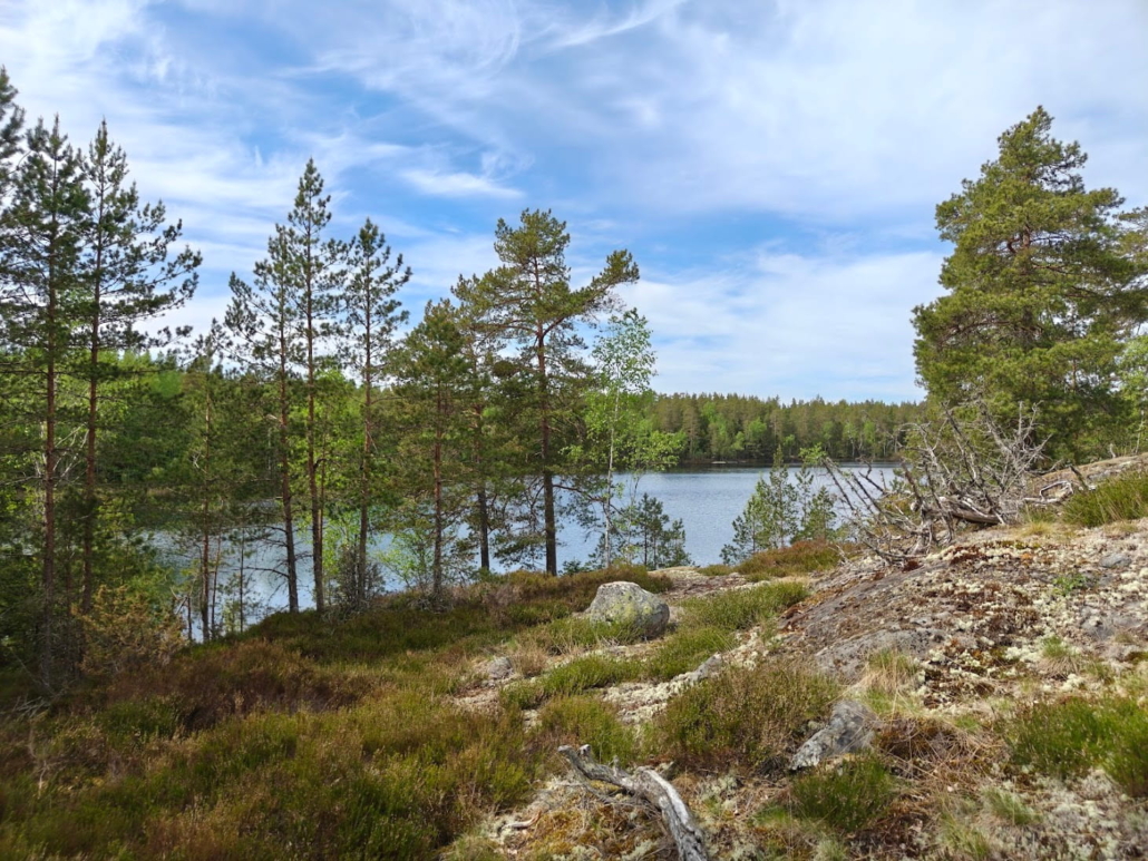
7. Svedja (Kaskimaa) swimming beach
- Location on map
- Kaskimaan lampitie, Raasepori
- Distance from train station: 5.3 km each way
- Sandy beach, pier, changing rooms, toilet, lakeside path
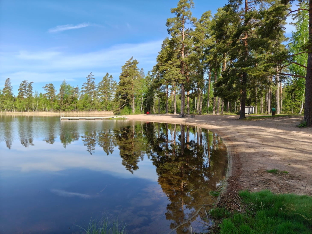
At the end of a small, narrow dirt road, though not very far from the town centre, I find the mirror-smooth lake called Svedjaträsket. A train heading towards Tammisaari and Hanko trundles quietly past as I step out from the car park to explore the beach. I find two changing rooms, one toilet, and a picnic table waiting for weekend visitors to gather round it. What steals my attention, though, is the beautifully curving sandy beach and the stately pine trees lining it. A little piece of paradise! On the far shore of the small Svedjaträsket there are a few buildings, but for the most part the entire shoreline is undeveloped. To the north and west of the lake stretches a forested area criss-crossed by larger and smaller trails, so with its beach and forest paths, Svedja is already a fine destination in its own right, perfect for a family with children, for instance. You can explore the forest for as long as feels right, and spend the rest of the time enjoying the swimming beach.

8. Skogängsgölen
- Location on map
- Skogängintie 182, Raasepori
- Distance from train station: 5.4 km each way
- Rocky shoreline and pier, changing rooms, toilet, lakeside path
Skogängsgölen is another swimming gem right next to Karjaa. Here too, the lakeside paths and surrounding forests offer as many hiking opportunities as each visitor cares to take.
Instead of a wide, curving sandy beach, Skogängsgölen offers a rocky shoreline: an inviting rocky knoll from which you can enter the water via a pier. When I arrive at the beach, early evening is settling in, and many others have come here too to refresh themselves at the end of a Friday, in honour of the start of the weekend. Some have come by car, others by bicycle, some by moped. A few are splashing happily in the lake’s dark water, others sit on the rocks chatting.
When I arrived here, I noticed that Google Maps seemed to dream up the most convoluted routes to reach the beach — including along gated forest tracks — when in reality you can get here perfectly easily and straightforwardly by turning off Turuntie onto Skogängintie and following it through CHARMING old farmsteads until the swimming beach comes into view.
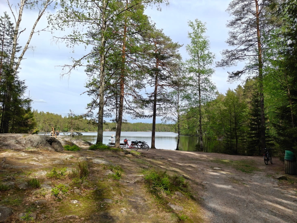
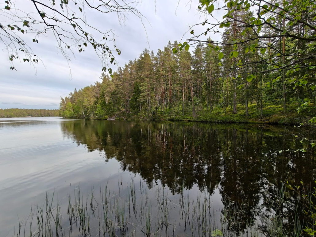
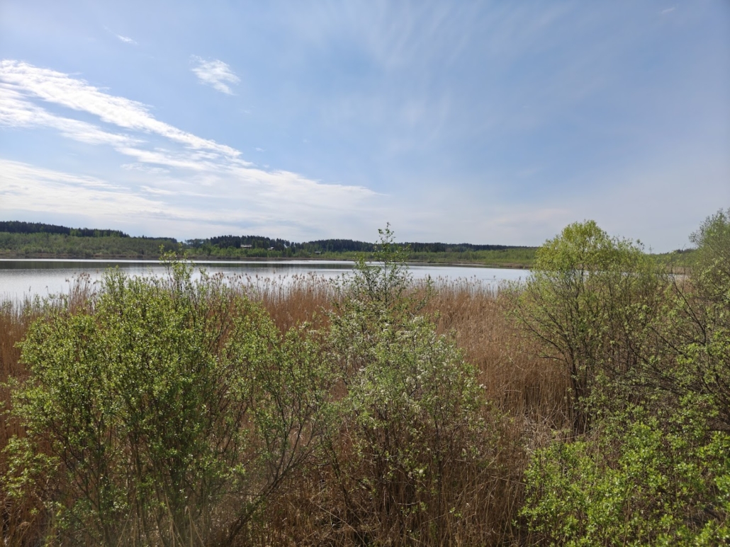
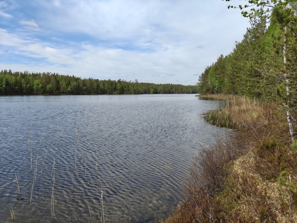
9. Lepinjärvi (Läppträsket)
- Location on map
- Lepinkaari, Raasepori
- Distance from train station: 3.6 km each way
- Trail network 3 km, lean-to shelter and fire pit, bird towers
Lepinjärvi has a reputation as a magnificent bird lake, so when I headed towards it, I expected the highlight to be its bird towers. How wrong I was! I’ll tell you more in a moment.
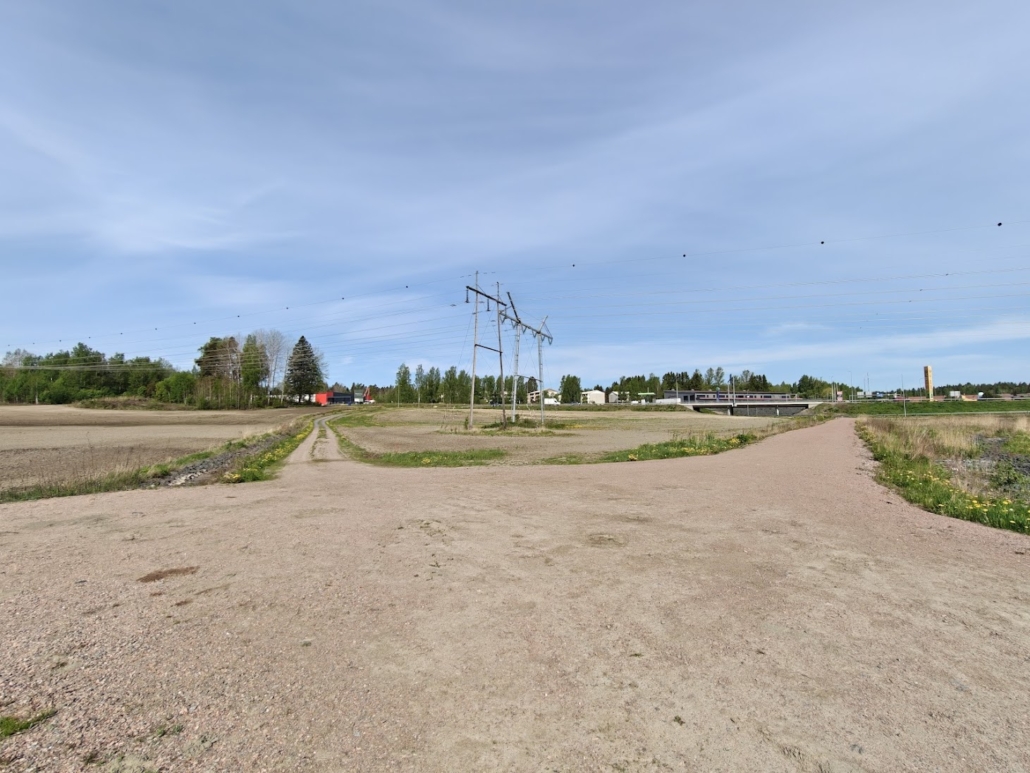
How to get to Lepinjärvi
Off the large and busy Hangontie (road 25) there turns a tiny field road, Lepinkaari, heading towards Lepinjärvi — the inconspicuous junction is near the Karjaa ABC service station. If you’re travelling by car, type Lepinkaari into your sat nav and hope there’s space for your car in the small field at the end of the track. If you’re on foot, slip around the corner of the Neste self-service station onto the light traffic route that leads under the Hangontie road bridge and from there towards the same field track that drivers arrive by. If you’re cycling, it’s worth leaving your bike somewhere around the service station: bikes are more hindrance than help on the trails at Lepinjärvi, and out on the open field there may no longer be anything to lock a bike to.
Don’t be puzzled if there are no signs for Lepinjärvi anywhere, I certainly didn’t manage to spot any.
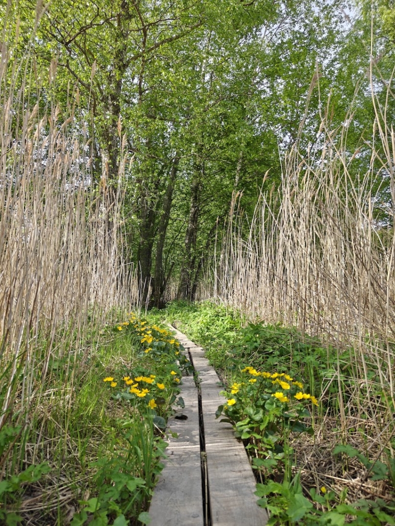
I padded contentedly towards the forest behind which I had seen the lake glinting. At the forest edge I found wooden signposts to the bird towers, and at the same moment the duckboards began. What followed was a genuine surprise: this lakeside forest is absolutely stunningly beautiful! The abundance of leaves, lush greenery, tall trees, flowers and birdsong was like something from a fairy tale! I had expected to arrive at an ordinary forest, some reedbeds and a couple of bird towers, but in all honesty the towers vanished from my mind the moment I was able to immerse myself in the embrace of this magnificent riparian woodland.
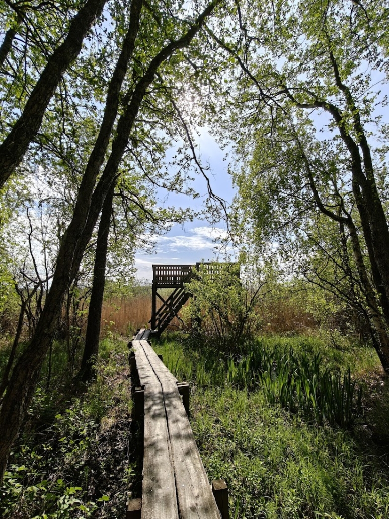
I first headed northeast towards Lillnäset and the taller tower. I couldn’t quite make it to the top of the tower on this occasion, as a bird nesting nearby had decided I had no need to go up there — fair enough. I enjoyed the beauty of the forest enormously along this stretch, all the same. The duckboards were in poor condition in places, so watch your step carefully.
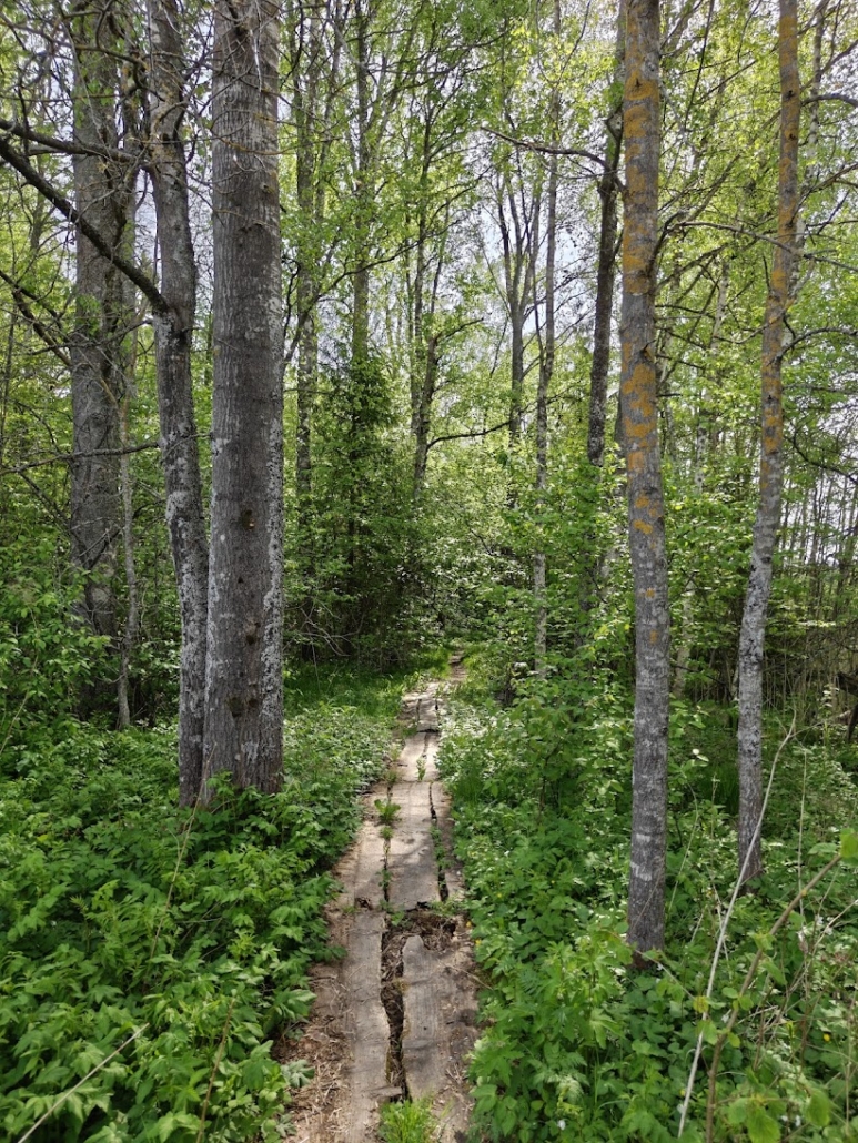
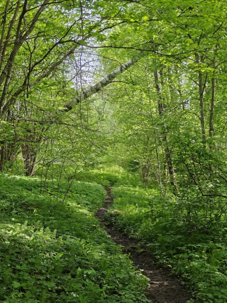
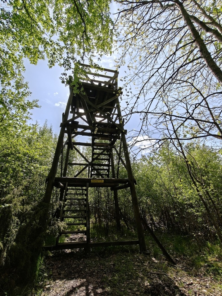
I retraced my steps back along the same path and then continued southwest towards the lower tower, which has been named the Pelican Tower. Along this stretch too the forest was tall and beautiful, and I heard the booming call of a bittern (a bird I usually associate with dusk?) several times, even though it was broad daylight. Underfoot there were duckboards again in places, and forest floor path in others. In this direction the duckboards were in better condition. The route was easy to follow, and since the vegetation made quite close acquaintance at times, I decided to do a tick check in the evening.
Along the path I found a tower whose summit offered a view over Lepinjärvi. Up to this point the lake had remained largely hidden behind the vegetation.
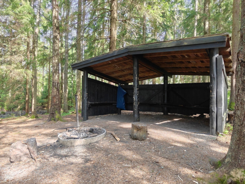
10. The Lepinjärvi lean-to shelter
- Location on map
- No firewood provided
Somewhat to my surprise, this destination also has a lean-to shelter. It waited at the end of its own path from the previous tower, I just needed to continue a couple of hundred metres inland. This shelter in the middle of the forest is more of a rain cover than an actual sitting-and-cooking spot, but if a wildfire warning is definitely not in force and you have your own firewood with you, this is a perfectly fine place to heat up your packed lunch.
I had neither packed lunch nor firewood, and to top it all off a wildfire warning seemed to be in effect, so I headed back to civilisation and treated myself to a delicious fast food lunch at the nearest service station, which fortunately really wasn’t far away. It tasted great, I must say, in the middle of a long day of exploring! Sometimes there’s a real advantage to a destination being right next to amenities rather than in the depths of the wilderness.
11. Lake recommendations for wilderness souls
For those craving trailless forests, undeveloped shores and solitude, Karjaa offers a surprisingly good option that you can even reach without your own transport. Between Karjaa and Lake Degersjön there lies a forested area full of woodland ponds, to whose southern end the previously introduced Skogängsgölen also belongs. Within this area it’s possible to find lakes or small ponds that are entirely undeveloped, and especially for walkers and cyclists the small forest tracks provide a good framework for exploring even where driving is prohibited. The true wilderness soul ventures off the tracks into the terrain to roam, and camping in the area is possible within the limits of everyman’s rights and responsibilities.
Söudon
- Location on map
- No hiking infrastructure
- Distance from train station: 6.6 km each way
As long as you give a wide enough berth to the two cottages in the area (visible in the map link above) — and refrain from lighting fires or riding a moped, as a sign in the area requests — you’ll find beautiful natural scenery and peace along the shores of Söudon. Note that the area has no hiking infrastructure whatsoever, so you really need to be sharp here: no fires, no toilet paper left in the terrain, all rubbish packed out in your rucksack, and so on.
A map-reading, outdoors-skilled hiker who knows hiking etiquette inside out is the right person for this place; they can also detour to the nearby Abborgölen pond and the pristine Väglös bog, or hike all the way to the shores of Porssjön and Långsjön lakes — as the crow flies, the distance through this undeveloped terrain is around three kilometres.
Långsjön and Porssjön
- Isthmus on map
- No hiking infrastructure
- Nearby swimming beach: Bastjön shore, Pursujärventie, map
- Distance from train station: 12.5 km each way
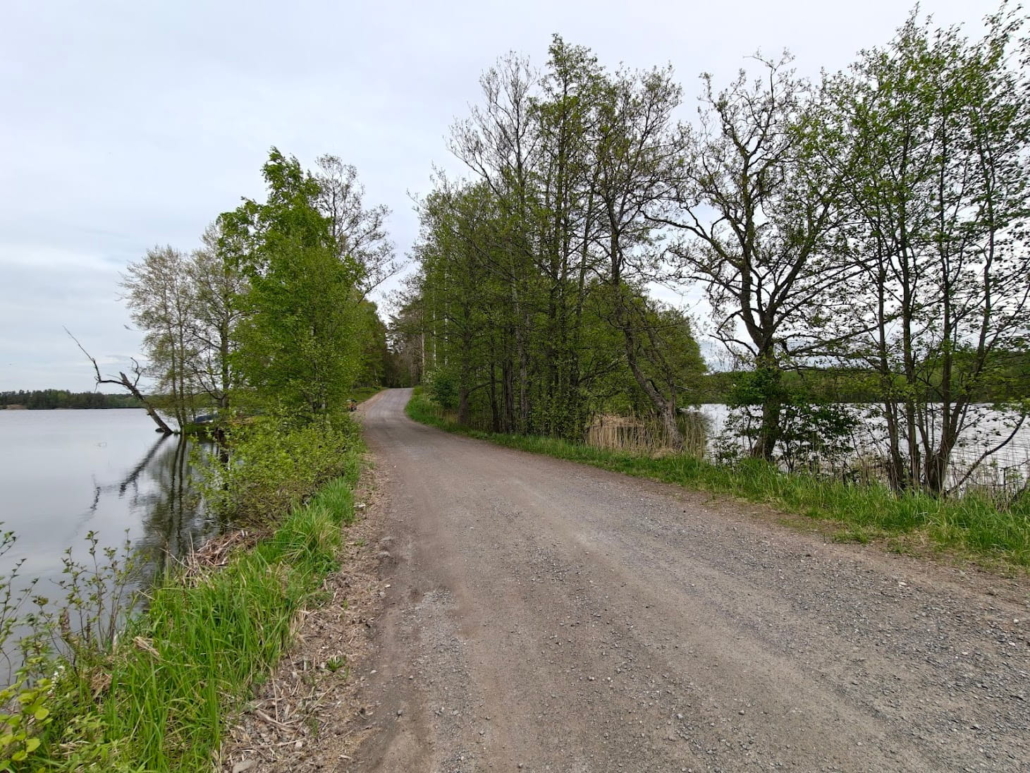
The day was beginning to wind towards evening. I drove along Gennäsintie road and admired its rural landscapes, which could sometimes be enjoyed from quite a height. The gravel road crunched softly beneath the tyres, and there was no other traffic. At a boat launch between Degersjön and Böleträsket I stopped to take in the scenery at my leisure. The undeveloped, forested shores were a feast for the eyes, and the complete silence felt deeply pleasurable.
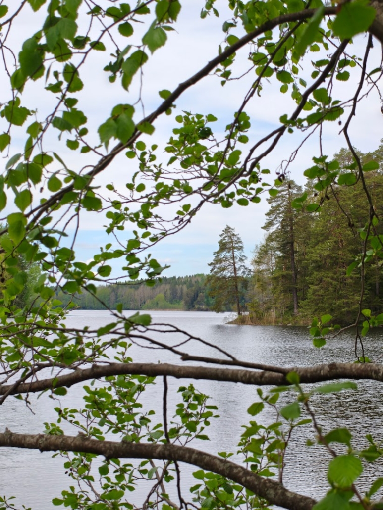
A little further along I left the car and cut through the forest to reach Långsjön. There is not a single building on the shores of this clear lake. Between Långsjön and the neighbouring Porssjön rises a forested, winding isthmus, past which the Porssjöbäcken stream tumbles down to a lake called Bastjön. Forest, rocks, streams and ponds like a wonderful patchwork quilt — mentally very far removed from the human world — this would be a lovely place to retreat to for a night of camping. Though perhaps a hammock camp would be a better choice here, as I couldn’t spot a single flat spot for a tent this time around.
After admiring the clear waters of Långsjön and listening to the silence of the forest to my heart’s content, my day in Karjaa was drawing to a close. I was hot, so thankfully there was still a refreshing dip in the waves of Skogängsgölen to look forward to before the journey home — and in fact I cooled down in another way on the way home too, stopping for an ice cream at the little village shop in Fiskars Iron Village.
Raasepori really is ridiculously beautiful countryside, you can’t think anything else when you travel these roads from one destination and village to the next! I hope these picks from my day out contained something to inspire, delight and help you with your own trip to Karjaa and its surroundings.
+1 Bonus tip: A long hike in southern Finland?
If you’re looking for terrain for a longer hike in southern Finland, want to travel by public transport, and have the necessary skills and equipment for hiking in entirely unmarked, trailless terrain where you’ll sometimes be far from civilisation with no hiking services such as firewood or outdoor toilets available, then I’d suggest that the stretch between Karjaa and Kisko (Salo) might well be worth considering.
Along this route you’ll find lakes including Långsjön, Degersjön, Iso-Simi and Iso-Kisko, the latter two of which belong to the pristine, undeveloped and pond-rich Pohja-Kisko lake plateau. Depending on your route choices, you can take in countless ponds along the way. You can decide for yourself, based on your own preferences, which way you loop around each body of water and whether you want, around the halfway point, to include a hotel night in Fiskars, for example. The stretch between Kisko and Karjaa can be covered in quite a forested manner, travelling from one pond or lake to the next, crossing small forest and country roads only occasionally. The more you meander and add ponds, streams, nature reserves and rocky outcrops to your route, the longer and more rewarding a hike you’ll get.
It should be noted that I haven’t actually completed this hike myself, as I don’t have adequate equipment (or skills) for such an undertaking. I have, however, heard several glowing accounts of this area, and the fact that public transport serves both ends of the route creates, in my view, excellent potential for a smooth hiking experience in a remarkably wild part of southern Finland. If you’ve hiked this stretch or part of it yourself, please do leave a comment sharing your experience!
Read next
Fiskars, Founded in the 1600s, is a Stunning Autumn Destination in Raseborg
Mustio Ironworks in Raseborg Surprised with Its Winter Beauty
Related Content


Leave a Reply
Want to join the discussion?Feel free to contribute!